Thursday, September 17, 2020
Williamsport, MD to Knoxville, MD
C&O Trail miles 99.4-58.0 (41.4 miles)
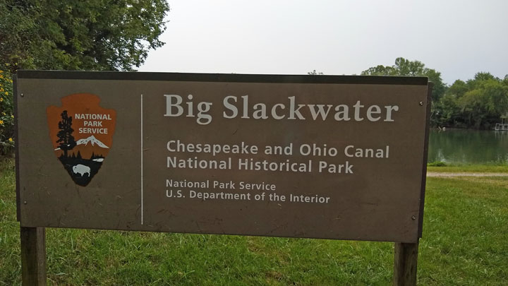
Highlights: Williamsport, C&O midpoint, and the Big Slackwater
The Red Roof doesn't offer breakfast, but there's a Waffle House in the same parking lot, which is even better! We ate a hearty meal, checked over our bikes, and were on our way.
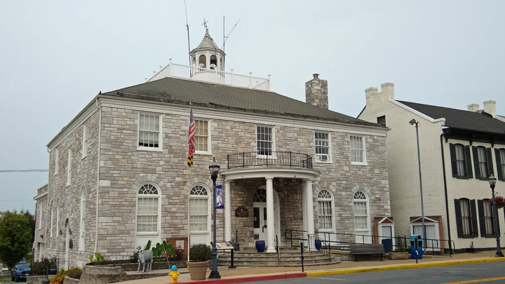
Williamsport Town Hall
During the Civil War, the Potomac River formed the border between the Union and the Confederacy. On what is now called Doubleday Hill in Williamsport, in June 1861, Union Major Abner Doubleday placed multiple siege guns to prevent Confederate troops from fording the Potomac at this strategic river crossing.
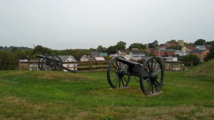
Union armaments protect the Potomac
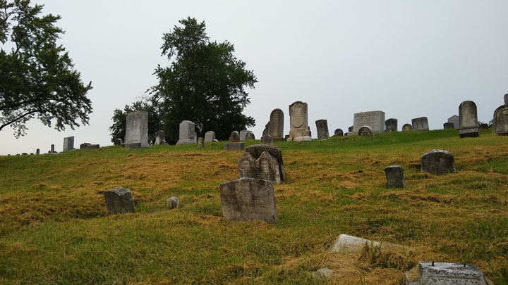
River View Cemetery on Doubleday Hill
Williamsport has a lot of nicely restored canal structures. In addition to the newly rewatered aqueduct we saw yesterday, there's an iron railroad lift bridge here and a working lock.
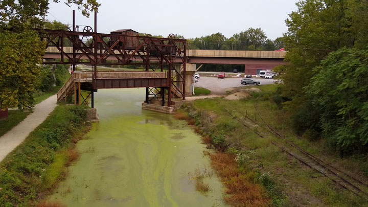
Western Maryland Railroad lift bridge
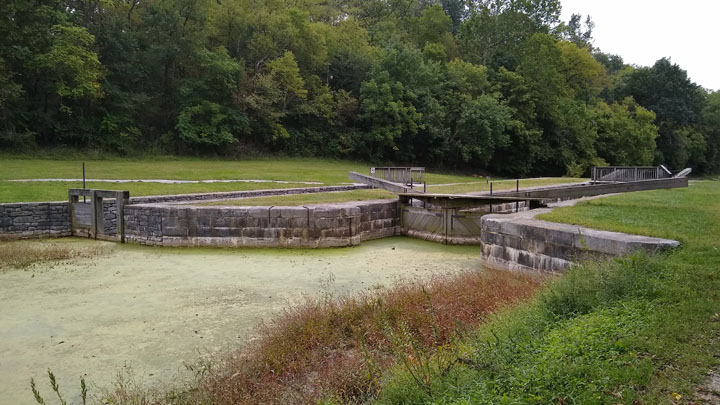
Lock 44 of 74, as we bike downstream
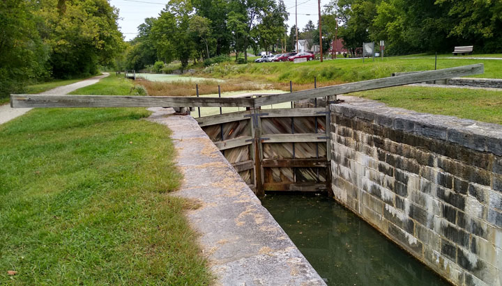
Lock 44 from below
There's no C&O Trail access points for the next ten miles out of Williamsport, so we had a nice peaceful ride this morning and spent a silly amount of time at mile 92.25, the midway point of the trail, taking selfies and congratulating ourselves.
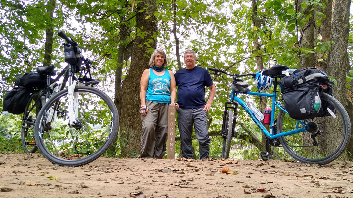
Midpoint, mile 92.25! We made it halfway!
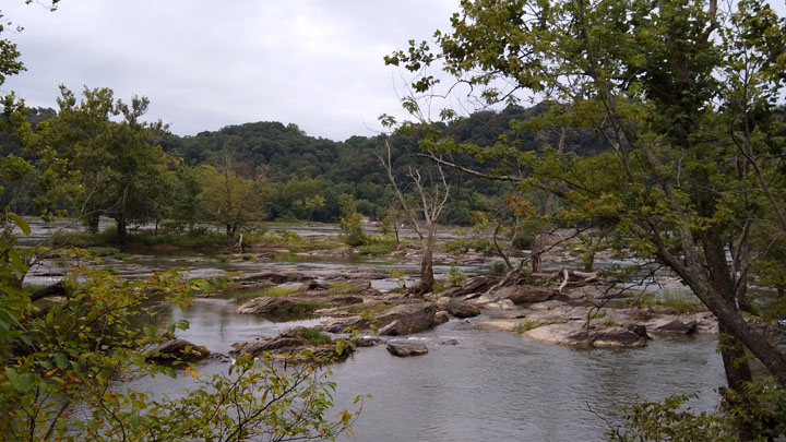
The Big Slackwater is one of the few areas along the C&O where the Potomac is deep and calm enough to be navigable, which allowed boats to travel through the river instead of through a canal. This area of the original towpath was repeatedly washed away by flooding, causing a five-mile detour for bikers until 2012, when the missing section was replaced with a 2.7-mile concrete path built over the water against the sheer cliffs.
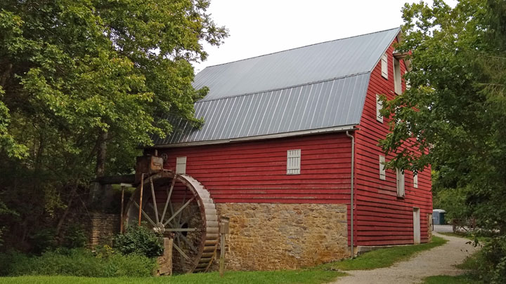
McMahon's Mill
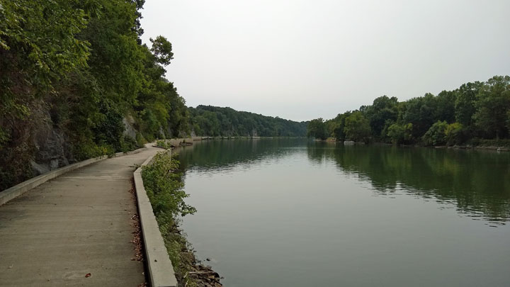
Peaceful path on the Potomac
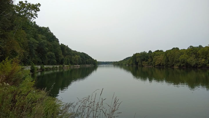
Potomac River
The afternoon was a series of stops: The very pretty Dam #4; multiple small caves; a view of Shepherdstown, West Virginia, on bluffs across the river; Antietam Creek Aqueduct; and ruins of the Shinhan limestone kilns. It was hard to make any progress!
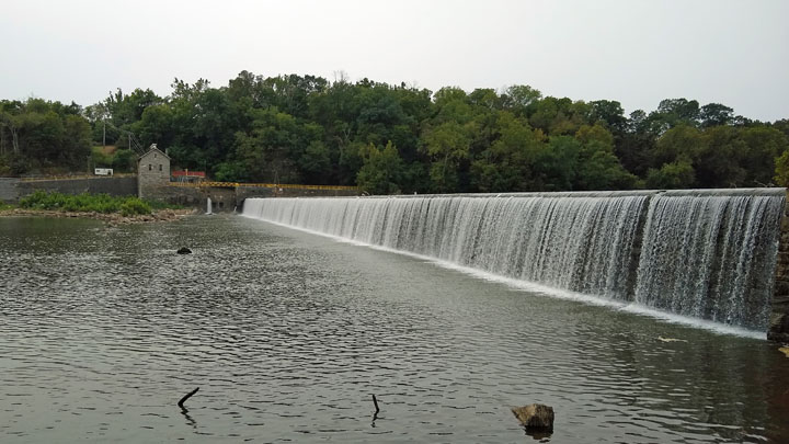
Dam #4, built to divert water into the canal
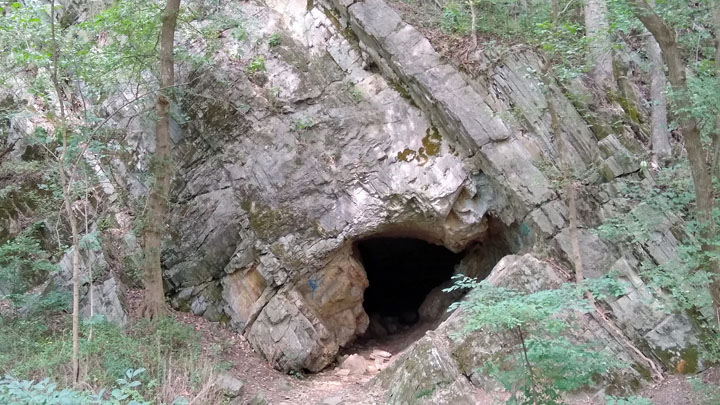
One of many small caves along the C&O
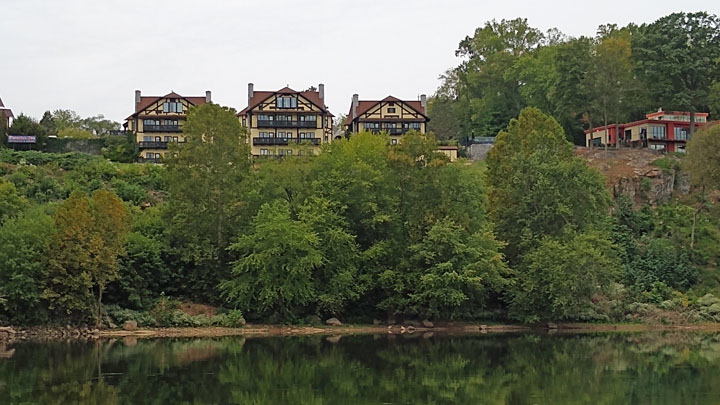
Shepherdstown, West Virginia
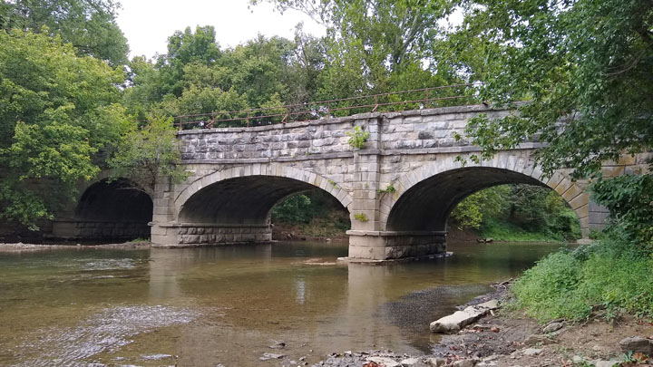
Antietam Creek Aqueduct
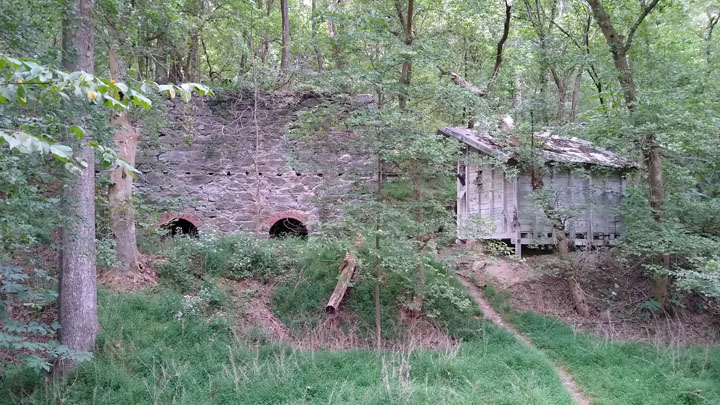
Shinhan limestone kilns
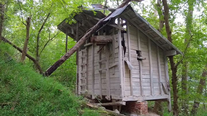
Handyman's dream
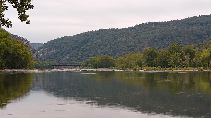
A pedestrian bridge with over 60 stairs connects the Maryland shoreline to Harpers Ferry, West Virginia, across the river. Late in the afternoon, we locked our bikes and walked across, but since our unlocked bags were attached to our bikes, we made it a quick trip. In a few days we'll return Harpers Ferry in our truck for a closer look.
Unnavigable portion of the Potomac
Craggy cliffs
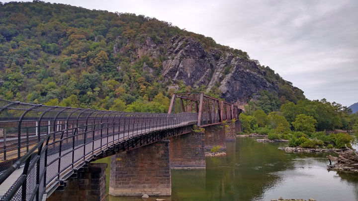
Railroad and Pedestrian Bridge to Harpers Ferry
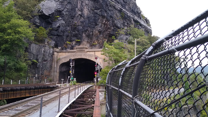
Harpers Ferry railroad tunnel
After Harpers Ferry, it wasn't far to our hotel in Knoxville, Maryland, which was good because it was about to rain. Unfortunately, we then got lost. Well, not lost exactly, but the towpath has limited points of ingress and egress, like an interstate, and we couldn't find the exit! I called the hotel, but they were zero help, and Google Maps was quite confused about our location. Finally, we were able to flag down a local biker who told us the way. THANK YOU!
Lodging: Hillside Hotel, owned by Knights Inn, Knoxville, MD. To access this hotel from the C&O Canal Towpath (or Appalachian Trail), get off the trail at mile marker 58, cross the train tracks, and take the left-most road 1.2 miles up a fairly steep hill to 19105 Keep Tryst Road. We checked in just before dark at 6:45 p.m. in a light drizzle. The rain began in earnest shortly after.
This hotel is a pain to get to and pretty run down, but on the upside, there's a good liquor store next door, the Guide House Restaurant across the street, and a gas station next to the restaurant that also has limited hot food options. The only two hotels in Shepherdstown were still closed due to Covid, and the B&Bs there were either expensive or full. The alternative was to schlep our bikes and baggage up the stairs and across the river to Harpers Ferry. No, thanks. Too tired to deal with an actual sit-down restaurant tonight, we picked up burgers and hot dogs at the gas station.
Jana's note: In addition to the “official” 41.4 miles we accomplished today, we also rode an extra two or three miles back and forth trying to find the trail exit at the end of the day. Plus, the 1.2 miles up the steep hill to the hotel should definitely count for extra credit...
Tom
Goetz's Homepage
|