Sunday, July 17, 2005 - Grand Canyon North Rim
First thing this morning, 9:30 a.m., we stopped at a Sinclair station in Fredonia, Arizona, to again try to buy some beer, but again we had a setback. It's Sunday, and they can't sell beer till 10:00. Good grief, we've been trying to get beer since Vegas. Who knew it would be so difficult? We decided to wait. I know they sell beer at the lodge we'll be staying at tonight, but we're afraid it may be jab prices. I want some beer at the bottom of the Grand Canyon. It's going to be over 110 degrees. We're going to need it!
Today we're visiting the north rim of the Grand Canyon. We want to see it from the top before we visit the bottom. Tom and I have both been to the south rim, but never the north. It's 90 miles from Kanab to the rim. We stopped at a general store/gas station just outside the national park boundary for sandwiches. Why is it every time we're out West, we end up with the gas-station sandwiches? The elevation at the north rim is over 8,000 feet, a thousand feet higher than the south rim, so it's quite a bit cooler here, maybe not even 100 degrees!
The Grand Canyon is of unfathomable dimensions: 277 miles long, as much as 18 miles wide, and reaching a maximum depth of 6,600 feet. The U.S. Geological Survey has conservatively estimated the volume of the Canyon at 52 billion cubic yards. If the United States decided to use the Grand Canyon as its only landfill, it would take over 300 years to fill.
The Grand Canyon!
My nephews describe the size of the Grand Canyon like this: Picture the biggest thing you can think of in your mind, and multiply that by 50. Then forget about it, because you're not even close. It's incomprehensible. This is my fifth visit to the Grand Canyon, and each time I see it, I'm surprised again at how big it is. It's impossible to even adequately keep the image in your brain. Your mind won't hold the whole thing!
View from the Bright Angel area
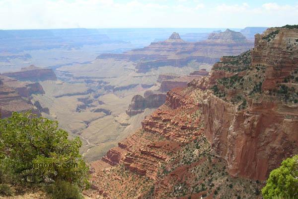
After entering the park, we first drove to the Bright Angel area, where the visitor center is located, and took a short, half-mile hike to a sweeping canyon view. It's a little hazy today due to distant wildfires and nearby controlled burns, but still fantastic.
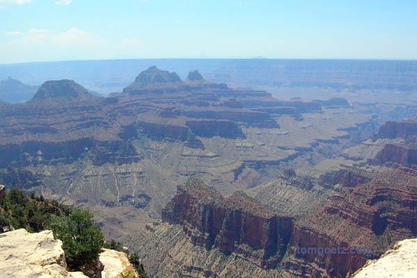
Another Bright Angel view
We then drove 23 miles on a twisting, turning road to Cape Royal, stopping at several scenic overlooks along the way and hiking the Cape Royal Trail (.6 mile) and the Roosevelt Point Trail (.2 mile). Cape Royal is the only spot on the North Rim from which the Colorado River is visible. Angel's Window, a natural arch, frames the groovy view. Through the arch you can see the Unkar Delta - we'll be there the day after tomorrow! We could see Desert View Watchtower across the canyon on the South Rim.
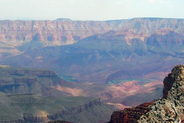
Unkar Delta, Colorado River, from Angel's Window overlook
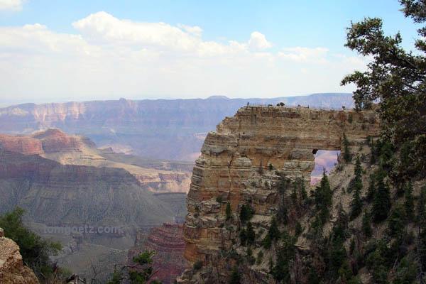
Angel's Window
From Cape Royal we drove 18 winding miles to Point Imperial, the highest point on either rim at 8,803 feet. From this overlook you can see the Painted Desert, the eastern end of the Grand Canyon, and Marble Canyon. Some people thought they could see Lake Powell, but I think it was the shadow of a cloud. Maybe I just don't have a good enough imagination.
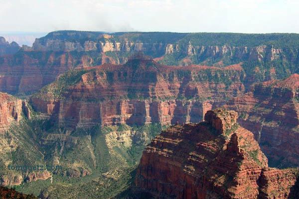
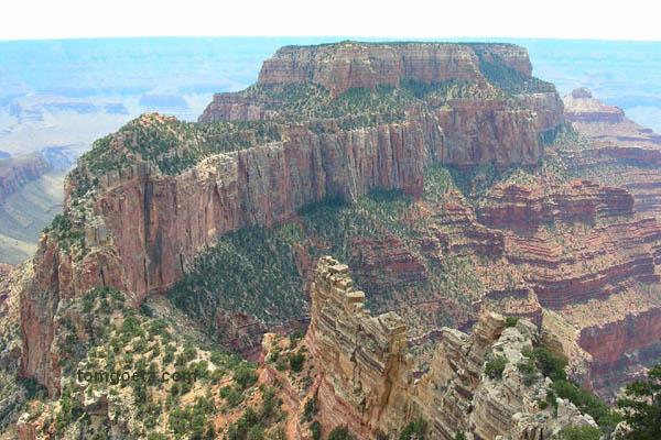
A view from Point Imperial
Before this trip I'd been told that the north rim isn't nearly as grand as the south rim. I beg to differ. Tom and I loved the north rim. The views are equally breathtaking, and there's way more solitude at the north. The south and north rims are 200 miles apart by car, so I'd say just go to whichever is closer.
Leaving the park, we had to backtrack a bit. It was 100 more miles to Marble Canyon, where we would meet up with my brother and our Tour West rafting group. We passed by the beautiful Vermillion Cliffs National Monument on the way.
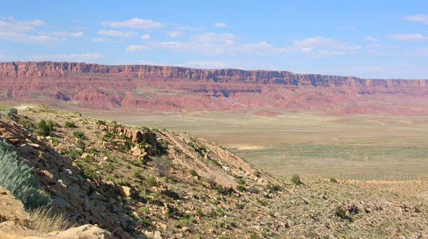
Vermillion Cliffs
At 5:45 p.m. we arrived at Marble Canyon Lodge, and it was HOT, like stepping out of the car into a pizza oven. We checked in and learned my family had not yet arrived, so we drove six miles to Lee's Ferry, the put-in point for the raft trip. We passed some very weird rock formations along the way.
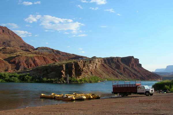
Lee's Ferry, where the raft trips begin
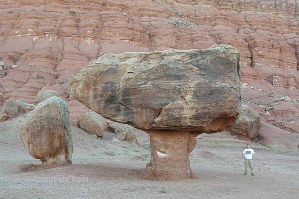
Balanced Rocks, Tiny Tom, Glen Canyon National Recreation Area
Finally at 7:00 we met up with my brother, Brian Neighbors, his girlfriend, Christine "Stine" Bethke, and Brian's sons, Chris and Jacob Neighbors. Yay! I hadn't seen the boys since Christmas, and they have grown RIDICULOUSLY tall. They are six-foot and six-two. Good Lord, they're only 16 and 14. How freaking tall are they going to get?
Our Tour West trip "officially" started at 8:30 p.m. with a meeting at the lodge in a non-air-conditioned room behind the convenience store. We were in danger of suffocating. We met our fearless crew, Dave, the lead guide, Cameron, a second guide, Russ, the swamper, and the rest of the passengers. Besides the six in our familial group, we were joined by a father and his two daughers, Ken, Angela, and Jenn, and a mother and her two sons, Dotti, Aaron, and Andrew. I was surprised there were so few people. When I took this trip before, both times we had a two-raft trip. This was only to be a one-raft trip. Excellent.
The meeting lasted a little over an hour. The short version is it's gonna be hot, so drink lots of water and go big on the sunscreen, real big. We also signed our acknowledgement-of-risk forms, and they passed out drybags for our gear. Brian and I could leave our cars parked across the street for the week. The other six people had taken a charter flight in from Vegas. At 8:15 a.m. we will meet a truck out front to take us to the raft.
By the way, the beer prices here weren't jab prices after all, and they have a decent selection. Also, being by the river, they know to sell only beer in cans. All our earlier beer trouble was for nothing!
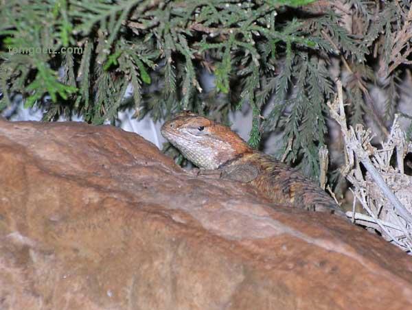
Lodge lizard