
7:53 a.m. A bell chimed in town 19 times. Why 19? Is that Nelson code for it's Sunday and you only have seven minutes left to get to service? Strange. Just before 10:00 the bells rang so many times I thought I might be in Amsterdam. Bells, bells, bells - the maddening bells! We got up and drank coffee on the veranda. It was another beautiful day.
10:15 We headed southwest out of Nelson through wine country. We had a long day ahead but wanted to enjoy our room till the last possible second. Standard check-out time in New Zealand is an early 10:00 a.m., and they really start hovering around your room as that time approaches.
We stopped at Buller Gorge, home of New Zealand’s longest swingbridge (as seen on "The Amazing Race"), 110 meters across. It was cool, but not nearly as high, long, or scary as it looked on TV. The bridge is 17 meters above the river.
Buller Gorge swingbridge
On the far side of the bridge we took a 15-minute loop walk through the bush along the White's Creek fault line, epicenter of the 1929 Murchison earthquake, and along the Buller River.
Tom and I rode back across the gorge on the 160-meter Comet Line flying fox. We hooked in together for a tandem ride because the more weight on the line, the faster you go! Very fun, but again not as scary as it appeared on television.
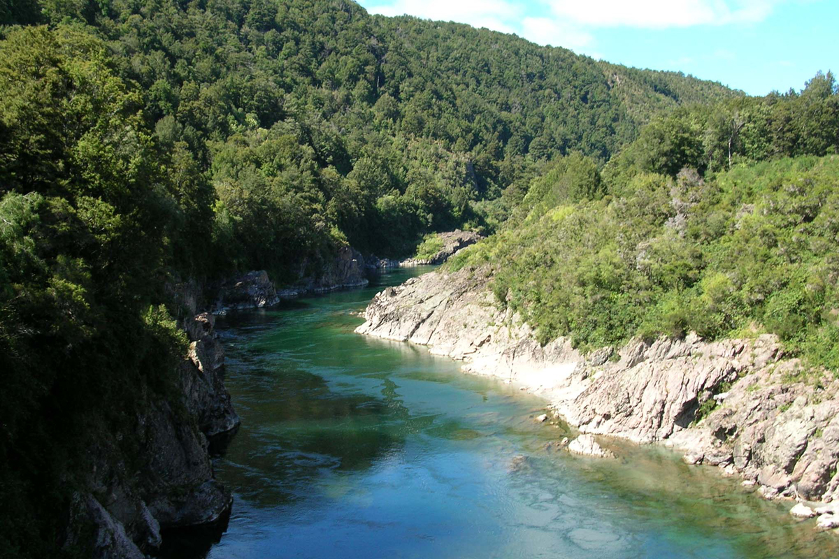
Buller River
The road from Buller Gorge to Westport passes through some dramatic bush and mountain terrain. Hawks Crag, an overhang barely high enough to fit a bus through, was seemingly hacked through the rock by sheer force of will of the tough west-coast road workers. The narrow roadway was plenty wide enough for our rental car, but not nearly wide enough for two cars to pass each other, and you can't see the whole thing from where you start across. I'm sure glad we didn't meet any opposing traffic here!
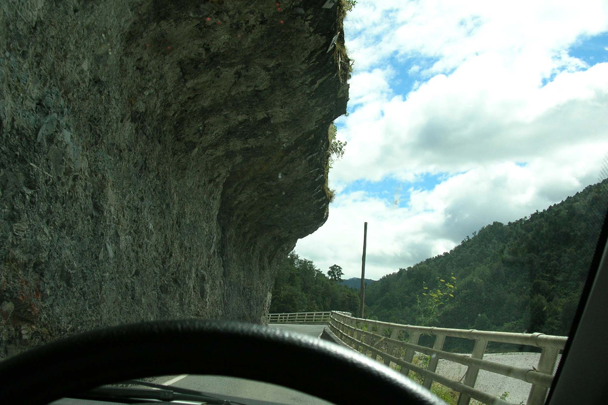
Driving through Hawks Crag
Westport, population 4,800, is the main town at the northern end of the west coast of the South Island. West of Westport at Cape Foulwind, a fur seal colony lives on the rocks of the Tauranga Bay seal colony. We saw seals, seal pups, agave plants, and beautiful scenery.
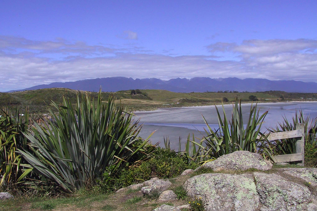
Tauranga Bay
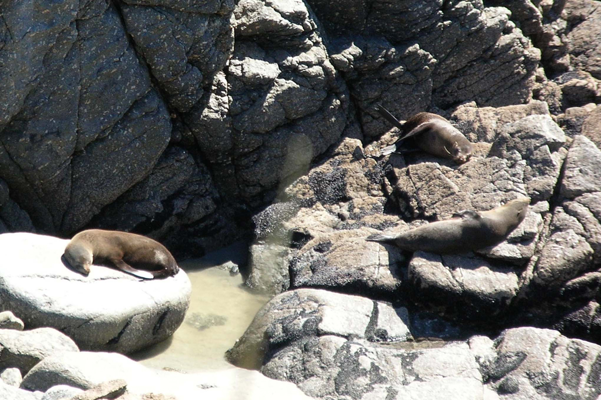
Sleepy seals
Westland, as the west coast region is called, is a narrow stretch of land squeezed between the Tasman Sea and the Southern Alps. It is no more than 70 kilometers (43 miles) wide at any point. In fact, no place in New Zealand is more than 80 miles from the sea. The road south from Westport offers some of the most gorgeous coastal scenery in the world - and hardly any people. South Island's population is less than a million people, just over 30,000 of whom live along the west coast.

Toi toi native grass / Penguin crossing
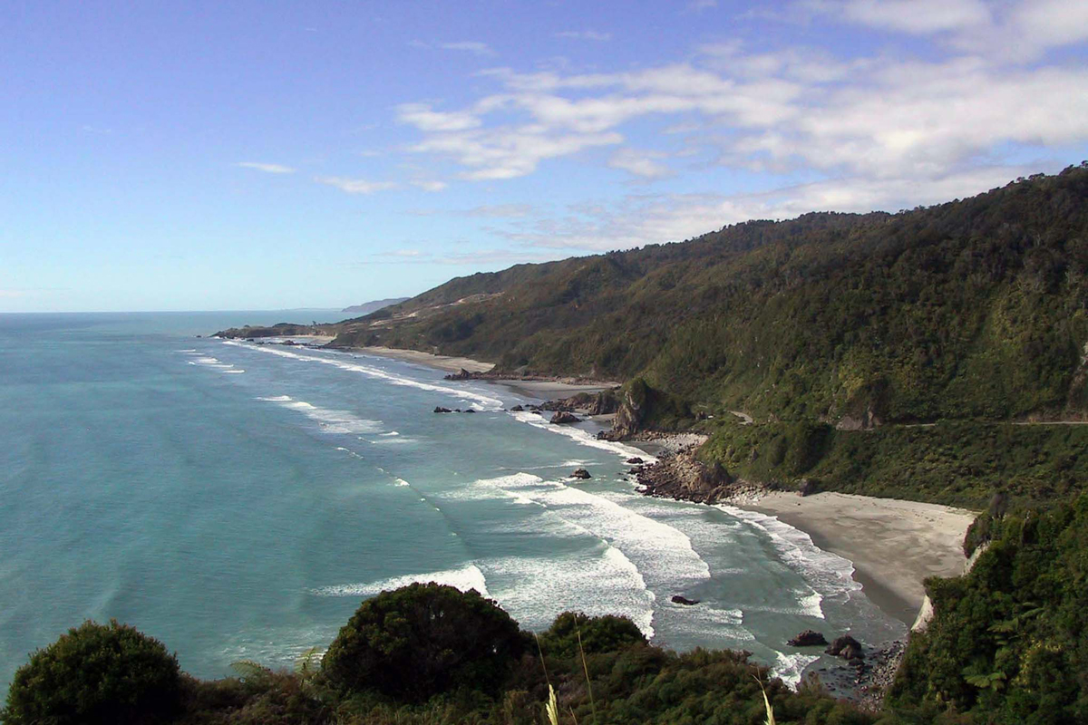
From Irimahuwhero Viewpoint
The main tourist attraction between Westport and Greymouth is Punakaiki and Paparoa National Park, best known for the aptly named Pancake Rocks. At high tide there are supposed to be some impressive blowholes, but we were there at low tide. No matter. The rocks themselves are sufficiently mesmerizing to warrant a visit. A 15-minute loop walk leads around the rocks and blowholes.

Pancake Rocks
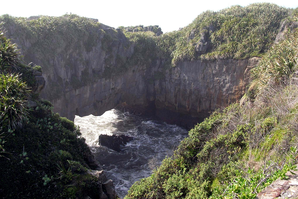
Puakaiki Surge Pool, low tide
The native plants near the Pancake Rocks were very interesting to me, and I kept feeling them to convince myself they were real. This is how I stupidly came into contact with some kind of Kiwi poison ivy. It itches! I had it all over my left hand and a few spots on my arm. My pinky swelled up so big I thought it might explode. I needed to put my hand on ice, but ice was hard to come by, so I stuck it in cold water whenever I got the chance over the next few days.

Where's the poison ivy?
Arriving in Greymouth around 5:00 p.m., it seemed like a ghost town. Honestly, not a soul was in sight. I know it was Sunday, but gee whiz. It was almost the same at Duke Backpackers hostel. The reception area was vacant, but we soon found an employee who showed us to our tiny double room with (hooray) our own bathroom. Most of the guests were Israelis, as Duke's is owned by an Israeli kibbutz, and all signs in the hostel are in both English and Hebrew. It's BYO towel, which seems to be a running theme, but it's an okay place and we were happy with it. We found a Subway that was open for dinner, and that's all we needed. All we'd had today was chips and peanuts, and we were hungry.
Looking through our various reservation information, I suddenly realized I was supposed to have reconfirmed our accommodation for tomorrow night a week in advance. Oh, no! We're to stay in the tiny town of Okarito, and if our reservation falls through, we're out of luck. I located a couple of pay phones across the street from our hostel but had a horrible time placing a call. The phones supposedly took credit cards, but they rejected all of mine. One of the phones also accepted coins, but it didn't say how much a call cost, and in any event, I didn't know if my call was local or long distance. After a 20-minute ordeal, I finally managed to call at 8:10 p.m., ten minutes after office hours. I left a message. We'd have to try again tomorrow while they're open.
After the phone fiasco, I needed a drink. Duke's also has a bar, and Tom and I had each been given a coupon for one free beer when we checked in. Of course, we didn't stop at one. That's how they get you! A draught beer was NZ$2.90. We met a couple of cool Kiwis, Dean, an importer-exporter living in Vietnam, and Grant, a local bouncer. Grant bought us a "bloodshot," an unlikely mixture of sambuca, tequila, and Tabasco sauce. It was actually pretty good. At 11:30 they called last call, and as we were leaving, the Israelis started flooding in. Apparently it was last call for everyone but them!