Monday, March 15, 2021
Remote West Texas
Big Bend National Park Day 3
Highlights: The Milky Way, Ross Maxwell Scenic Drive, Lower Burro Mesa Trail, and Santa Elena Canyon
Again we got up pre-twilight to look for the Milky Way. Success! I was so inspired, I even tried my hand at some night sky photos. I have limited manual settings with my point-and-shoot camera, but I did the best I could.
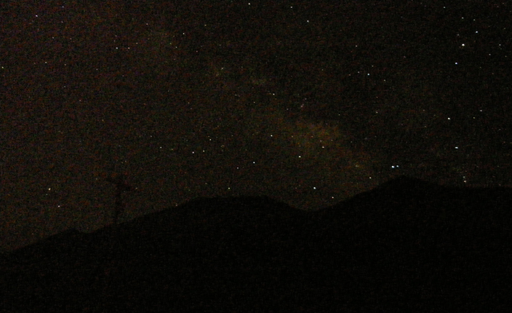
Milky Way over the mountains
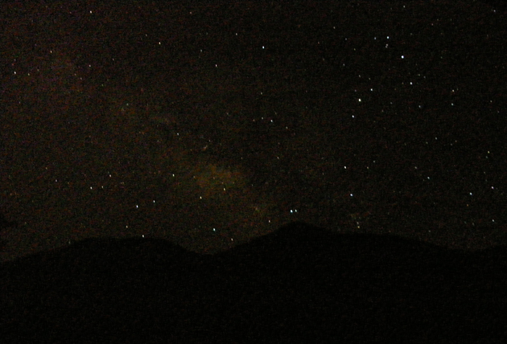
Our glorious galaxy
After a long re-snooze, we finally approached the park entrance at 11:45, where we were stopped dead in our tracks a mile from the gate. Today's delay was due to an ongoing road construction project that should have been completed in January. Grrrr... It took an hour and 10 minutes to finally make our way through. Good grief!
Once inside, the cars dispersed and it was smooth sailing. Today we're driving the Ross Maxwell Scenic Drive, a 30-mile road through the desert towards the Santa Elena Canyon, with tons of stunning views along the way.
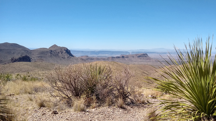
Sotol Vista
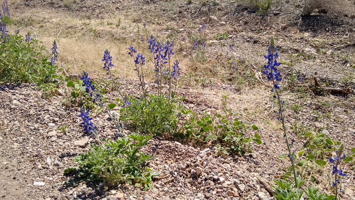
Beautiful blue bonnets
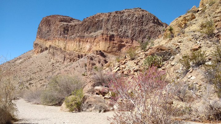
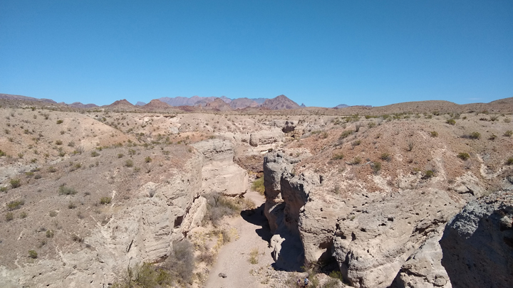
Lower Burro Mesa Pouroff Trail was our first hike of the day, 1.1 miles through a dry creek bed ending in a narrow canyon at a 100-foot pouroff, or dry waterfall. Easy and flat, with lots of cool cacti and interesting geologic features along the way.
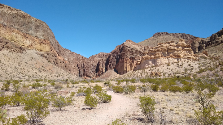
Lower Burro Mesa Pouroff Trail
Lots to look at
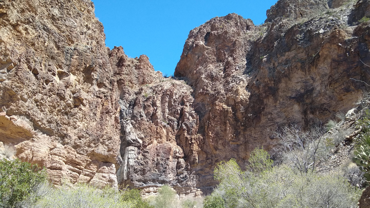
Heading into a canyon
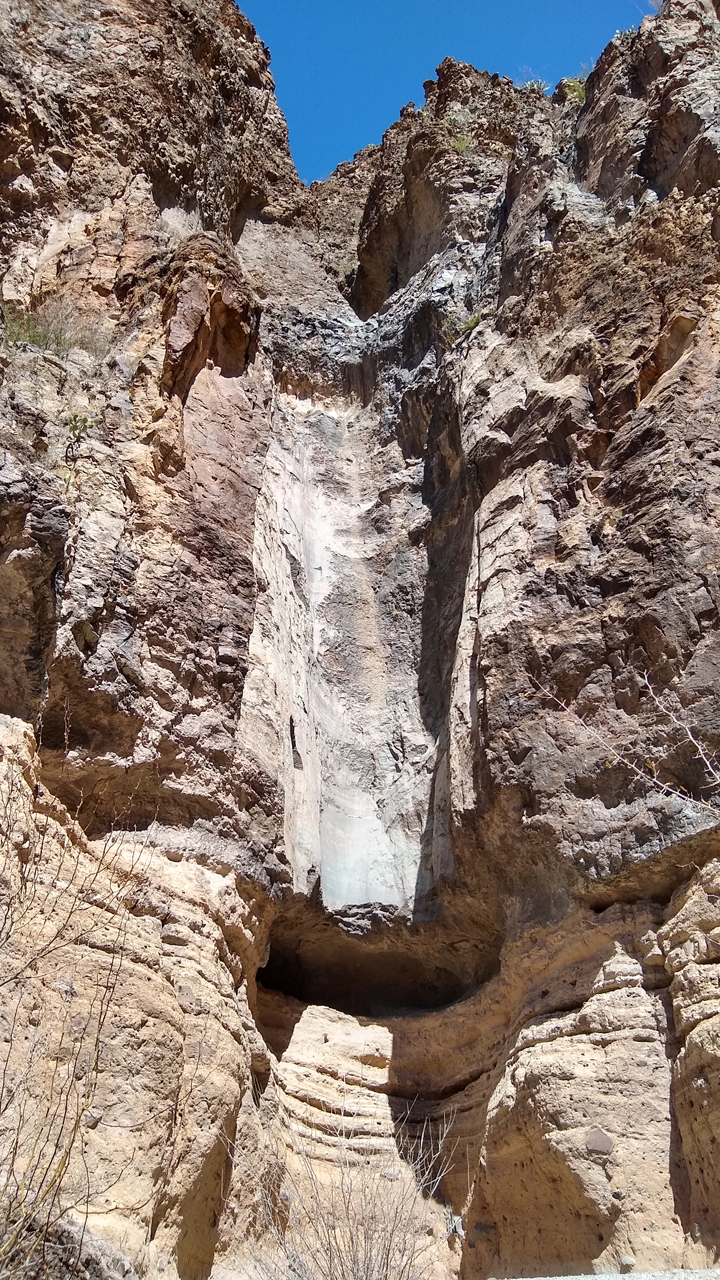
Lower Burro Mesa Pouroff
The trail was pretty secluded, so in addition to our constant vigil for rattlesnakes, we kept our heads on a swivel for mountain lions as well!
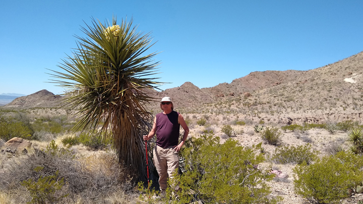
Giant dagger yucca, taller than Tom
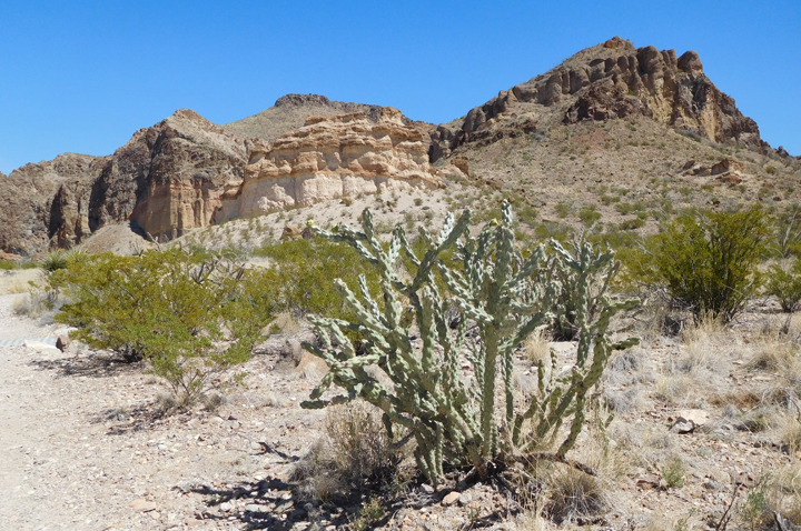
Cane cholla
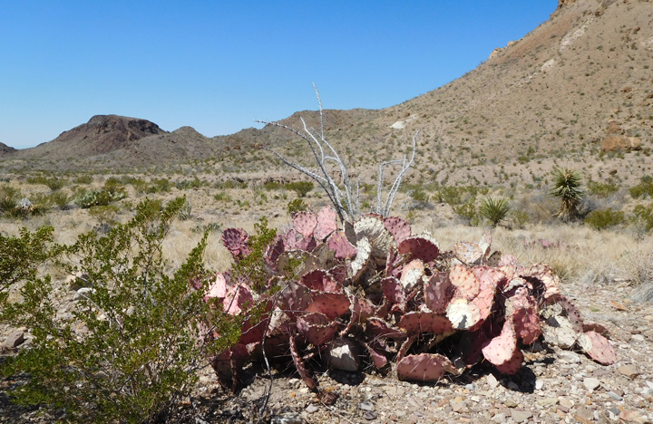
Purple prickly pear, unique to Big Bend
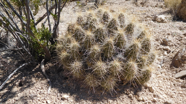
Strawberry pitaya
The Mule Ears are twin peaks of volcanic rock formed from magma that came up through fissures in the earth before hardening. The softer material surrounding the pillars eventually eroded, leaving the distinctive landmark protruding from the desert.
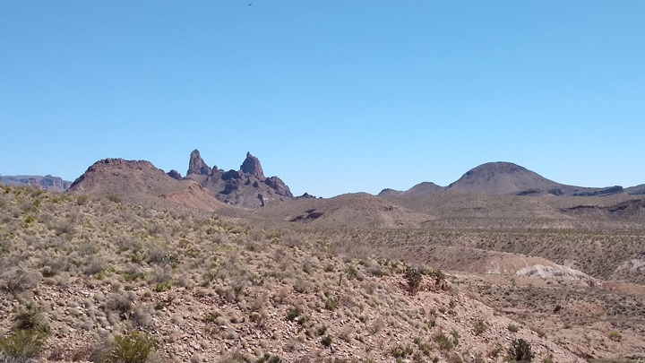
Mule Ears
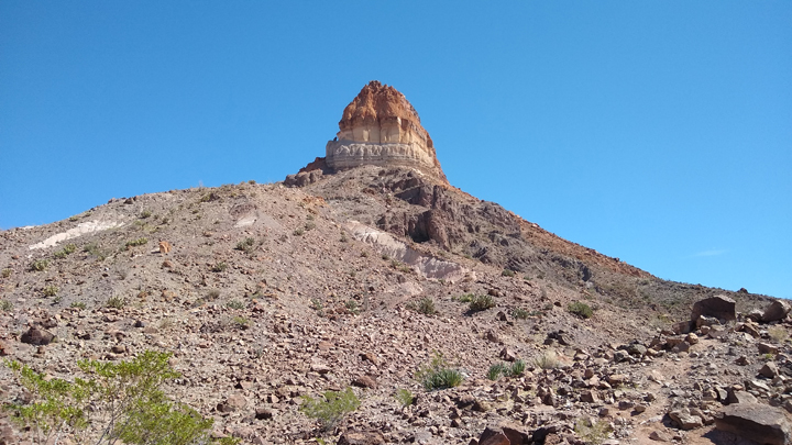
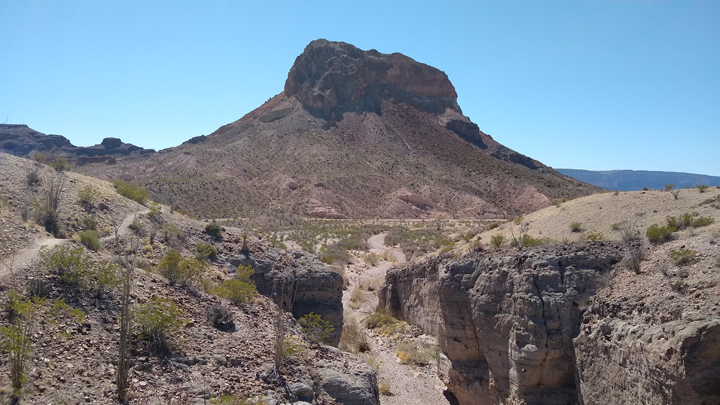
Cerro Castellan
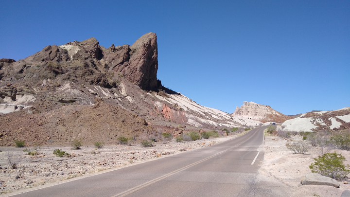
Ross Maxwell Scenic Drive
Tuff is an off-white volcanic ash that's hardened into a rock-like substance. Water draining from the Chisos Mountains over thousands of years eroded the rock, resulting in the formation of Tuff Canyon.
West overlook of Tuff Canyon
Cerro Castellan from Tuff Canyon
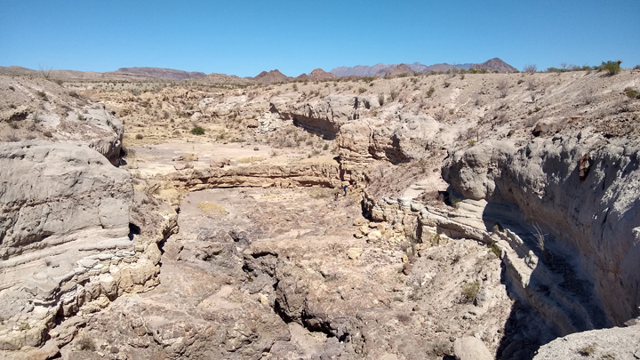
East overlook of Tuff Canyon
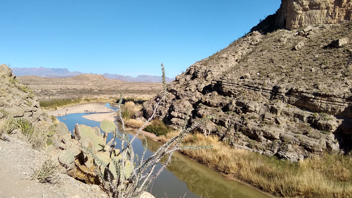
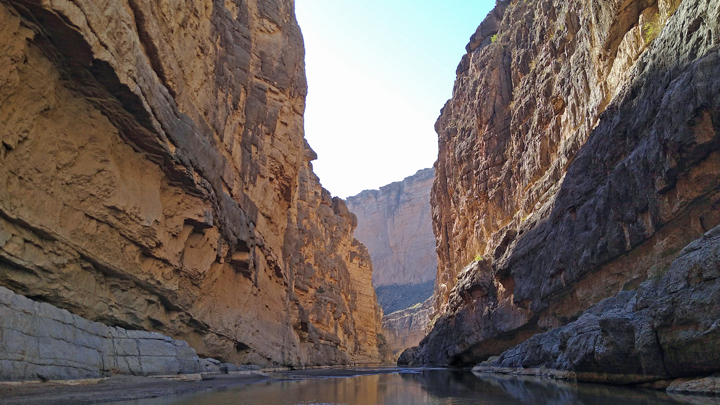
Ross Maxwell Scenic Drive ends at the 1,500-foot cliffs of Santa Elena Canyon, the pride and glory of Big Bend National Park and the perfect place to end our visit. From the bank of the Rio Grande, a 2-mile trail leads up steep steps to an overlook and back down into the shady canyon, where we waded into the shallow river. I will neither confirm nor deny if we crossed the Rio Grande into Mexico...
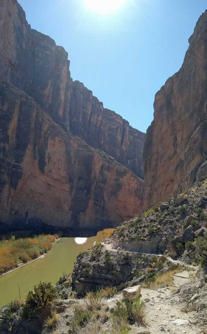
Santa Elena Canyon
Rio Grande
Inside the canyon
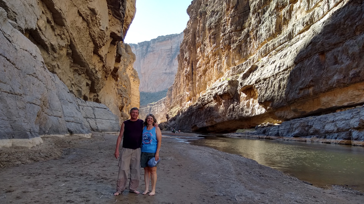
Tom and Jana, after a hike and a wade
We retraced our route on the Ross Maxwell Scenic Drive, back out of the park and beyond, arriving “home” to Tin Valley with ten minutes till sunset. Considering the long road construction delay earlier in the day, we were lucky to return before dark.
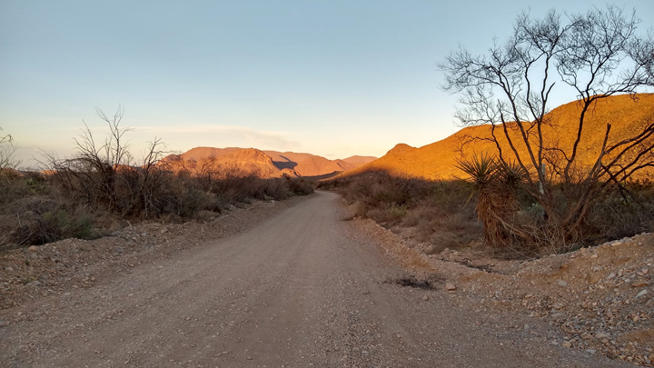
Golden hour on the road to Tin Valley
I'd cooked extra diced beef a couple nights ago, so we nuked that along with a couple of baked potatoes for an easy and delicious dinner. Tomorrow we move on.
Driving distance: 155 miles
|