Tuesday, June 14, 2022
Skyline Drive, Royal Gorge, Black Canyon
The wildfire smoke largely cleared out of Canon City overnight, leaving just a wee bit of haze in the air by morning. Much improved!
The one-way, 2.8-mile Skyline Drive is built on a high razorback sandstone ridge above Canon City. The road is steep and narrow, with sheer dropoffs on both sides and no boring guardrails. Fun! The city and mountain views from the pulloffs are great.
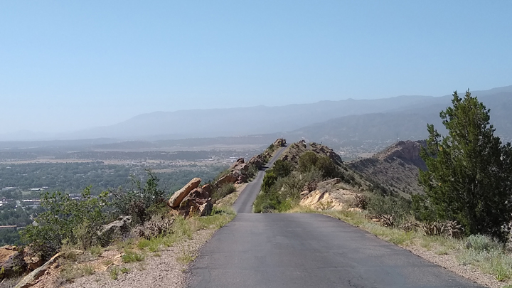
Skyline Drive, Canon City
From a small parking area at the top of Skyline Drive, we hiked up an even higher and narrower ridge for additional thrilling views. We had the place all to ourselves.
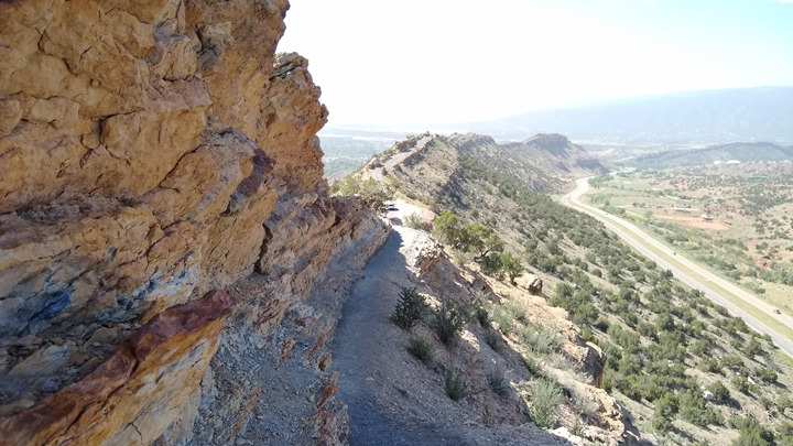
Perilous path
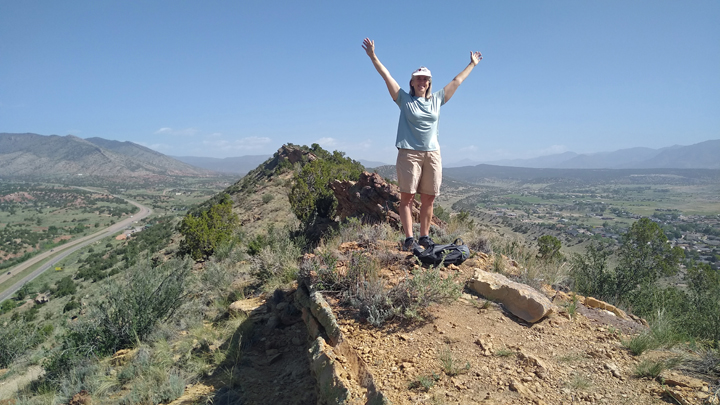
Jana claims Colorado
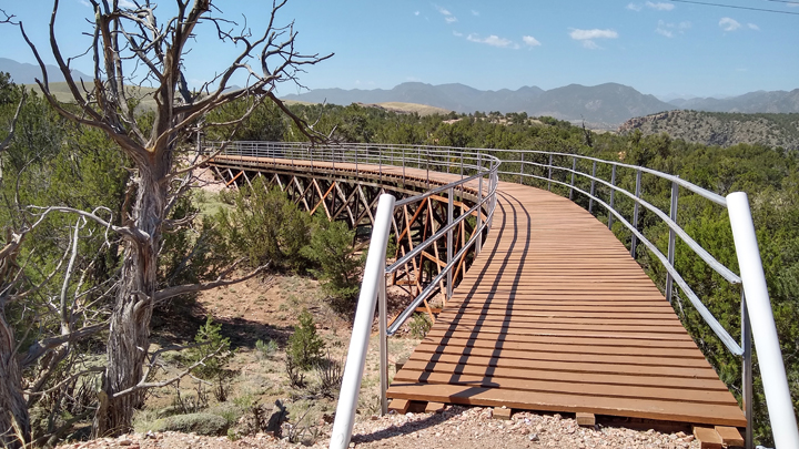
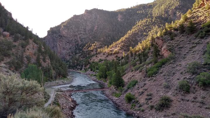
The Royal Gorge Bridge & Park is just outside Canon City. The park's gondola was closed today for maintenance, leaving the only other attraction of interest the pedestrian bridge spanning the gorge, but at 30 bucks each, we passed. Instead, we found a super-cool hike leading to an outstanding canyon overlook.
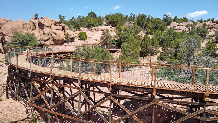
Point Alta Vista Trail
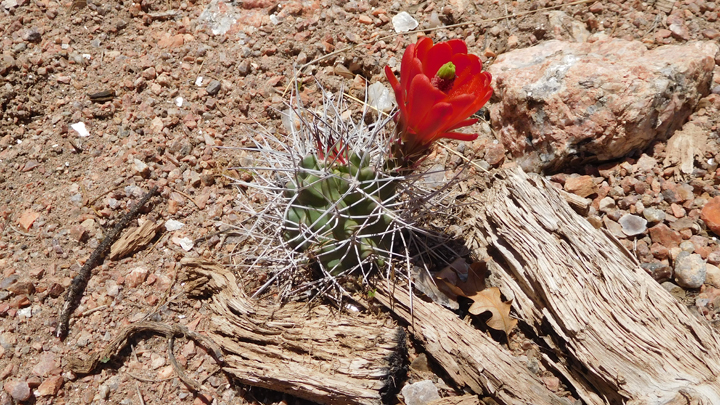
Beautiful bloom
Train / trail turnaround
The Point Alta Vista Trail is on private property but open to the public. The path lies on the rail bed of a former tourist train and crosses a bunch of cool train trestles. Apparently, it's not a well-known trail, because we didn't see another soul on the 2.3-mile hike until right before we left. Unbelievable!
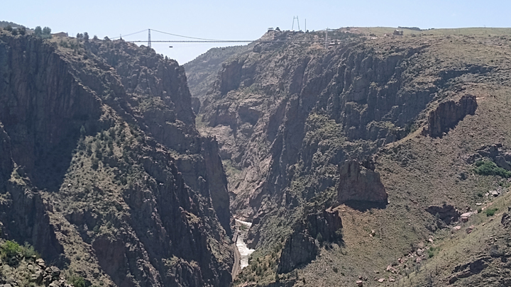
Royal Gorge
Viewing platform
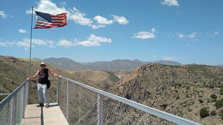
Tom at trail's end
From Canon City, we took scenic US 50 west, following the very pretty Arkansas River for much of the way. Then we climbed up, up, up the Rocky Mountains and over the Continental Divide. Fortunately, Tom had now begun to acclimate to the altitude, to the point that he was even able to drive over Monarch Pass at 11,312 feet.
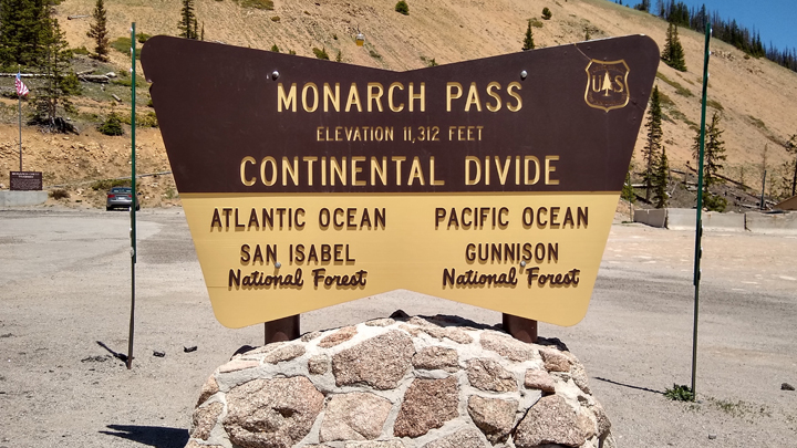
Crossing the Rocky Mountains
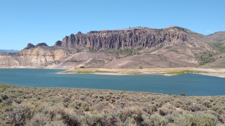
West of Gunnison, US 50 tracks the Gunnison River for a number of miles, partially along the ridiculously attractive Blue Mesa Reservoir, Colorado's largest body of water. We were surprised to spot a lone bighorn sheep grazing next to the highway.
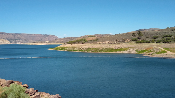
Blue Mesa Reservoir
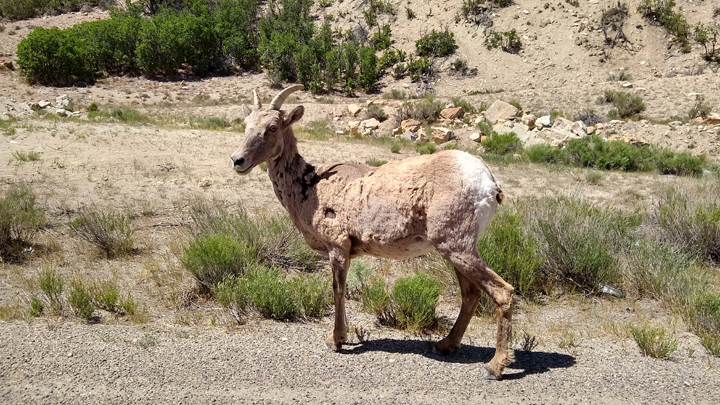
Bighorn sheep
After crossing the reservoir, we stopped at Dillon Pinnacles Vista Point. Wow! This is about the time we learned of US 50's closure to our west due to road construction. The road was scheduled to reopen each evening at 5:30, so we had a couple of hours to kill before continuing on our way.
Dillon Pinnacles
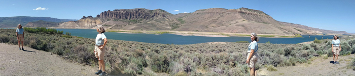
Jana, Jana, Jana, and Jana
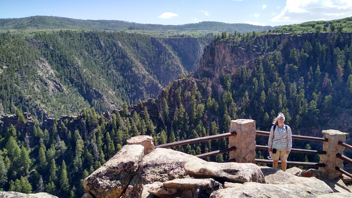
Plan B: Side trip on Highway 92 along the Morrow Point Reservoir of the Gunnison River to a high point overlooking the Black Canyon. This is part of the Curecanti National Recreation Area, which encompasses a large swath of the Black Canyon, three reservoirs impounding the Upper Gunnison River, and portions of the surrounding mesas. This diversion only took us a dozen or so miles out of our way, but the two-hour delay went by quickly.
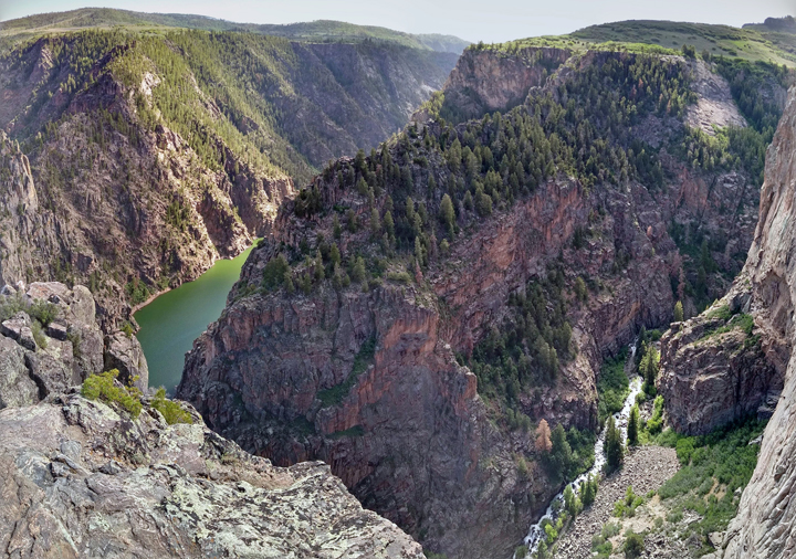
Black Canyon
Jana enjoys the delay
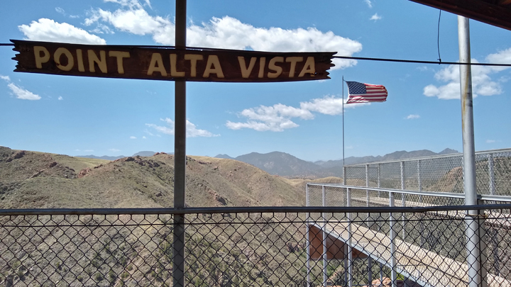
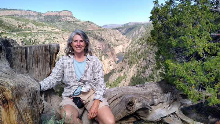
We killed most of our time at the Pioneer Point Overlook on the north rim of the Black Canyon, above the confluence of Curecanti Creek and the Gunnison River, at an elevation of 8,048 feet. The views were amazing, and again we had the place all to ourselves!
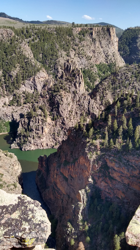
Curecanti Creek joins the Gunnison River
Windy vista
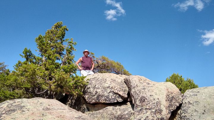
Triumphant Tom
Just before 5:30, we got in line for the reopening of US 50. It was just five miles of construction, but with one-way-at-a-time traffic, it took us over an hour to make our way through. Ugh!
On the other side of the road work, we made another series of stops in the Curecanti NRA, this time within the Black Canyon rather than above it. First was the Cimarron Canyon Rail Exhibit, which displays some cool old railroad equipment.
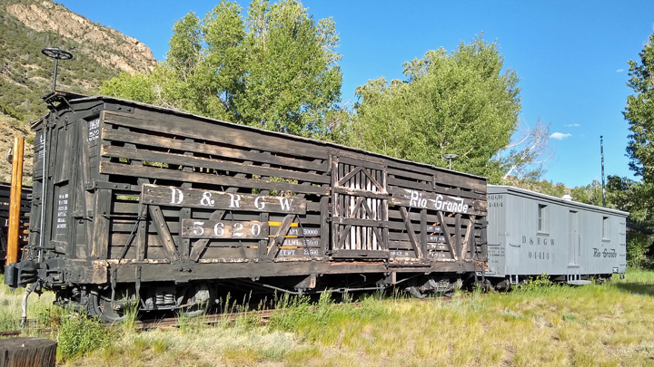
Cimarron Canyon Rail Exhibit
Beginning in 1882, the Denver & Rio Grand Railroad spent 15 months laying track through the Black Canyon, one of the most challenging stretches of rail in Colorado. Deep within the canyon, a historic steam engine, coal tender, box car, and caboose are displayed on a freestanding narrow-gauge train trestle.
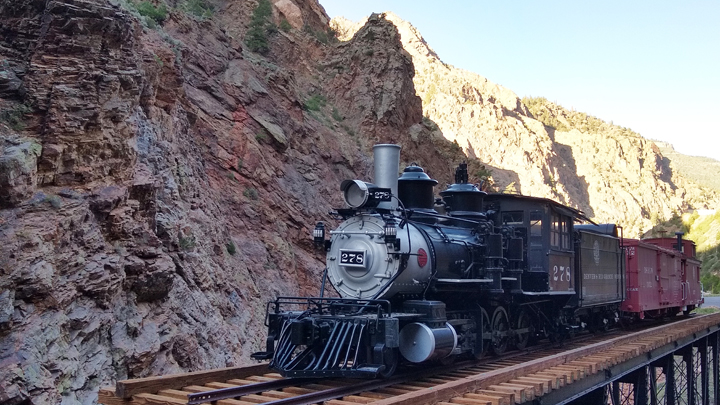
Denver & Rio Grand Railroad
Beyond the rail exhibit, we walked over a footbridge spanning the Crystal Reservoir impoundment of the Gunnison River. Cimarron Creek flows into the river here just below the Morrow Point Dam.
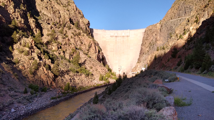
Morrow Point Dam
At the bottom of the Black Canyon
Shortly before sunset, we finally arrived at our hotel in Montrose. We'd expected to be here much earlier and had some other activities in mind, but the construction delay had changed that. But you know what? Plan B turned out even better!
We walked over to Mio Mexico for a great feast. Later in the evening, we enjoyed the super full moon from behind our hotel. Pictures can't do it justice, so I hope you saw it for yourself!
Lodging: Stay Wise Inns in Montrose, Colorado, a more modern hotel than most the of places we'll be staying. This hotel put a lot of emphasis on their “egg-cellent” breakfast, and I did enjoy my omelet the next morning.
|