Monday, June 20, 2022
Cottonwood Canyon, Bryce Canyon National Park
Before heading into small-town Utah for four nights, we figured we better stock up on beer while still in Arizona. That's how we found ourselves at Stix Liquor & Sporting Goods, where you can purchase beer, wine, liquor, fishing gear, guns and ammo - in other words, anything you need for a good time!
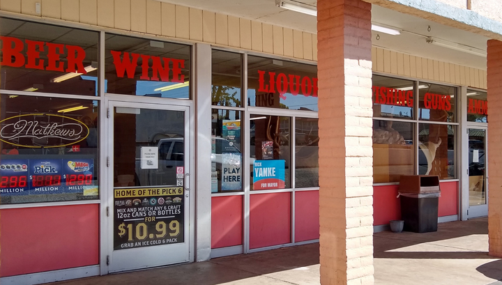
Stix Liquor & Sporting Goods
Unfortunately, US 89 from Page to Bryce Canyon would take us well out of our way to the west. There's an alternate route, but it's unpaved and sounded sketchy. We immediately ruled it out. That is, until just inside Utah, we happened upon the Big Water Visitor Center for Grand Staircase-Escalante National Monument.
When we stopped for a map and to inquire about the condition of the shortcut road toward Bryce, the ranger encouraged us to take Cottonwood Canyon Road through the monument. Contrary to the BS on the Internet, she told us the road is in good shape, super scenic, and we'd be fine. Sold!
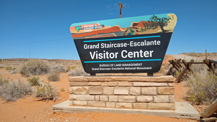
Last area to be mapped in the lower 48
Grand Staircase-Escalante is a HUGE area of federal land - almost 1.9 million acres - protecting the Grand Staircase, the Kaiparowits Plateau, and the Escalante River Canyons. Cottonwood Canyon Road (aka Road 400) runs for about 46 miles through the heart of the monument, between US 89 in the south and Kodachrome Ranch State Park in the north, ending about 15 miles southeast of Bryce.
Entering the backcountry
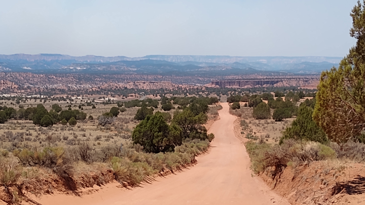
Cottonwood Canyon Road
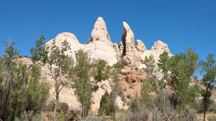
Funky pinnacles
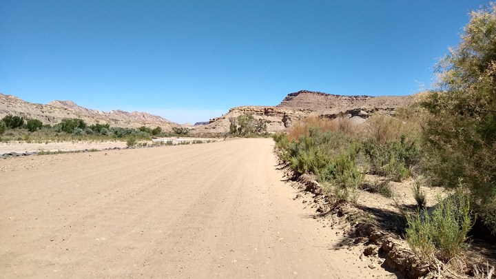
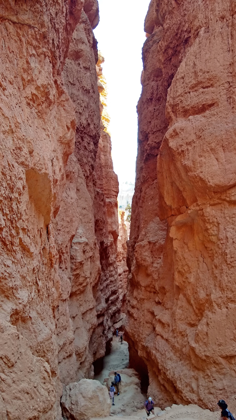
The dirt and clay road was indeed well maintained, just like the ranger said. It follows the Paria River north for the first several miles, then continues through the Cottonwood Wash below the sawtooth-like Cockscomb Ridge on one side of the road and softer-looking sandstone on the other.
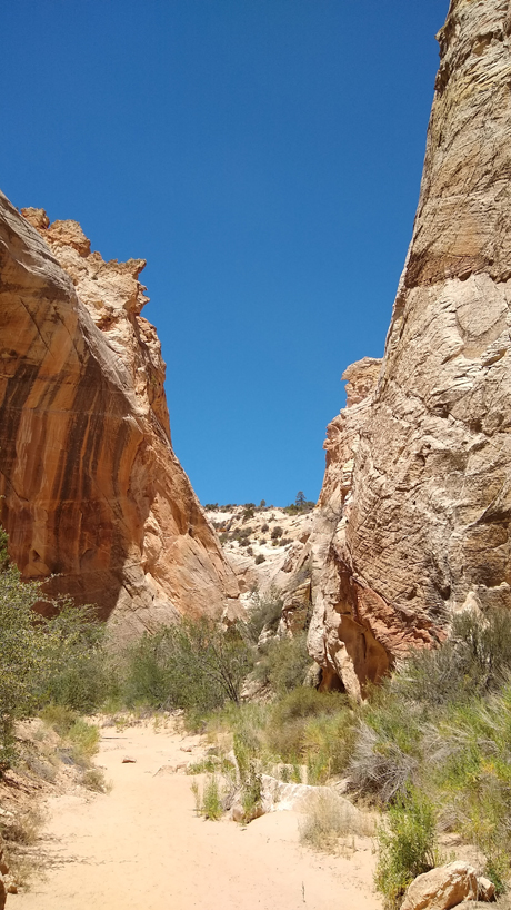
Cottonwood Narrows
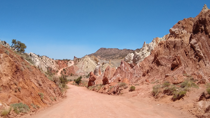
The road turned red
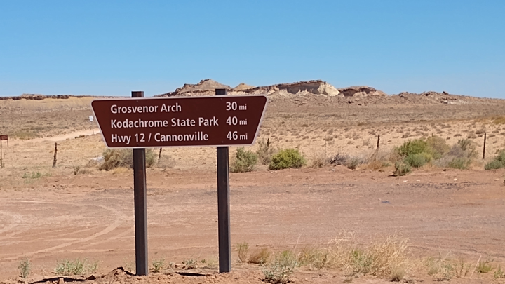
A few miles before returning to pavement, we took a side road to Grosvenor Arch, a huge sandstone double arch. The arches are 150 feet above ground level and just as impressive as what you find in Arches National Park.
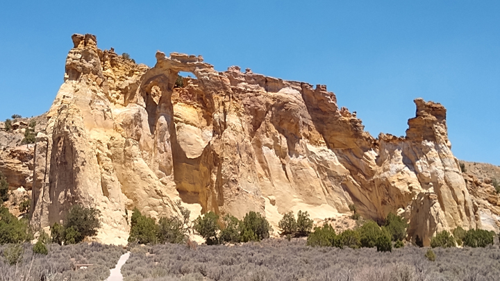
Grosvenor Arch
The dirt-road shortcut through Grand Staircase saved us close to 100 miles, but the travel time was about the same as going around the long way. Unlike the highway, however, we had Cottonwood Canyon Road practically all to ourselves!
Kodachrome Ranch State Park
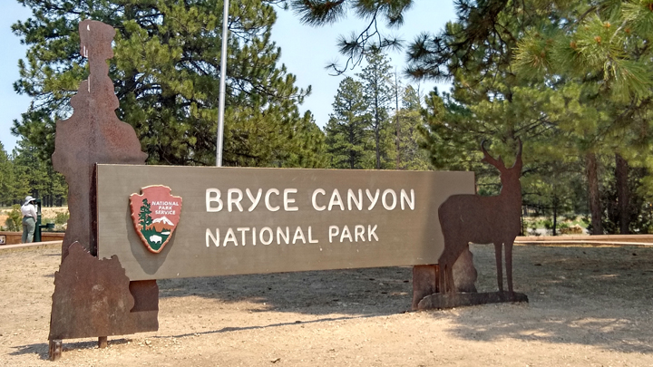
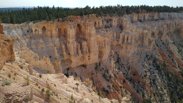
We reached Bryce Canyon National Park early in the afternoon, and the wildfire smoke was pretty heavy. Oh, well. The aptly named Scenic Drive runs for 18 miles through the park. As you drive through Bryce, most of the lookout points are on the left, so we drove directly to the far end of the road and worked our way back.
Fun fact: Bryce Canyon is not a canyon
The smoke increased the further we proceeded into the park. By the time we reached the end of the road at Yovimpa and Rainbow Points, it was pretty bad. These are the park's highest points, at 9,115 feet. The smoke was pretty unpleasant, so we didn't stay long.
Yovimpa Point, looking in a smoke-free direction
Wildfire smoke in the distance (right)
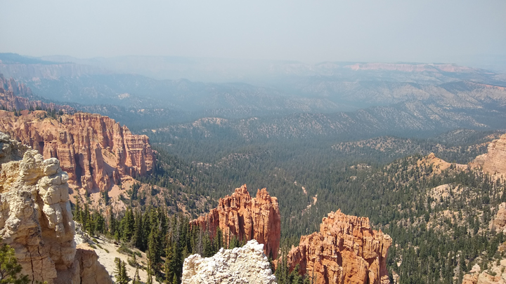
Rainbow Point, smoky view
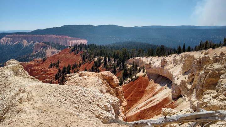
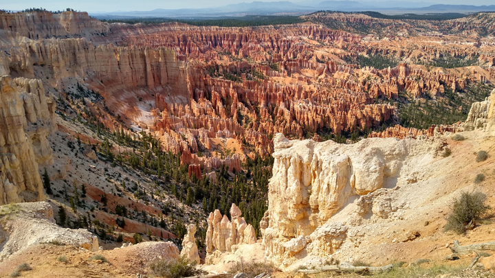
Regardless of the smoke, we stopped at every pulloff. The views began to clear as we drew closer to the park entrance and the elevation decreased. There were no crowds today, as I was worried there would be. Do we have the wildfires to thank?
Agua Canyon
Natural Bridge
No smoke in the lower elevations!
Paria View
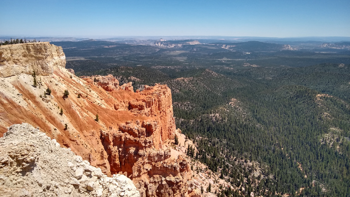
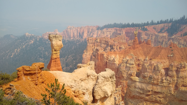
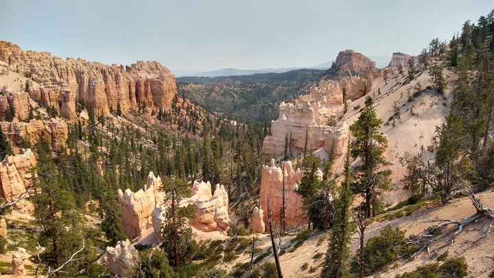
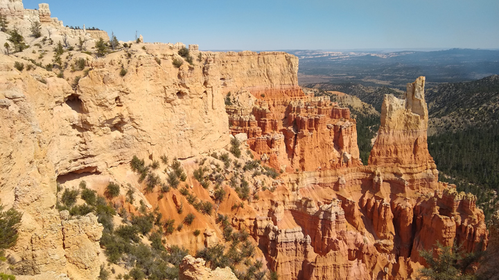
The absolute best views were at Bryce Point and Inspiration Point. By the time we reached this area, we'd dropped below the smoke, and the view of the multicolored hoodoos in the Bryce Amphitheater was phenomenal!
From Bryce Point
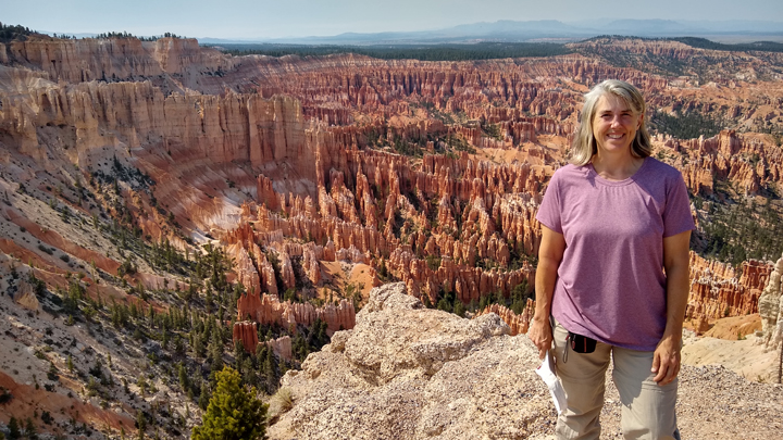
Jana at Bryce Amphitheater
Glorious Bryce Amphitheater
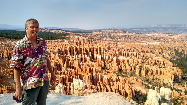
Tom at Bryce Amphitheater
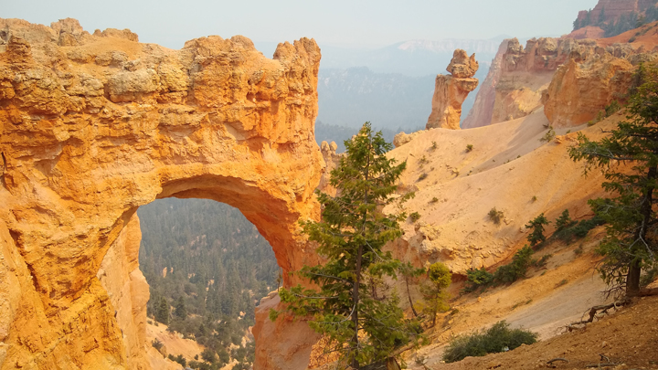
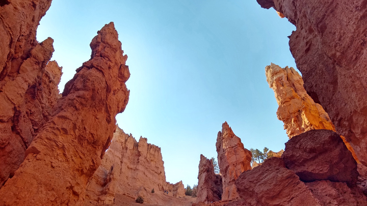
The only thing we needed to complete our Bryce experience was a hike down into the hoodoos. For the most bang for our exertion buck, we chose the Navajo Loop Trail, descending the loop via Wall Street and climbing back up past Two Bridges. Tom had been to Bryce before, and he recommended this trail. Good call!
Wall Street, part of the Navajo Loop
Among the hoodoos
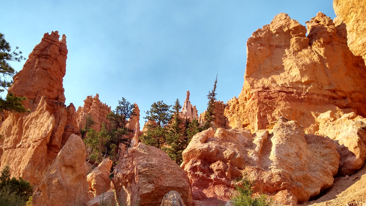
Along the Navajo Loop Trail
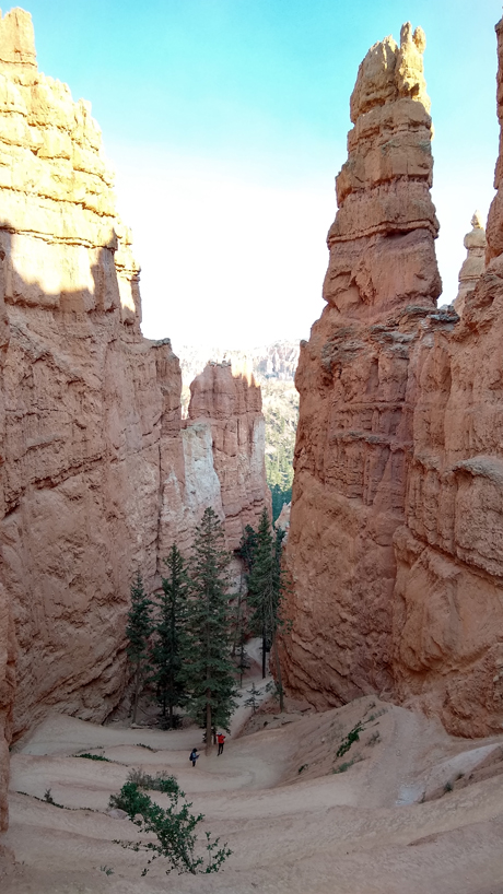
Steep trail at high elevation, literally breathtaking
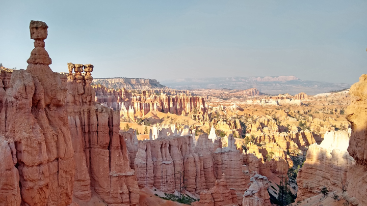
Thor's Hammer
Bryce Canyon was our furthest point west on this trip. From here, we have six days left to make it back to the Denver airport for our flight. I hope we can find something fun to do on the way...
The sun begins to set
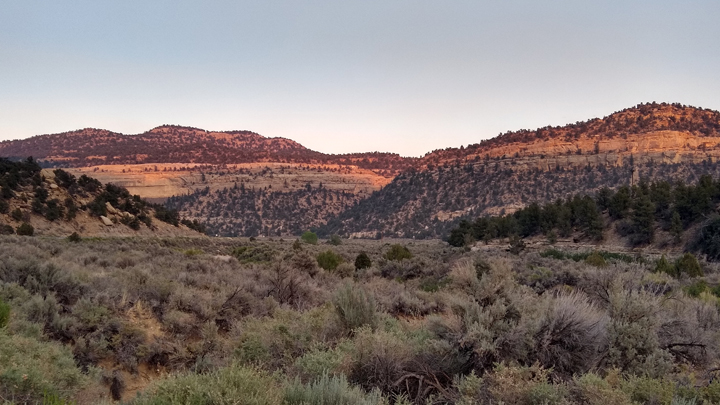
Along scenic US 12
Leaving Bryce, we drove scenic US 12 east for an hour to little Escalante, Utah, population 797. The hotel office was closing when we arrived at 8:30, and by the time we pulled up, they'd already taped our room key to the front window. But the receptionist hadn't left yet, and she told me we could still get dinner across the street if we ordered by 8:55.
So without even entering our room first, we ran across the street to 4th West Pub, where we put in a last-minute order for some delicious street tacos and a couple of beers. Just in time!
Lodging: Prospector Inn, Escalante, Utah. A big, clean, comfortable room in the middle of nowhere. What more do you need? We'll be here two nights.
|