Monday, September 9, 2002
Traveling from Cut Bank to Glacier National Park, we crossed
the Blackfeet Indian Reservation, stopping briefly at Camp
Disappointment near Browning, Montana, the farthest point north
reached by the Lewis and Clark expedition.
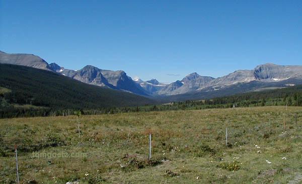
On the Blackfeet Reservation
Glacier National Park is sometimes called the "Crown of the
Continent," as if Canada was just perhaps a figment of our
collective imagination. Glacier is the United States side of the
Waterton-Glacier International Peace Park, a 1,800-square-mile,
glacier-carved wilderness of mountain lakes, glaciers, forests,
streams, and wildlife.
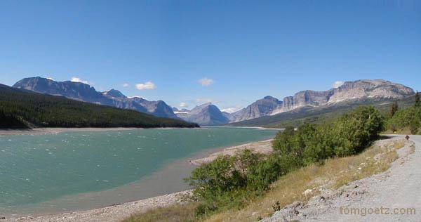
Many Glacier area, Glacier National Park
Immediately upon entering the park in the Many Glacier area,
two black bears ambled across the road in front of us. Woo-hoo!
Maybe since Glacier has fewer visitors, we'll see even more animals
here than we did at Yellowstone!
After yesterday's marathon driving session, we were ready for
some hiking. Glacier-Waterton is home to approximately 700 black
bears, 300 grizzlies, 40 wolves, and an unknown number of mountain
lions. The national park literature recommends making noise while
you hike so you don't surprise the bears, that they'll "usually"
move out of the way if they hear you approaching, so we dutifully
clapped our hands and shouted "hey, bear" as we hiked. Did we feel
silly? Of course. But we did it anyway.
A 1.1-mile (each way), steep hike took us to Apikuni Falls.
No one else was around. Awesome! It seems all you have to do to get
away from people in most national parks is hike about 100 yards
from your car.
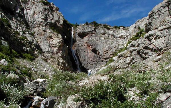
Apikuni Falls
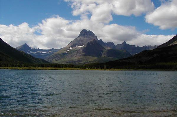
The 2.6-mile Swiftcurrent Nature Trail led us around the
Swiftcurrent Lake and provided great views of some glaciers. We saw
fresh bear poo on the trail!
On our hike
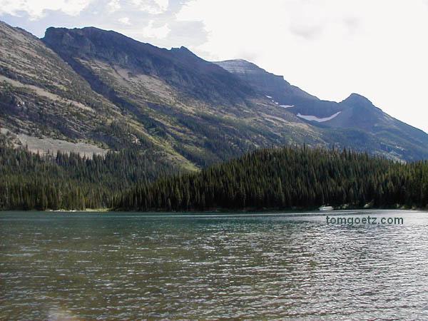
Swiftcurrent Lake
We left the Many Glacier area and re-entered the park at the
main eastern entrance, St. Mary, where we picked up
Going-to-the-Sun Road. This 52-mile winding road through the center
of the park opened in 1933, after 20 years of construction. It is
an engineering marvel and no doubt one of the most scenic roads in
the world!

Going-to-the-Sun Mountain
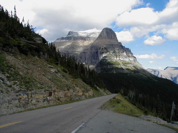
Going-to-the-Sun Road
The road follows along the shoreline of the park's two
largest lakes, St. Mary Lake and Lake McDonald, and crosses the
Continental Divide at Logan Pass, elevation 6,646 feet. We stopped
at nearly every turnout and scrambled around on the rocks, taking
photos. Fabulous!
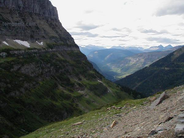
More gorgeous scenery
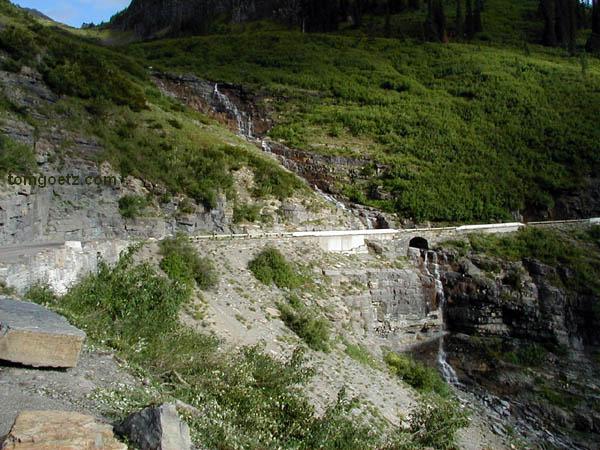
The waterfall goes under the road!
Near Logan Pass a silly-looking mountain goat was licking up
someone's spilled drink in a parking area.
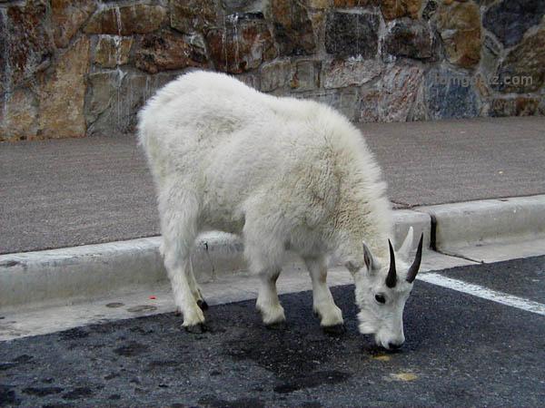
Goats will eat anything
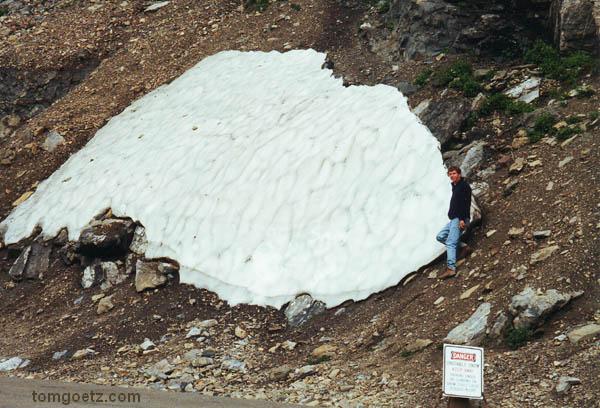
"Danger - Unstable Snow. Keep Away."
Shortly before leaving the park, we saw a rustling in the
trees off to the right, and I slowed to a stop. Tom rolled down his
window to get a photo of whatever might be there, when the branches
moved again to reveal the biggest black bear either of us had ever
seen - and startlingly close, I might add. It was just munching on
berries and not paying any attention to us, thankfully.
We're staying the next couple of nights in Whitefish,
Montana, just west of Glacier, at Allen's Motel. Our room is a
pre-fab structure with a fridge and microwave, and there's somewhat
of an odor about it, but, hey, the price is right.
Tonight we scored an excellent Mexican dinner at Dos Amigos,
especially great after requesting hotter salsa.
A very reasonable 111 miles today.
|