Monday, June 13, 2022
Garden of the Gods, Pikes Peak, Phantom Canyon
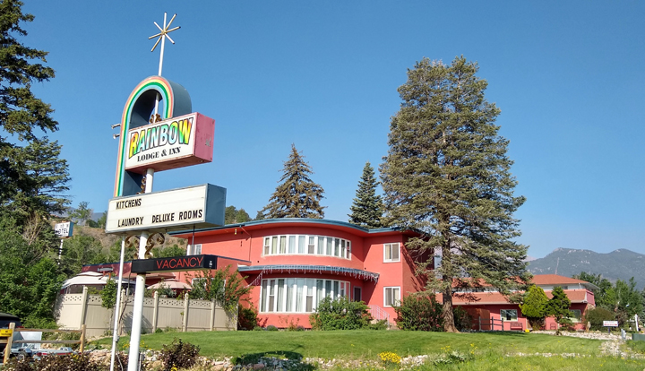
Character and comfort
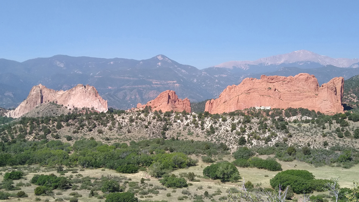
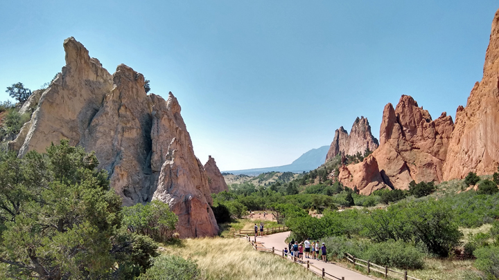
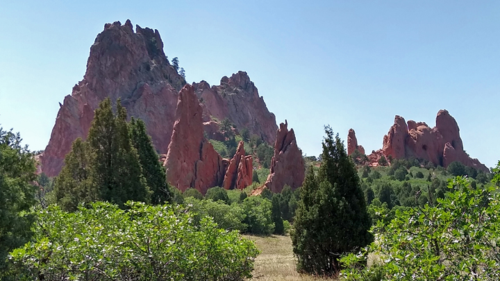
Garden of the Gods is a public park in Colorado Springs with 21 miles of trails winding through towering red sandstone formations. It doesn't take a lot of time. You can stop at all the roadside viewpoints and hike a short trail or two in a couple of hours.
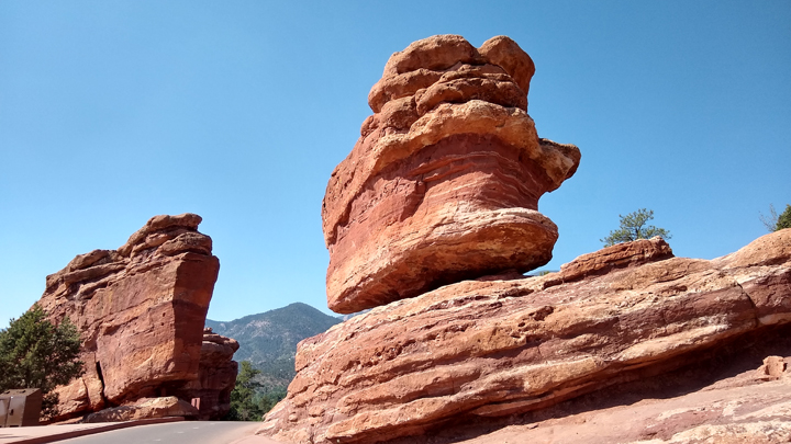
Garden of the Gods, Balanced Rocks Formation
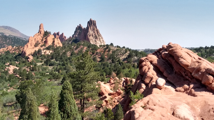
High Point Overlook
Mesa Overlook
We hiked the park's most popular trail, the 1.5-mile Perkins Central Garden Trail. It was pretty busy, but definitely the trail to do on your first visit to the place. Very cool!
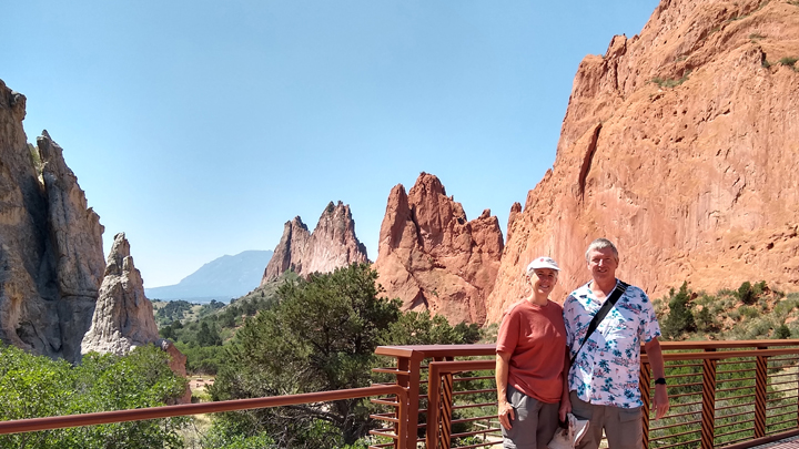
Jana and Tom in the Garden of the Gods
Perkins Central Garden Trail
Along the trail
The entrance station to Pikes Peak is only about a dozen miles from Garden of the Gods.
Due to its popularity, driving to the top now requires a reservation. We arrived at the entrance gate at our appointed time of noon and headed up the mountain.
Colorado has 54 mountains over 14,000, and Pikes Peak is one of only two fourteeners with a road to the top. Somehow, we'd decided it was a good idea to make this high-altitude drive within 24 hours of leaving home, with no time to acclimatize. Not our brightest idea.
Partway up, we took an unpaved side road over to the Catamount Lakes, at 9,200 feet. Between the rough road and the altitude, Tom wasn't feeling great but still wanted to continue upward. But by the time we hit 10,000 feet, he was feeling so bad that we backtracked to the Crystal Reservoir Visitor Center at an elevation of 9,160. After a few minutes, Tom insisted he was well enough to wait there while I completed the drive to the 14,115-foot summit, still 14 miles and 5,000 vertical feet away.
Pikes Peak and South Catamount Lake
With Tom waiting below, I raced on to the top as quickly as I could. Admittedly, it was a slow race - about 10 mph for the steepest part of the climb. There are no guardrails along the steep and winding road, but it's paved and plenty wide, so not particularly scary. We've driven a LOT hairier roads than this!
It was sunny and 61 degrees at the peak, with at least 30 mph winds, and there was snow on the ground. The view went on forever! I walked a circle around the summit, took a celebratory selfie, and headed back down.
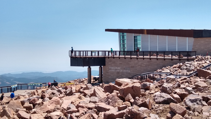
Pikes Peak Summit Visitor Center
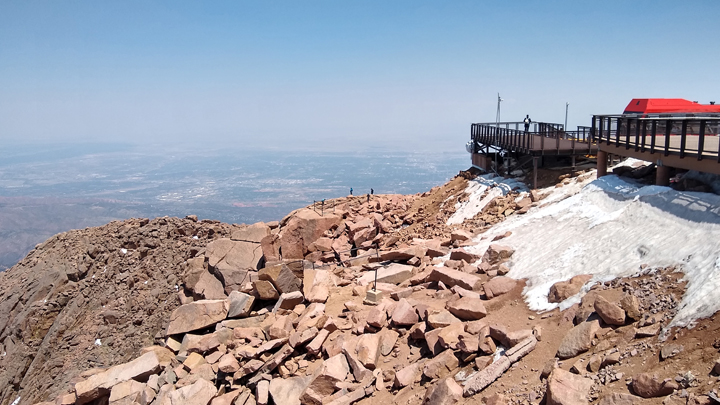
Snow!
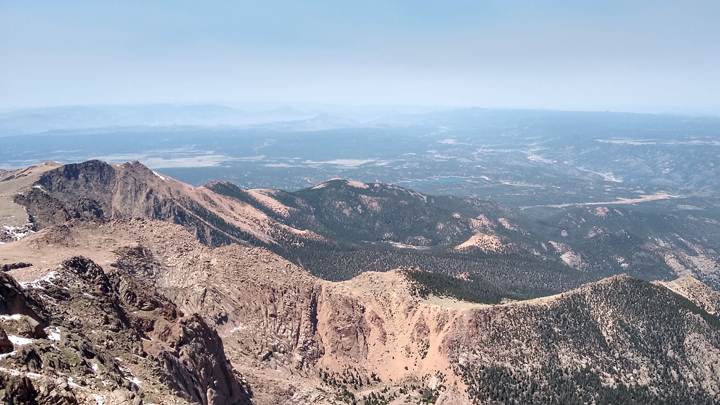
View from 14,115 feet
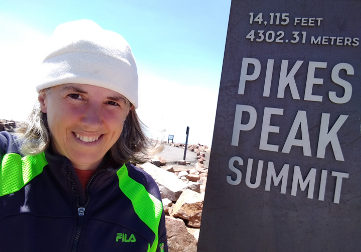
Jana's summit selfie
An hour and a half after leaving Tom, I picked him back up at the Crystal Reservoir. He was feeling much better by that time and had even hiked about a mile and a half around the visitor center while he waited, a very pretty place. But it's too bad he couldn't come with me to the top!
Pikes Peak from Tom's hike
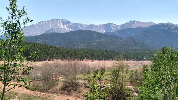
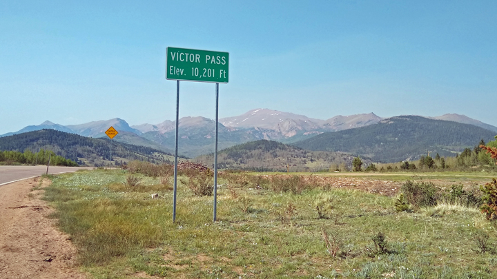
The Cripple Creek & Victor Mining District is 45 minutes southwest of Pikes Peak. We were just passing through en route to our next scenic drive but were quickly captivated and made several stops, even going on an unscheduled hike - just a short one, though, since it was over 10,000 feet.
On the Gold Trail
Mining country
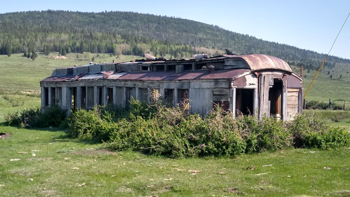
Former train car / miner's cabin
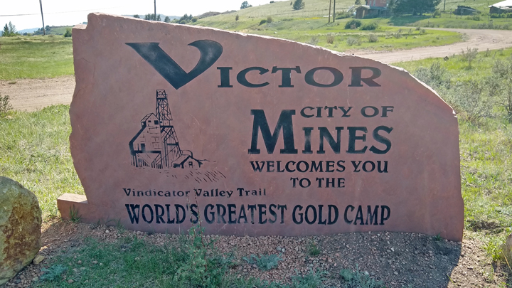
Gold was discovered in Victor in the 1890s, and during the subsequent gold rush, the area quickly became the second largest gold mining district in the country. The boom ended as World War I began, but mining continues in the area even today. Many years ago, Tom's dad even went on a little prospecting trip nearby.
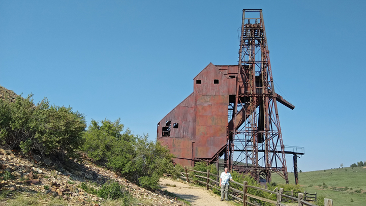
Theresa Gold Mine
Valley view in the mining district
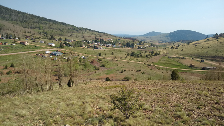
In its heyday reaching a population of 18,000, Victor is now home to just 400 residents. After decades of mining, there's old, abandoned mineworks all over the surrounding hillsides. There's a little bit of Gold Belt tourism here. I just hope the area doesn't get too popular and lose all its charm.
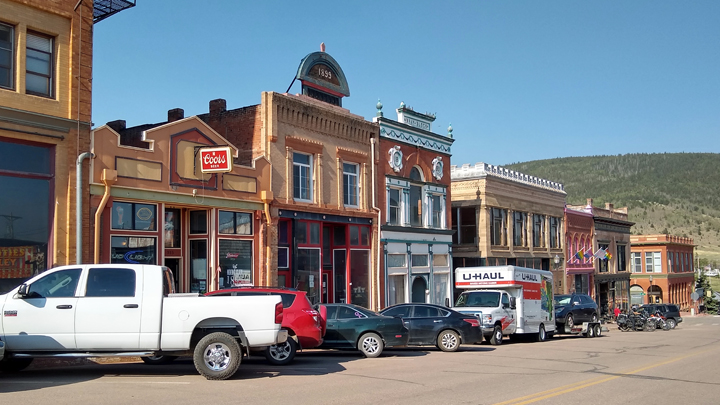
Downtown Victor, Colorado
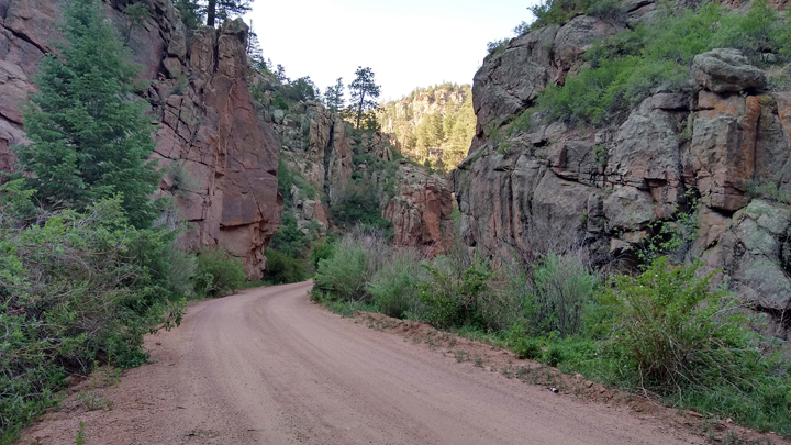
Connecting Victor with Canon City is the Phantom Canyon Road, a National Scenic Byway. The narrow, twisting 30-mile dirt track passes through a rugged ravine on top of what was once the Florence and Cripple Creek Railroad. There are several elevated bridges, two tunnels, and loads of narrow gaps chiseled through the rock barely big enough to accommodate a car.
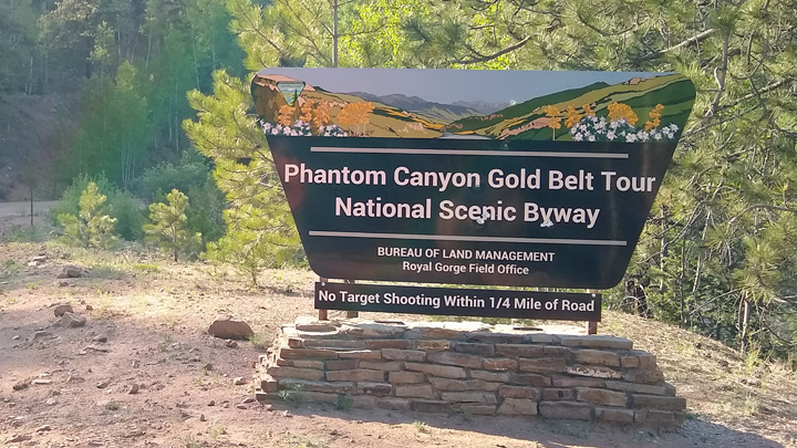
The byway begins
Phantom Canyon Road
Beginning outside Victor, Phantom Canyon Road decreases in elevation from 9,500 to 5,500 feet as it descends towards Canon City. Much of the road is too narrow for two vehicles to pass, and if you're the downhill driver, as we were, the other guy has the right-of-way, and it's your obligation to back up the hill to a space wide enough to let him go by. And of course there's no guardrails, and you're often on the edge of a precipice. Bwahaha!
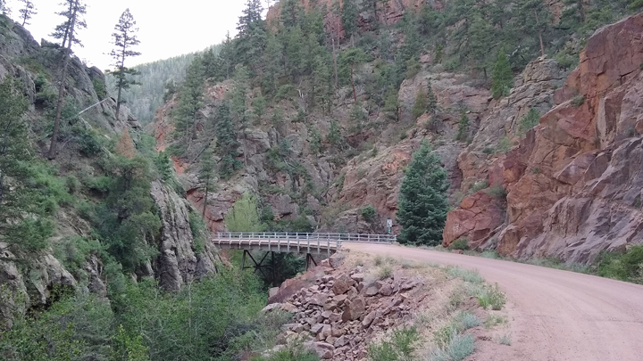
Cool curved bridge

Narrow passage
It was nice to have high-clearance Big Red on this road, but it was well graded and could easily be done in a regular car. It just would have taken longer. With all the stop-worthy spots along the way, it still took us two and a half hours to go 30 miles.
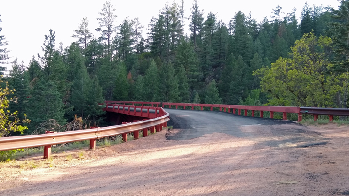
Another cool bridge
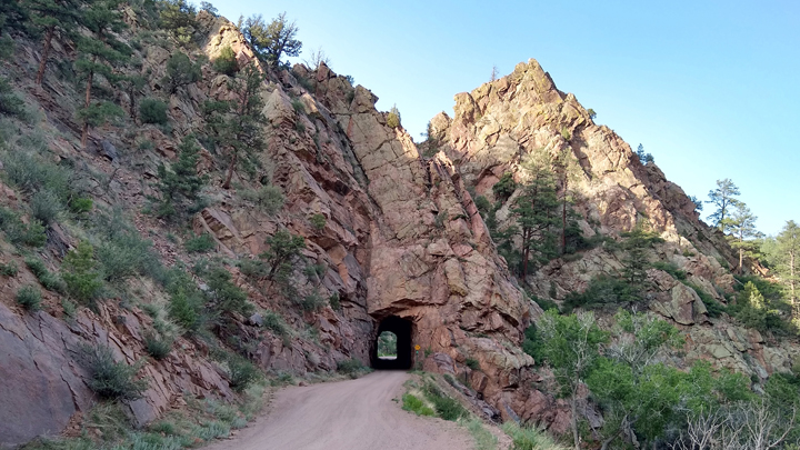
Tight tunnel
Eventually, we popped out of the canyon a few miles east of Canon City. As soon as we left the canyon, the sky became super hazy due to wildfire smoke all the way from Flagstaff, Arizona. Yikes!
Fiery sky
For dinner, we went to World's End Brewing Co. Their motto: “Pouring Salvation One Pint at a Time.” The beer was decent but not exceptional. The food menu was extensive, but we kept it simple with chicken avocado paninis and fries. Very good.
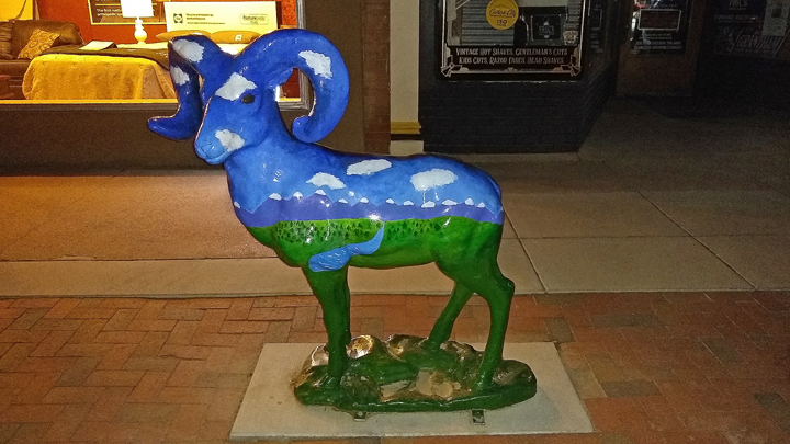
Bighorn sheep, Canon City
Leaving the pub, we drove a few miles out of town to the Elkhorn Loop Picnic Area to try to get a night view of the Royal Gorge Bridge, but it turned out that a view would have required a hike, and it was too dark to risk venturing out toward the canyon rim. The blood-red moon from the smoky sky was cool, though.
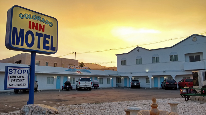
Lodging: Colorado Inn Motel, Canon City. A little mom-and-pop place with small, clean, cute rooms. The owner was super friendly and even texted me later in the evening with wildfire updates.
|