Sunday, June 19, 2022
Horseshoe Bend, Marble Canyon, Lake Powell, The New Wave
Today is the halfway point of our trip. For just 5 bucks, we refreshed our clothes at the Sunshine Laundry next door to our hotel, and we're good to go for another week!
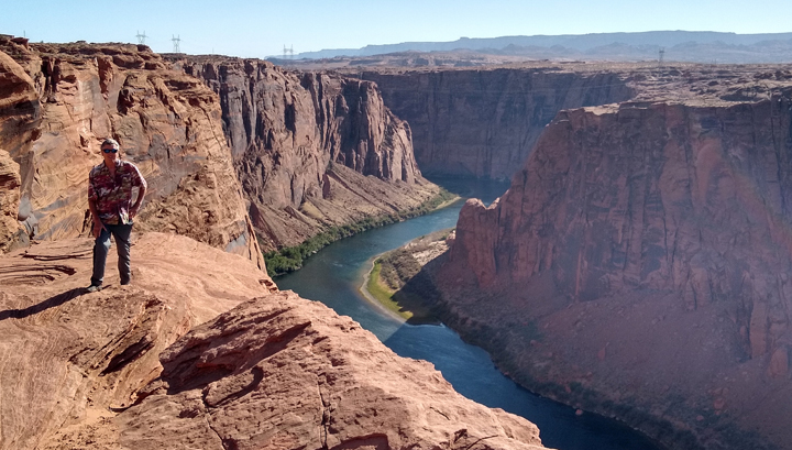
Horseshoe Bend is one of the most iconic and photographed landmarks in the western United States, yet somehow we'd missed it when we've been nearby in the past. Time to fix that! An easy 1.5-mile round-trip walk led us to a wide overlook of this mesmerizing curve in the Colorado River, 1,000 feet below.
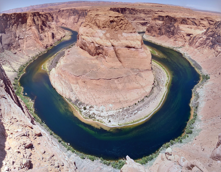
Horseshoe Bend of the Colorado River, Page, Arizona
Not surprisingly, there was a fair-sized crowd at the overlook, but it was super worth it, even in the brutal sun. The Colorado River seemed so peaceful far below, in contrast to the scene up top, where far too many people lined the cliff-edge posing for perilous pictures.
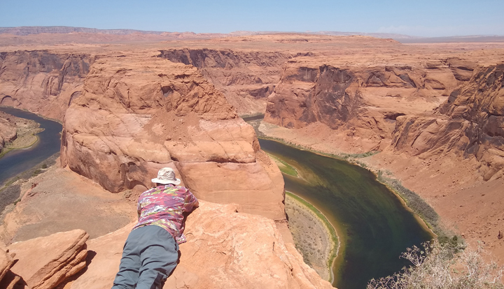
A photo to scare Tom's mom
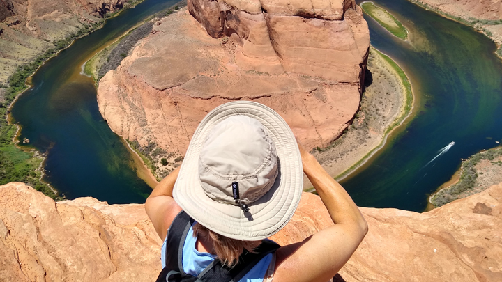
Photo of Jana taking a photo
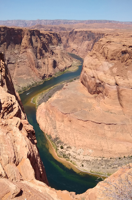
Half of the Horseshoe
Leaving the vista, we headed south from Page on steep and curvy US 89 up and over Antelope Pass before zigzagging down to the US 89A junction, where we turned north again toward Marble Canyon and Lees Ferry.
Antelope Pass
On reaching the Colorado River, we stopped at the Navajo Bridge, one of only seven land crossings of the river for 750 miles. Spanning Marble Canyon 467 feet above the river, at the time it opened in 1929, this was the highest steel arch bridge in the world.
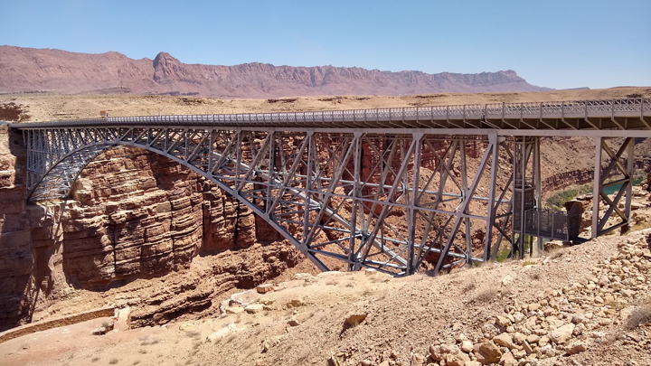
Navajo Bridge
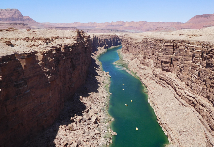
Rafters on the Colorado River
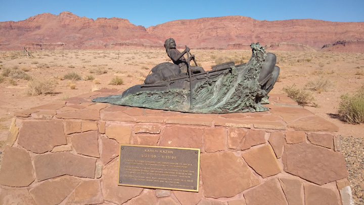
Tom and I rafted through the Grand Canyon in 2005 with my brother and nephews, meeting up with our guide and group at Marble Canyon Lodge, just around the corner from the Navajo Bridge. Since we were in the neighborhood, we thought we'd revisit a few places.
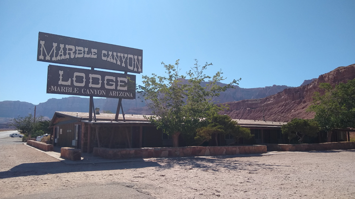
2005 lodging
Daring adventurer
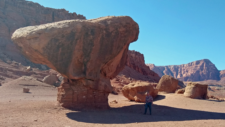
Balanced Rock, Tiny Tom, revisited
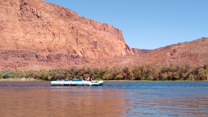
River trips through the Grand Canyon on the Colorado River leave from Lees Ferry, the only place in 700 miles where you can drive right up to the river. Stepping out of our truck at the boat launch was like walking into a blast furnace. Two groups, one commercial and one private, were busily rigging their rafts for trips starting the following day. The commercial operator happened to be Tour West, the same outfit we'd rafted with years before!
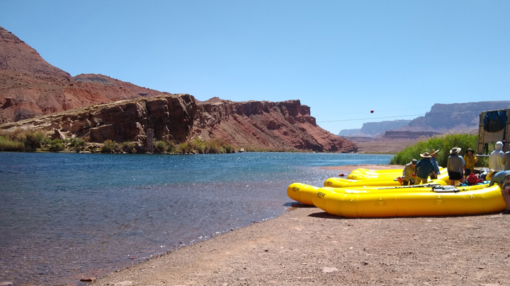
Private rafting group at Lees Ferry
Tour West guided raft
As we watched the rafting preparations from the relative comfort of the shade, three wild mustangs wandered down to the river for a drink on the opposite shore. An idyllic scene.
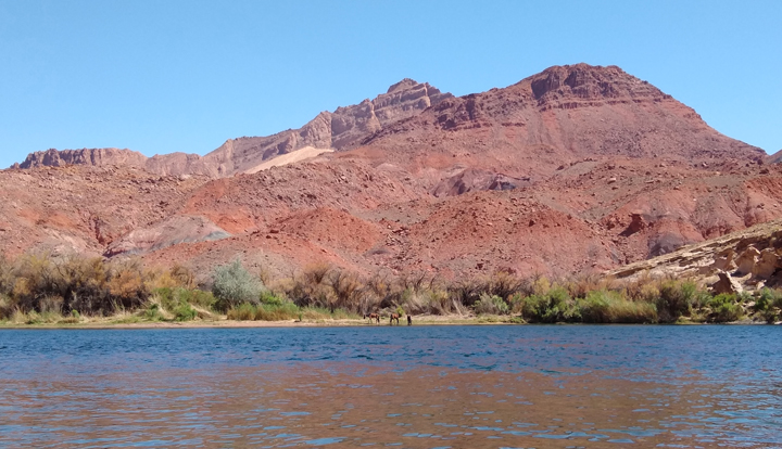
Wild mustangs

Roaming free
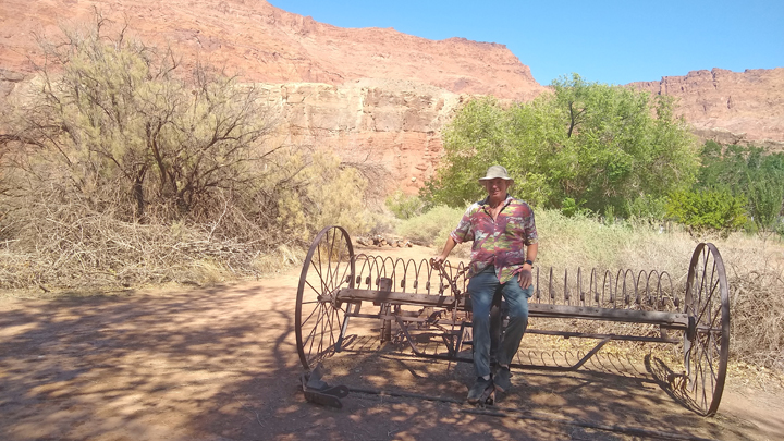
Nearby Lonely Dell Ranch Historic Site is the former home of the families who operated Lees Ferry until its sinking in 1928, just a few months before the opening of the Navajo Bridge. Several old buildings remain, as well as an abandoned orchard. Due to the broiling sun, we almost chucked our plans for a mile-long hike, until we realized that we could do most of our walk in the shade of the fruit trees.
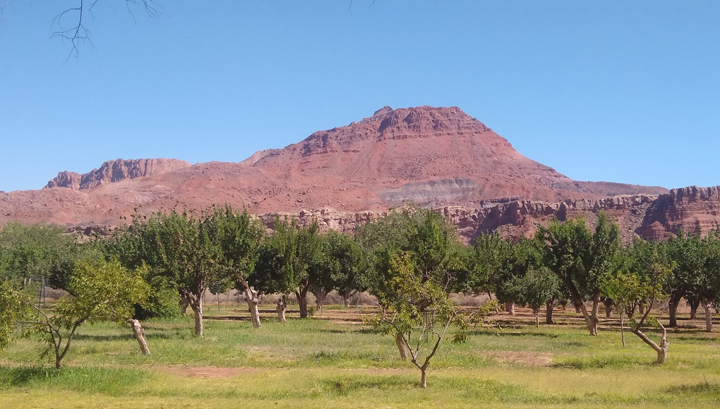
Lonely Dell Ranch Orchard
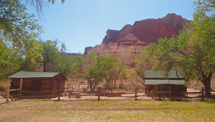
Lonely Dell Ranch Historic Site
You're allowed to pick up to five gallons of produce from the orchard per person per day for personal use. Seems like plenty. According to a sign, there were almond, apple, apricot, fig, nectarine, peach, pear, plum, and quince trees. Of course, not everything was in season. We picked a couple of apples and peaches and were able to gather enough apricots to last us for the next week!
Tom sits in the shade
Horses wanted
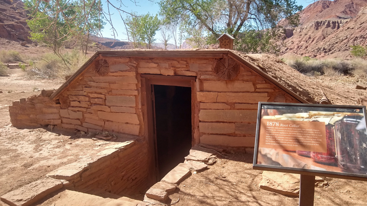
1878 root cellar
Once we backtracked to Page, our next stop was the Glen Canyon Dam Overlook, where a short trail with a fair number of stairs led down to a great dam viewpoint.
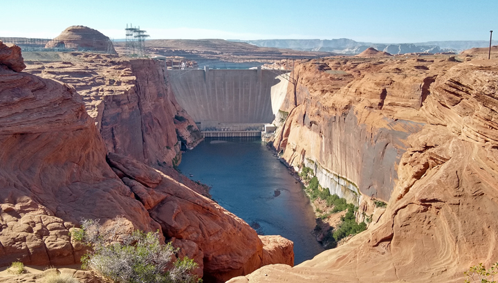
Glen Canyon Dam
Tom above Glen Canyon
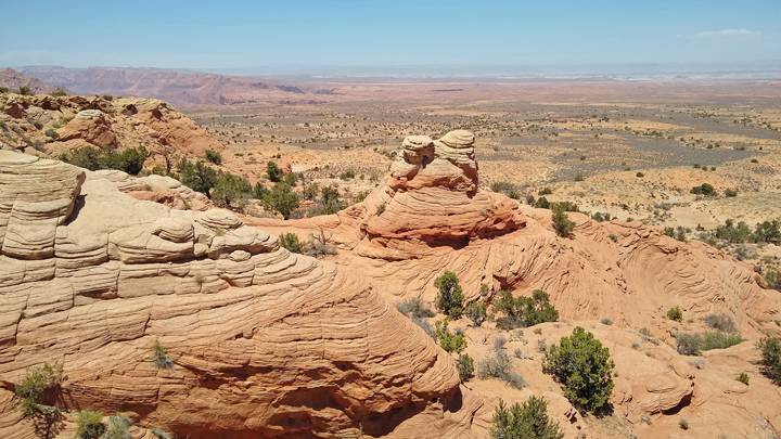
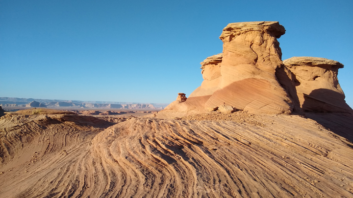
By 6:00, the sun was low enough for another hike. The New Wave is a cool sandstone formation with a wavy configuration. Trail access is just north of Page off of US 89. Contrary to Alltrails' directions, the path begins across the road from the Beehive campsites. We missed the trailhead and ended up trudging through deep sand. Once we found the path, it was heavily cairned and very easy to follow. Most of the trail was even outlined with rocks.
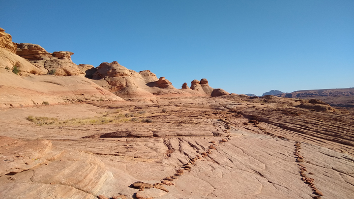
The New Wave Trail, clearly marked
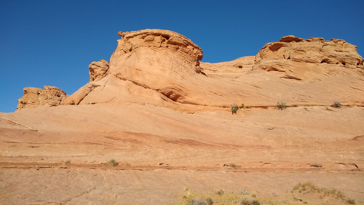
Wavy sandstone
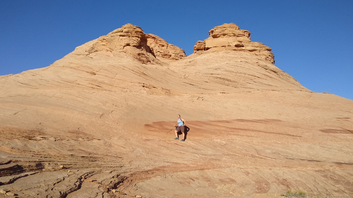
Jana at The New Wave
Midway through the New Wave Trail is a side path to Radio Tower Rock, also heavily cairned and impossible to miss. This is an outstanding viewpoint of the surrounding area and looking back toward the New Wave. Including the side path, we hiked about 1.5 miles.
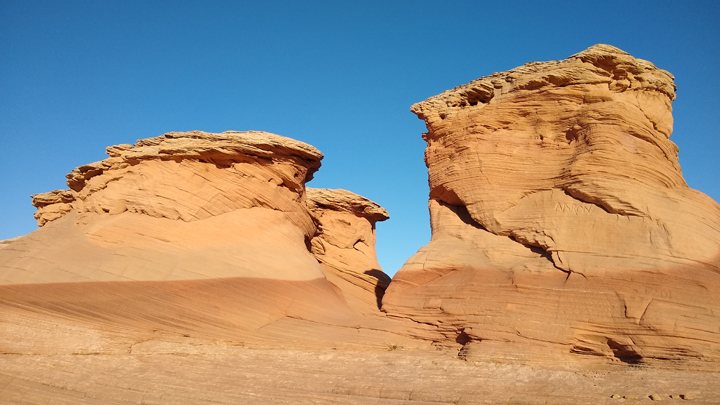
Two-tone towers
From the side path
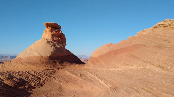
Radio Tower Rock
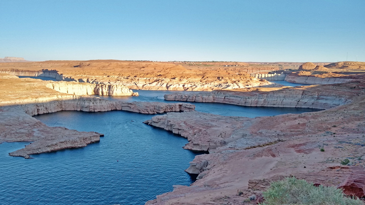
After the hike, we still had time for a couple more scenic viewpoints of Lake Powell. The water in the lake is very low; however, it's 13 feet higher than this time last year. I first rafted the Grand Canyon with my dad and brother in 1983, at which time Lake Powell was so flooded that the only thing that kept it from overflowing were 4x8 sheets of plywood added to extend the dam's gates and releasing half a million gallons of water per second into the Colorado River.
Lake Powell from Navajo Mountain Overlook
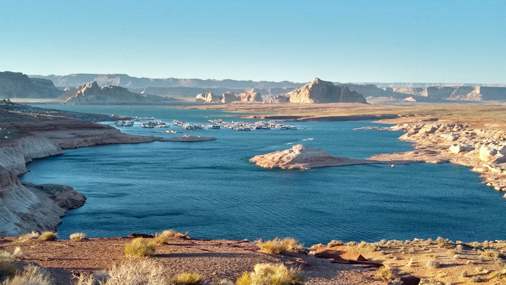
Lake Powell and marina from Wahweap Viewpoint
We ended our day with dinner at State 48 Tavern, a pulled pork sandwich, Cubano, and fries. Of course, we had beer as well. It's a tavern, after all. The food was good, but not as good as last night's dam restaurant, right around the corner.
Lodging: Knights Inn, Page, Arizona, night two.
|