Wednesday, June 22, 2022
Burr Trail Road, Capitol Reef National Park
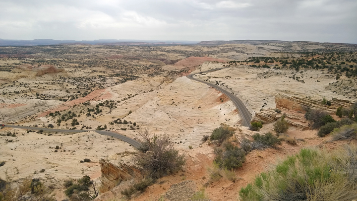
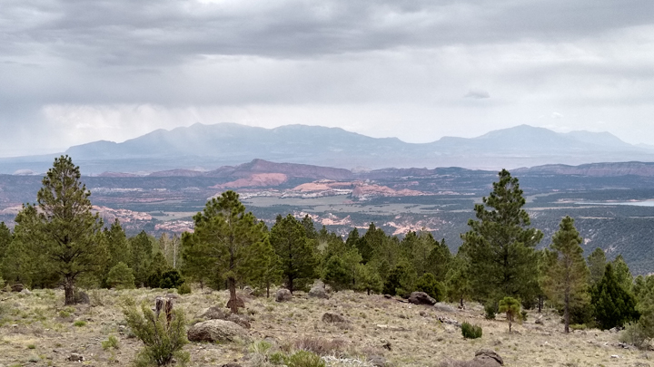
We left Escalante heading east, soon coming to the portion of Scenic Byway 12 called the Hogback, where hairpin turns trace the top of a razorback ridge with steep dropoffs to each side, and of course no guardrails - because what fun would that be? The views are really something!
Scenic Byway 12
Feast for the eyes
The Hogback
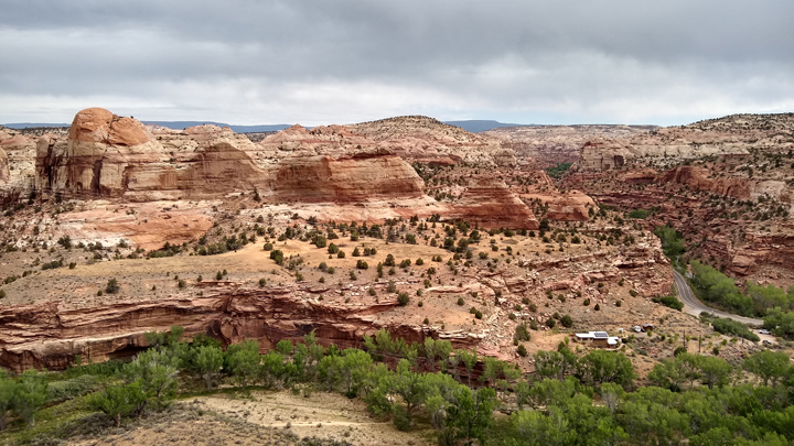
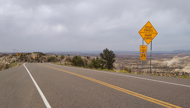
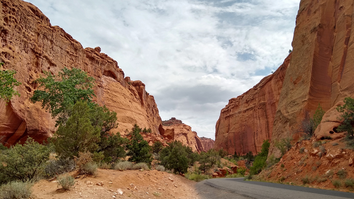
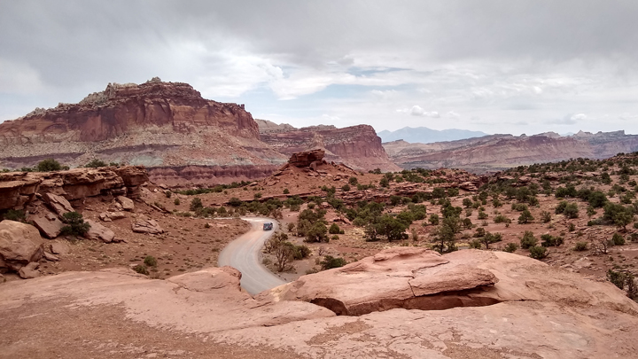
At Boulder, we turned onto Burr Trail Road (aka Road 100), following a pretty creek through red sandstone hills before dropping into Long Canyon. The first 31 miles of the road are paved, before it becomes a more adventurous route, heading over the Circle Cliffs, across the Waterpocket Fold of Capitol Reef, and eventually reaching Lake Powell. If only we had more time! We drove the first 14 miles before turning back.
Burr Trail Road
Long Canyon
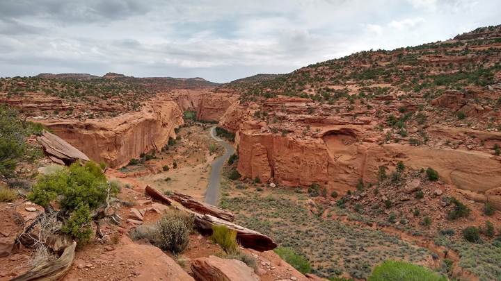
At an unmarked spot along Burr Trail Road, exactly 11.2 miles from its intersection with Highway 12, is a little slot called Singing Canyon, only about 100 feet long but definitely worth a stop, if you can find it.
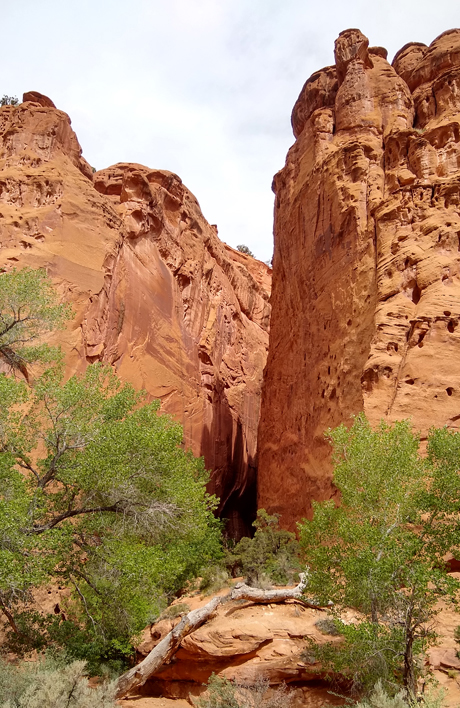
Singing Canyon
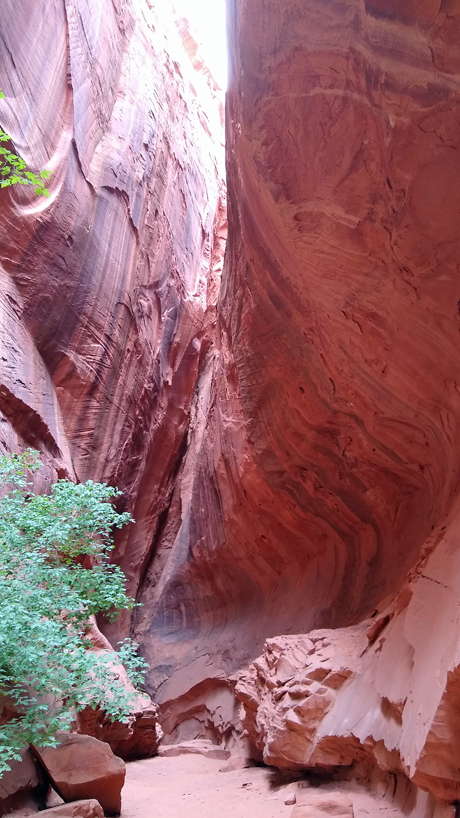
Amazing acoustics!
After Boulder, we left Grand Staircase-Escalante National Monument for the last time, continuing on Scenic Byway 12 through a portion of Dixie National Forest before turning onto Highway 24 at Torrey and entering Capitol Reef National Park.
Oasis of green in the desert
More Scenic US 12
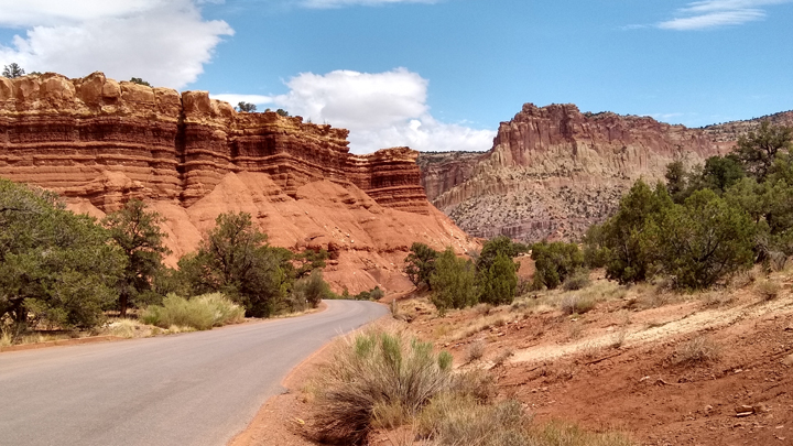
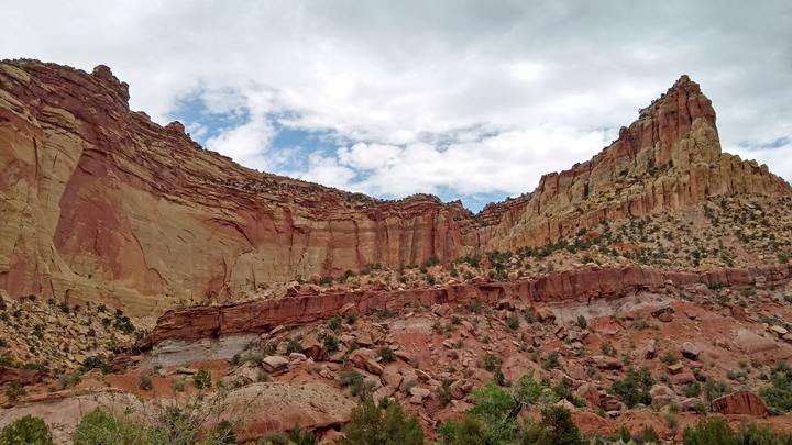
The “capitol” part of the Capitol Reef name comes from a line of white sandstone domes thought to resemble the U.S. Capitol building. Impassable ridges were referred to by early settlers as “reefs,” which is where the park gets the second part of its name, from the Waterpocket Fold, a 97-mile-long ridge where layers in the earth's crust have folded over each other, making a formidable barrier.
Coming from the west, we first reached Goosenecks Road, which leads to Panorama Point and the trailhead for Goosenecks Overlook and Sunset Point. I'd chosen a few trails for today, but after yesterday's six-miler through the slot canyons, we agreed to take it easy and keep the hiking to a minimum. The Sunset Point Trail was less than a mile and very rewarding.
Capitol Reef National Park, Panorama Point
Sunset Point
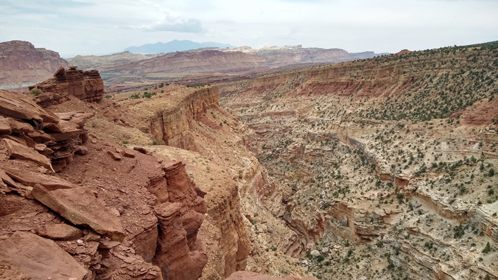
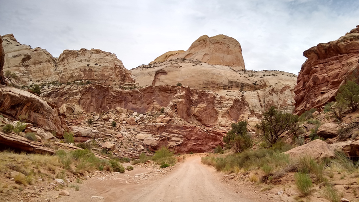
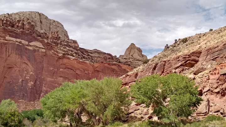
The main attraction in Capitol Reef is the paved, eight-mile Scenic Drive, which goes through a small portion of the Waterpocket Fold. We drove this road plus two short, unpaved side roads leading to the Capitol Gorge trailhead and into the Grand Wash.
Along Scenic Drive
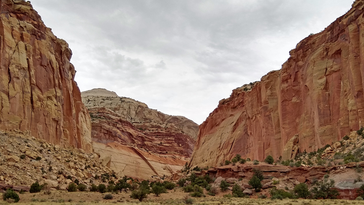
Within the Waterpocket Fold
Geology of Capitol Reef
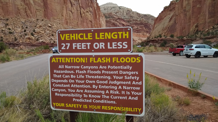
There were multiple signs in the Waterpocket Fold warning to watch out for flash flooding, and I was a little uneasy during our time down in the washes. I found out later that the day after our visit, there was indeed a flash flood, with dozens of visitors having to be airlifted to safety and multiple vehicles washed away. Yikes!
Warning!
The park's visitor center and areas along Highway 24 were fairly busy; otherwise, Capitol Reef was quiet and uncrowded. Hopefully, we can return to Capitol Reef someday when we have more time and energy, because I'd love to do some hiking!
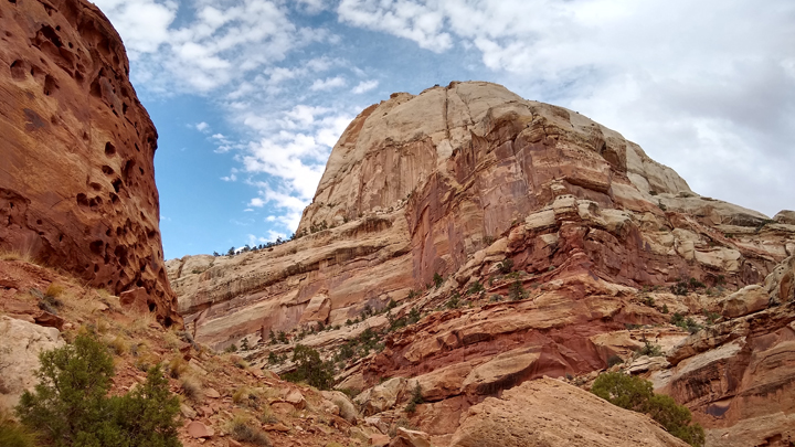
Dome of white Navajo sandstone
Each one a "capitol" dome
Final shot from Capitol Reef
Unscheduled stop: Carl's Critter Garden in Hanksville. The things you come across while driving through the desert! Looking around was free, but we left Carl a well-deserved donation.
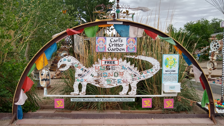
Eye-catching art
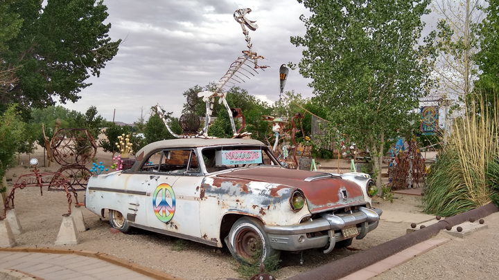
Eclectic collection
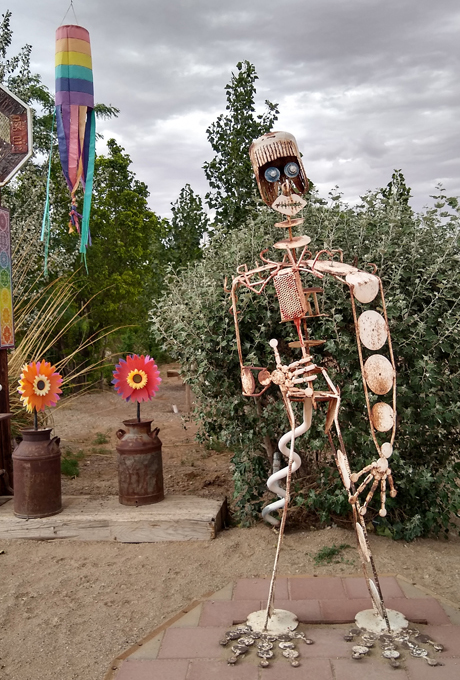
Hello there
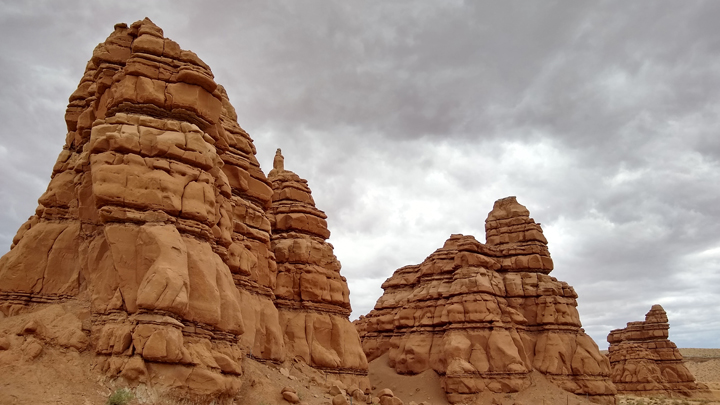
At Hanksville, Highway 24 veers to the north through a desolate desert, and it got REALLY windy. We stepped out of the truck just long enough to take a few photos toward Goblin State Park right before a sandstorm.
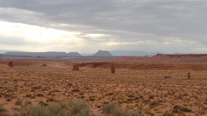
Sandstorm starting
Random rocks
We then took I-70 east for half an hour through landscape that looked like a big gravel pit. I was just starting to get depressed when we turned south on US 191 toward Moab, and my worries immediately lifted. This is gonna be awesome!
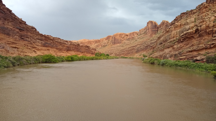
Entering Moab, we stopped at Lions Park, where a footbridge/bike path crosses the Colorado River in an area of red rock walls and lush green riverbanks. A nice contrast after crossing the barren desert.
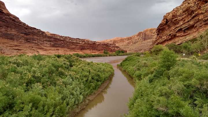
Made it to Moab
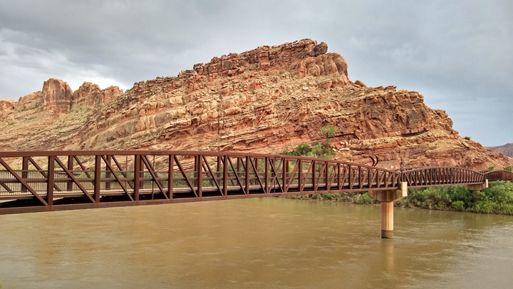
Colorado Riverway Bridge
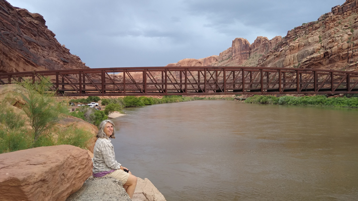
Jana enjoying our vacation
Calm Colorado River
After checking in to our motel at 8:00 p.m., we were quick to head back out before the whole town closed down. Even Moab Brewery - the only brewery in town - was only open till 9:30. We split a Hatch green chili burger and a big ole burrito, accompanied by delicious beers.
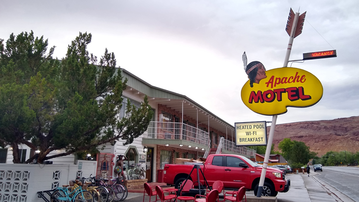
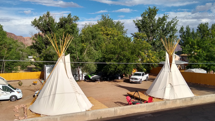
Lodging: Apache Motel, Moab, Utah. Expensive, but less expensive than other Moab hotels. I loved the retro look, but it was a little quirky and could use some updates. Everyone was very friendly. John Wayne slept here!
Throwback in time
Circle the pickups!
|