Thursday, June 23, 2022
Canyonlands National Park
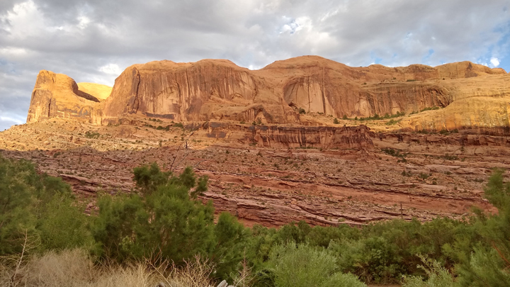
Canyonlands National Park protects a large swath of wilderness in the midst of the Colorado Plateau in southeastern Utah. The park is divided into four districts: Island in the Sky, The Needles, The Maze, and The Rivers. It takes hours to drive between the districts, so we concentrated on Island in the Sky, 45 minutes outside of Moab.
There are hundreds of canyons within Canyonlands, but the two largest were carved by the Green and Colorado Rivers. Island in the Sky sits on a large mesa between the two rivers, with just a narrow neck of land where a road could be built to access the mesa.
Canyonlands National Park
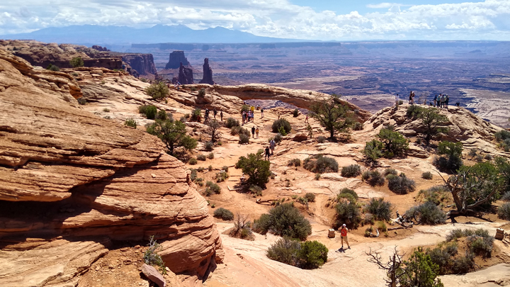
Mesa Arch is a small arch in a grand location. The view over the cliff edge through the arch is dizzying! With just a .6-mile hike to see the arch, it was a little crowded but well worth it.
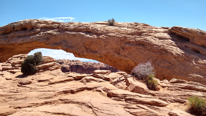
Mesa Arch
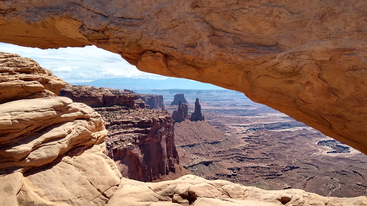
View through Mesa Arch
La Sal Mountains in the distance
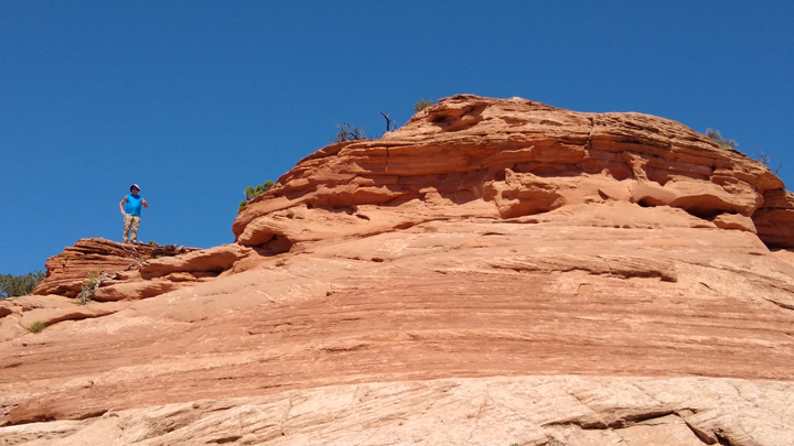
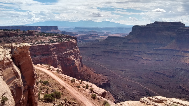
Tom's overlook
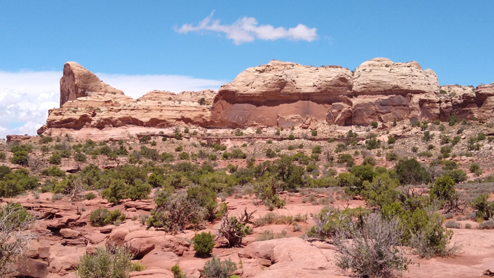
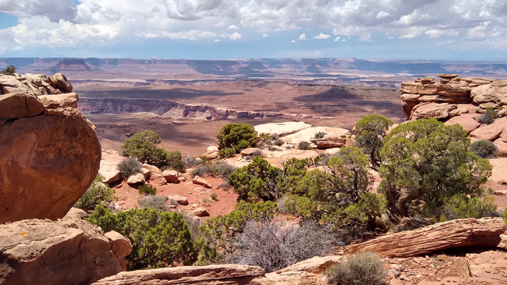
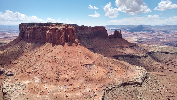
We stopped at every viewpoint along Grand View Point Road and Upheaval Dome Road, the only two paved roads in this district of Canyonlands NP. The views were expansive, and we watched distant dark clouds come closer for hours.
Alcove Spring trailhead
Green River Overlook
Candlestick Tower Overlook
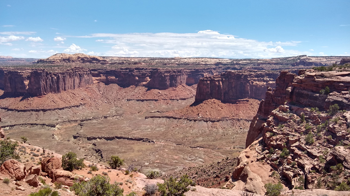
The road dead-ends at Grand View Point Overlook. From there, we followed a trail along the cliff's edge for another mile, enjoying ridiculously outstanding views all along the way.
Grand View Point Overlook
Along the Grand View Point Trail
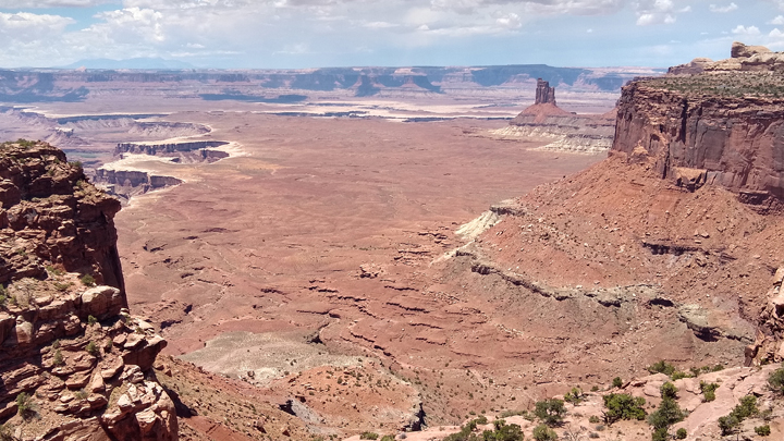
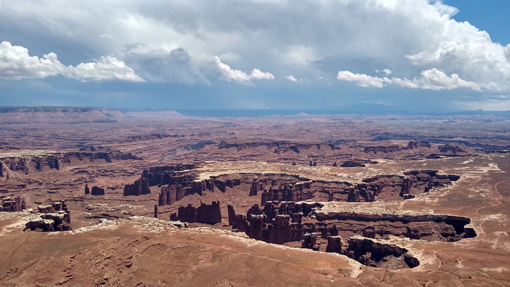
At the trail's terminus, we scrambled up a final boulder and were rewarded with THE MOST INCREDIBLE VIEW IN THE WORLD, a 360-degree panorama so amazing it almost hurt to look at.
Junction Butte
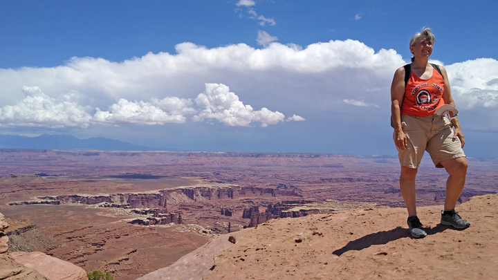
Jana at Canyonlands
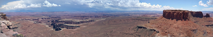
Grand View Point panorama
Once we'd exhausted all the paved roads, Tom was determined to drive into the backcountry. I didn't want to end up on some craptastic goat-trail after both of us getting so banged around on Hole-in-the-Rock Road two days ago, and I noted my objection.
To settle our stalemate, we inquired of a ranger regarding road conditions, and to my dismay, the ranger encouraged Tom's plan. I was not impressed. He did say we'd need to file a backcountry permit for one portion of the proposed route, which gave me further qualms, but ultimately we left the visitor center with official permission for this folly.
What the ranger didn't mention was, hey, if it rains before you set out, DON'T GO. So after sitting out a brief downpour, off we went.
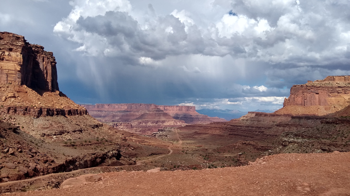
Impending rain
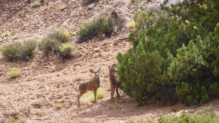
Mule deer
The incredibly steep, unpaved Shafer Trail Road leads down a series of switchbacks 1,400 feet into Shafer Canyon. For most of its course, the road is too narrow for vehicles to pass, so we had to look way ahead to be sure to meet approaching vehicles (there were only two) at a spot wide enough to get by.
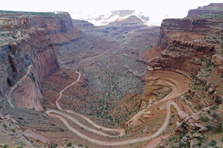
Shafer Trail Road
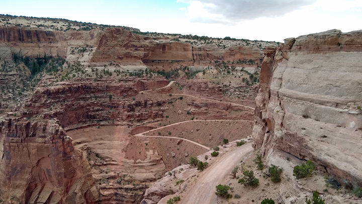
Partway down Shafer Trail Road
I have to admit, it was a spectacular drive! Once we reached the canyon bottom, we continued for a few miles along White Rim Road. This is the portion of road that required a backcountry permit, but it wasn't a bad drive in our pickup.
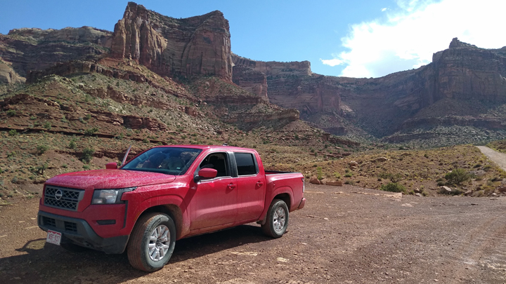
Big Red at the bottom
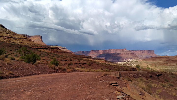
Receding rain
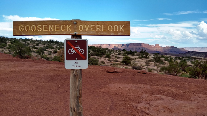
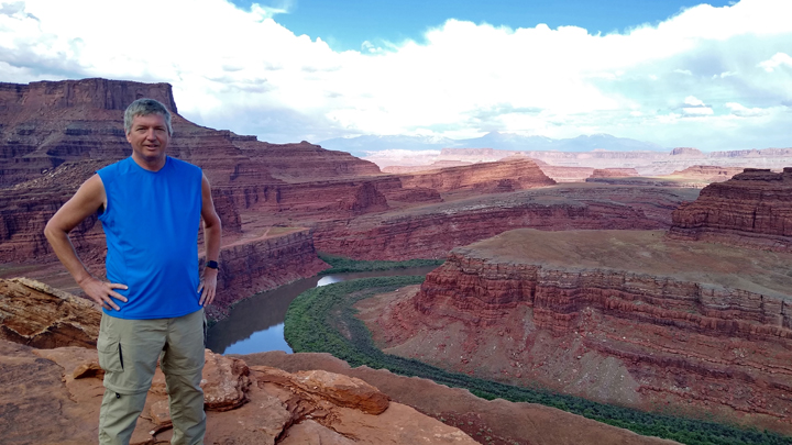
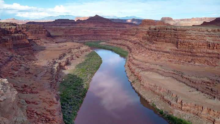
We stopped and hiked a little over half a mile to the Goosenecks Overlook of the Colorado River. (Note: There are two Goosenecks Overlooks nearby, one reached via White Rim Road and the other along Potash Road.) This was as far as we drove on White Rim Road before turning around.
Pretty place
Triumphant Tom
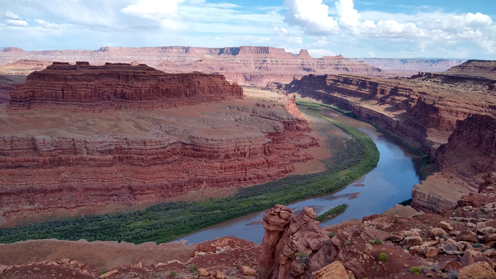
Goosenecks Overlook, White Rim Road
Loving life!
Again to my dismay, when we turned around, Tom announced that instead of taking Shafer Trail Road back up to the canyon rim, we were going to return to Moab via Potash Road, a much longer unpaved track, because the steep canyon road was “too scary.” OMG
So now we turned down sketchy Potash Road, where soon we came to a place in the “road” that was just a rocky riverbed with water running across it. I just had Tom convinced to turn the hell around when a 20-something girl, Emily, pulled up behind us in a Jeep. We briefly spoke before she pulled around us to continue on her way. Thinking this confident driver must have some experience, Tom decided to follow her.
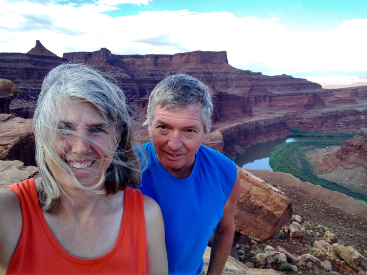
Tom and I followed Emily for a ways, driving right in her tracks, until we came to the second Goosenecks Overlook. Both vehicles stopped at this breathtaking spot before we all continued on.
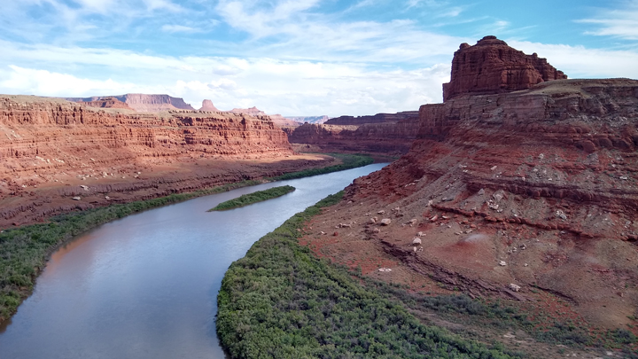
Goosenecks Overlook, Potash Road
Not long after, Tom and I stopped again at Thelma and Louise Point. Emily, however, forged on ahead, and once we lost her, we assumed we'd never see her again. This magnificent point is where the ending of “Thelma and Louise” was filmed, a stand-in for what was depicted as the Grand Canyon.
Thelma and Louise Point, outside Canyonlands
A little later, we were surprised to catch up to Emily again. Apparently, she stopped here for a good, long while before traversing the first major mud bog. Probably, she was waiting for Tom to see what he'd do. She'd just made it successfully to the other side when we arrived, so we plowed through as well.
Then we came to another, longer mud bog/water hole. Having made it through the first one, Emily and Tom drove right into this one as well. Success! I had my eyes closed. Is this just going to keep getting worse? The answer is yes.
Potash Road had left the national park a while ago, passed through some BLM land, and we were now in a large area of private property owned by a potash company. Completely unmaintained, I wouldn't call this section a road at all. Normally, it was probably a 4x4-drivable dry wash, but due to what we now came to realize was a flash flood, at present it was a hellish, muddy, flowing stream.
At this point, we all would have turned around had it been an option, but we'd passed the point of no return. With the depth and nature of the long, muddy stretch just ahead of us unknown, Tom and Emily got out to contemplate the problem while I stayed in the truck having some kind of out-of-body experience. This is when Tom found out that Emily was not, in fact, an experienced off-road driver, and he ended up giving her 4-wheel-driving tips.
Finally, Tom took off his shoes, waded out into the watery muck, declared the bottom “more solid than you might think,” and there was nothing left to do but go for it. Emily was still in the point position, so she went first. I held my breath as she plunged in. She made it! Then it was Tom's turn. We made it too! Thank the Lord.
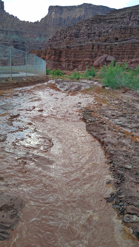
Unmaintained Potash "Road" in flood
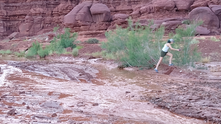
Emily by the side of the "road"
More solid section of the mud road
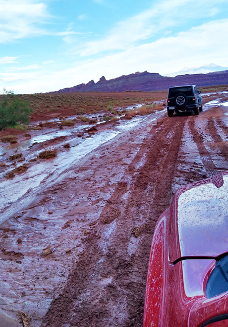
We drove through several more horrific washout mud bogs before FINALLY emerging onto pavement, but I'd lost track of all time and space and can give no further details. I do know that Potash Road, starting from its intersection with Shafer Canyon Road until we got to the pavement, was around 18 miles. Do not go if it's recently rained! There was a couple in a Subaru about to enter the road from the other direction as we finally emerged, but we flagged them down and warned them away. You're welcome!
Pavement!!!
Sunshine on the sandstone
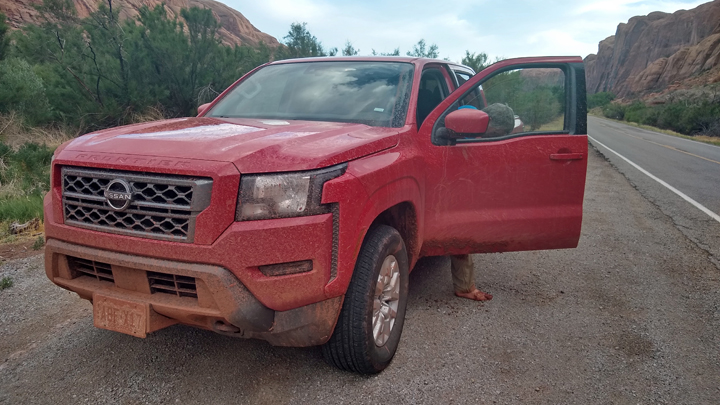
Leaving Potash Road behind, we followed Scenic Highway 279 along the Colorado River through a peaceful sandstone canyon to Moab. Back in town, I fed $10 worth of quarters into the car wash while Tom erased all evidence of what will forever be known as Mudageddon!
Back at the hotel, we weren't really up for going out. Instead, we warmed up some food in the microwave and decompressed with some beer. What a day!
P.S. Canyonlands NP rules! I'm ready to go again! (But never again on that road.)
Lodging: Apache Inn in Moab, night two.
|