Iceland Day 3 – Tuesday, September 9, 2014
Skógafoss, U.S. Navy Plane Wreck, Dyrhólaey/Reynisfjara, and
Fjaðrárgljúfur Canyon
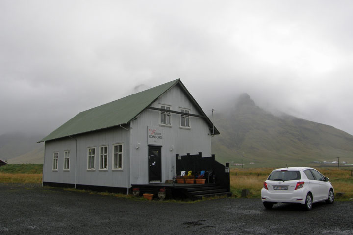
After the last two days of deluge, I was delighted to wake up this
morning to hardly any rain. In the daylight we found that our
guesthouse is situated in a very scenic spot. We ate some quick
PB&Js, left our room key in a drop box, and began the day's
adventures.
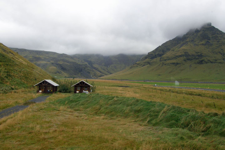
Our little
guesthouse
View from Welcome
Edinborg
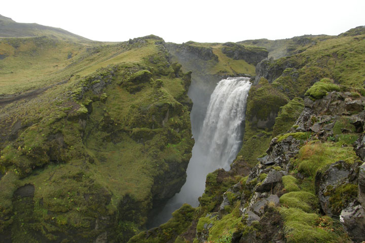
Just a few minutes east of the guesthouse, we reached the spectacular
Skogafoss. At 62 meters high and 25 meters wide, it's one of the
biggest, best known, and most beautiful waterfalls in Iceland.
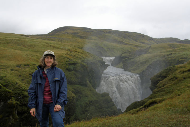
After admiring the falls from the bottom, you can climb to the top
via a very long staircase, probably around 400 steps.
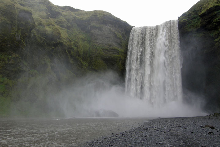
Skógafoss
Once you reach the top of Skogafoss, you can cross a fence to
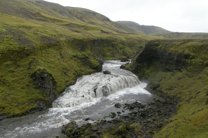
access a fantastic hike past many more world-class waterfalls. The
trail continued on, but eventually we turned back, satisfied with
the waterfall saturation we'd achieved. We passed so many
waterfalls I lost count! There's supposed to be at least 20 falls
if you see them all. We spent about 2 ½ hours round trip on the
hike. The entire waterfall hike takes about eight hours, and a
longer hike continues past the waterfalls all the way to Thorsmork
(Þórsmörk) and beyond, if you're prepared to hike for days. This
hike was one of the highest highlights of a trip of highlights!
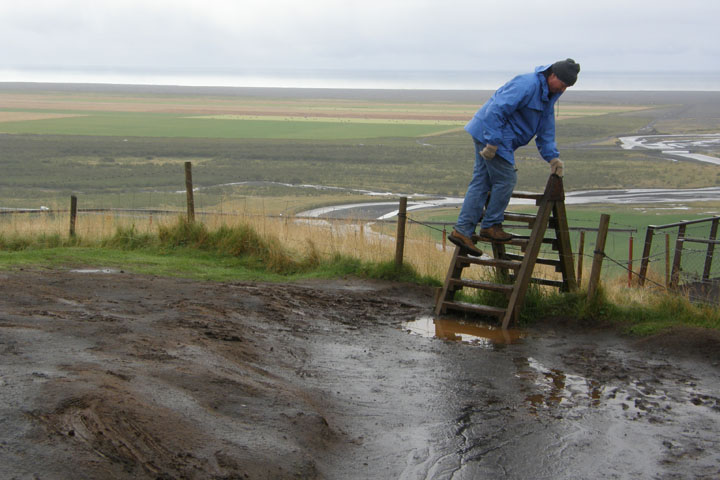
Tom accesses the
waterfall trail
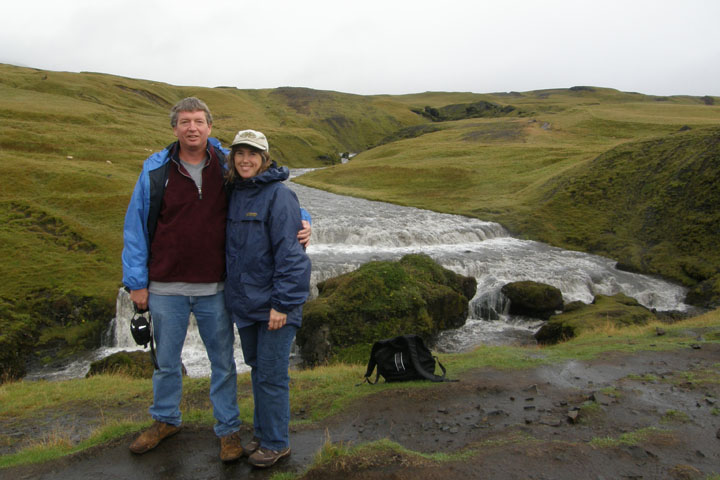
Tom and Jana - The rain
has stopped!
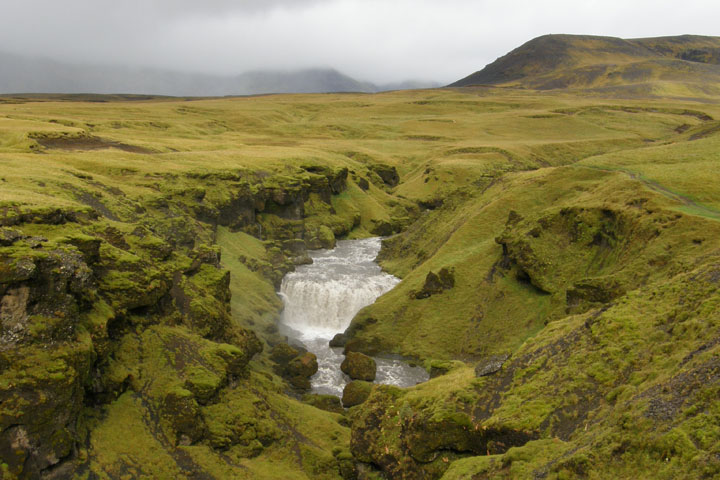
Wow
Jana at yet another
falls
And
another
Last one before turning
around
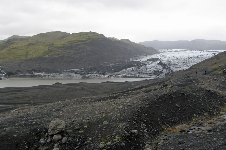
Back on the Ring Road, soon we came to Solheimajokull glacier, the
first glacier of our trip. Since it was the first, we drove down
the access road and walked over close enough for a good view. Well
over 10 percent of Iceland is covered in ice, so we'd have plenty
more chances for glacial viewing later on.
Sólheimajökull
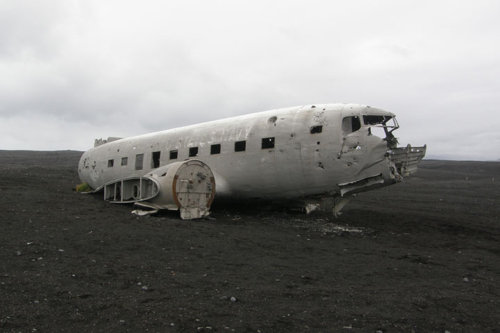
Iceland is completely cluttered with outstanding natural wonders
and a few interesting man-made ones as well, including a wrecked
U.S. Navy DC-3 that crashed on a black gravel beach on the south
coast in November 1973 after running out of fuel. At least the
pilot thought he was out of fuel. As it turns out, the second tank
was found to still be full after the crash, and a resourceful
nearby farmer had free fuel for years. Thankfully, all the crew
survived. The plane is still sitting there today, no one ever
having bothered to haul it away.
U.S. Navy
aircraft
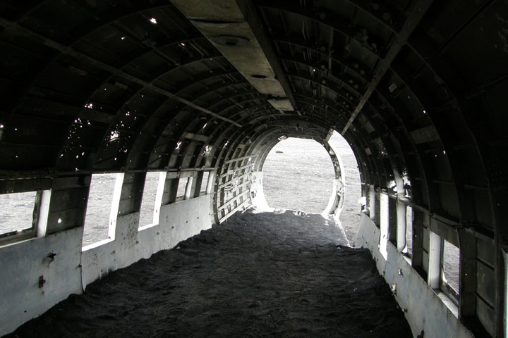
Inside the
DC-3
The plane is accessed off Highway 1 down a terrible farm track of
compact sand/pebbles/rock that was completely inappropriate for our
tiny rental car, but I'm happy to report that we made it there and
back with nary a busted oil pan. Distances are very deceiving out
here. We drove and drove and drove and didn't seem to be getting
any closer to our destination, then suddenly we topped a little
rise, and there it was. Very surreal.
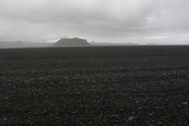
Bleak beach where the
plane crashed
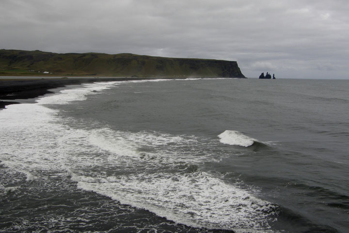
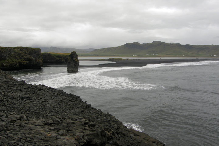
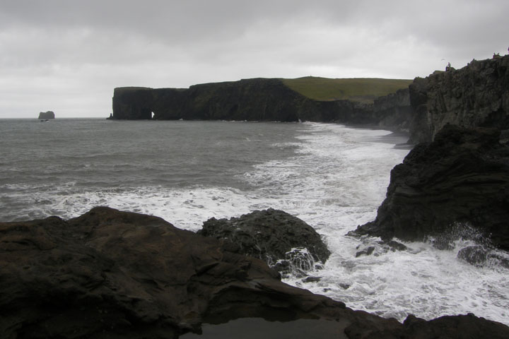
The next fantastic wonders were found down Rt. 218 at Dyrholaey and
Rt. 215 at Reynisfjara Beach, two sides of an estuary off the Ring
Road just west of Vik. Dyrholaey, "the hill island with the door
hole," is a small peninsula on the west side of the estuary. After
turning onto 218, the road splits into two parts: You can turn
right and go up a hill or stay straight for the low road. First we
went right, which led to a fantastic panoramic view and an
interesting lighthouse. From here you can walk to the end of the
huge stone arch reaching out into the sea from which the peninsula
take its name.
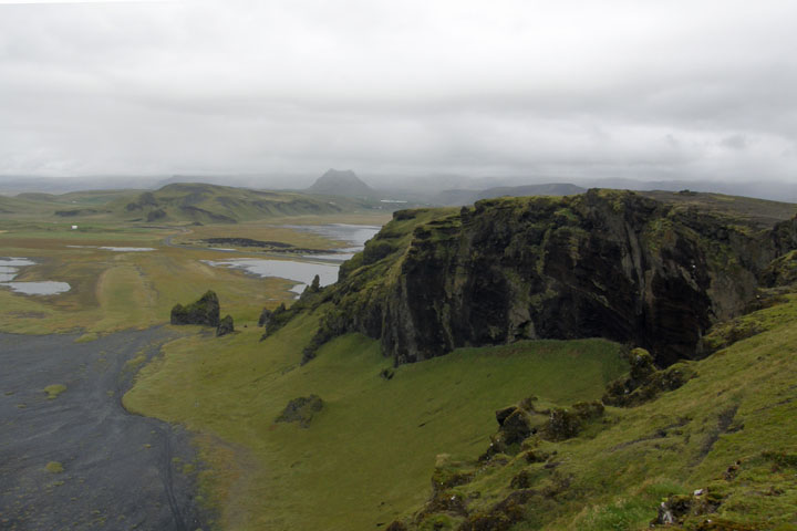
A view from the high
road at Dyrhólaey
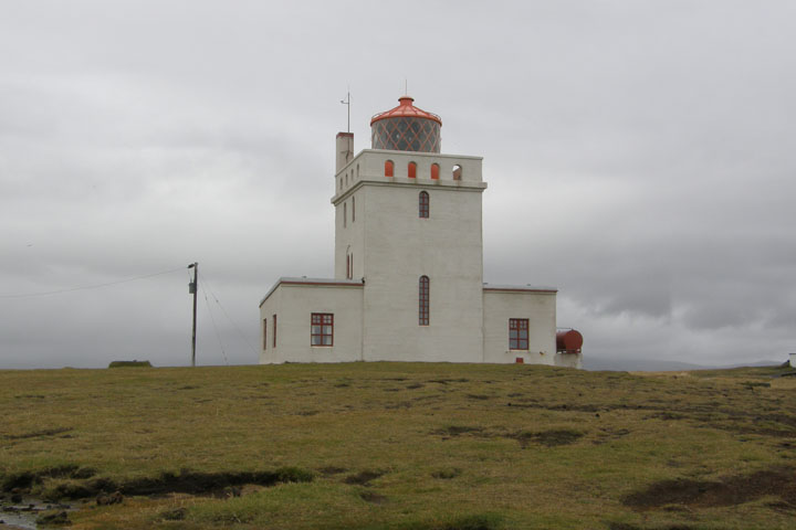
Dyrhólaey
lighthouse
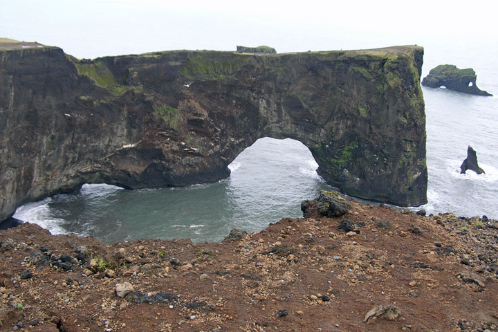
Dyrhólaey
arch
At the end of the "low road" part of 218 at Dyrholaey, you reach a
very picturesque area with a small stone arch and crashing surf,
with great views of a gorgeous black beach and the Reynisdrangar
sea stacks.
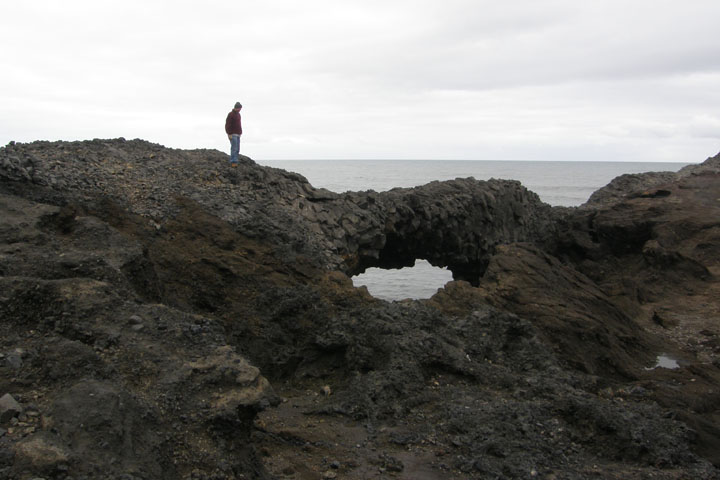
Tom at the small stone
arch
Crashing
waves
Reynisdrangar sea
stacks
Reynisfjara
beach
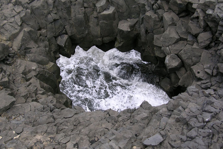
Rt. 218, on the east side of the estuary, leads to the Reynisfjara
Beach, where we found incredible formations of basalt columns and
the aforementioned magnificent sea stacks. Naturally, there are
fantastic views to the west back toward Dyrholaey. This whole area
is a nature reserve and puffin nesting area, but the puffins were
out of season at this time and out to sea. Just as well, as they
close much of the area to visitors during that time to protect the
baby puffsters.
Dyrhólaey from
Reynisfjara
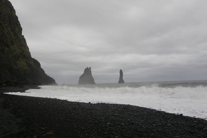
Reynisdrangar sea
stacks
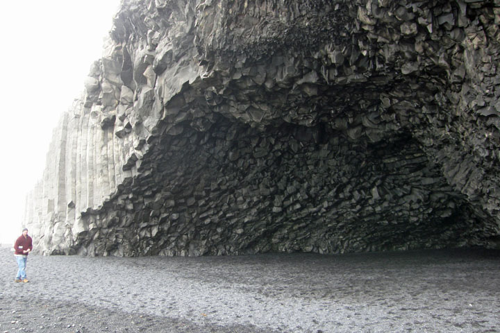
Basalt cave at
Reynisfjara beach
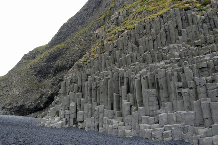
Studlaberg basalt
columns
Past Vik, we had an uneventful few dozen kilometers with only one
stop. We'd noticed some weird spiky formations in the fields
alongside the road and finally pulled over at a roadside turnout at
Laufskalavarda lava ridge to investigate. The weird formations were
actually man-made cairns. A plaque explained that all travelers
crossing the desert of Myrdalssandur for the first time are
supposed to pile up stones to make a cairn, to bring them good
fortune on their journey. It's silly, of course, but we each
located a pebble and added it to one of the cairns. It couldn't
hurt...
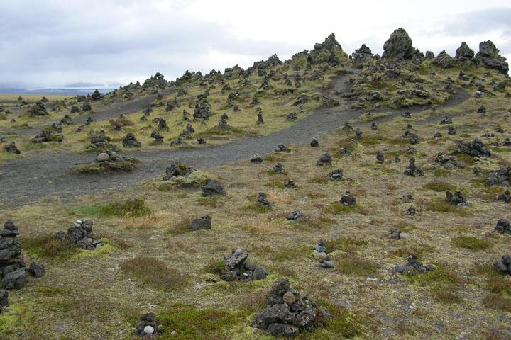
Laufskálavarða good-luck
cairns
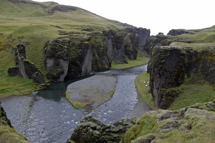
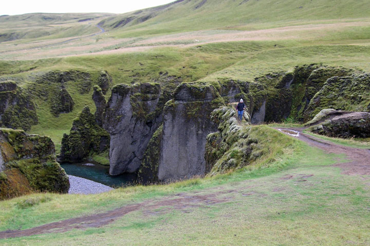
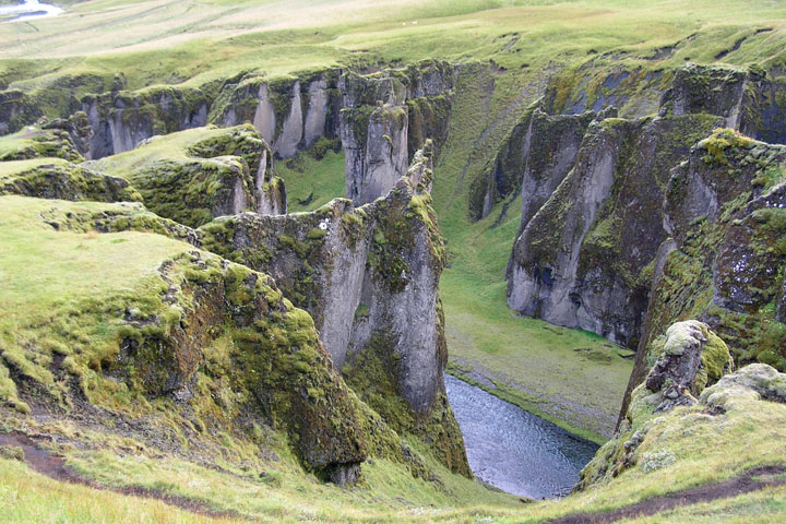
Fjadrargljufur Canyon, just west of Kirkjubaejarklaustur, (aren't
Icelandic place names delightful?) is reached from the Ring Road by
driving just a few kilometers down Rt. 206. You reach the canyon
before Rt. 206 becomes an “F” road, so supposedly this road is
suitable for a 2WD. NOT SO. That we made it without damage does not
change that fact. I parked at the canyon next to one of the biggest
4WD trucks I'd ever seen, and it had a flat tire. You have been
warned.
Anyway, Fjadrargljufur is a gorgeous, twisting canyon with
beautiful vegetation, unlike any other canyon we've ever seen. We
followed a walking track along the southern edge for a mile or so
before the trail left the canyon rim and we turned back. Again, the
scale is deceiving. The canyon is over 100 meters deep in
places.
Fjaðrárgljúfur
Canyon
Jana on the
edge
Gorgeous
gorge
After a full day of sightseeing, we reached Klausturhof
Guesthouse, in the only little village for many miles in either
direction, Kirkjubaejarklaustur. Our room was the size of a
broom closet, and the walls were so paper thin that we could hear
the person next door showering like they were in the room with us.
About what I expected. This town has a population of 120, so we
were happy to have a room at all! Actually, there's a couple of
other, somewhat pricy, hotels in town, but we got this place for
$80, so it was a decent value (for Iceland), even if we did have to
supply our own sleeping bags and towels. There wasn't even enough
space in the room for our limited amount of luggage, but we could
park right outside the door, so we managed. At least the room had a
private bath, which is rather uncommon in Iceland for budget
accommodations.
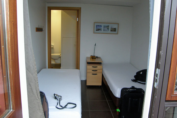
So
small
The guesthouse had a shared kitchen and also had a cafe on site,
but we decided to go out after our big day, not that there were
tons of choices in this tiny burg. Dinner was at a busy little cafe
called Systrakaffi. We split a chiliburger with fries and a
12-inch pizza with three or four typical toppings and had one
boring beer each (Gull and Tuborg) for $48. The beers were $8
apiece, which for Iceland is cheap. Most of the time, a draft beer
at a restaurant or bar is closer to $12. Ouch! There was a much
more diverse menu, with lots of lamb and seafood, but after all the
hiking, this is what we wanted. It was very good.
|