Wednesday, September 2, 2015
North Oregon Coast, Astoria to Newport
It poured down rain overnight, but by morning the sky was a
brilliant blue. A great day for a drive down the coast! For two
days we'll follow Highway 101 south, with occasional detours
bringing us even closer to sea.
Our motel last night was situated almost directly under the
Astoria–Megler Bridge. Located 14 miles from the mouth of the
Columbia River, the bridge is over four miles long, the longest
continuous truss bridge in North America.
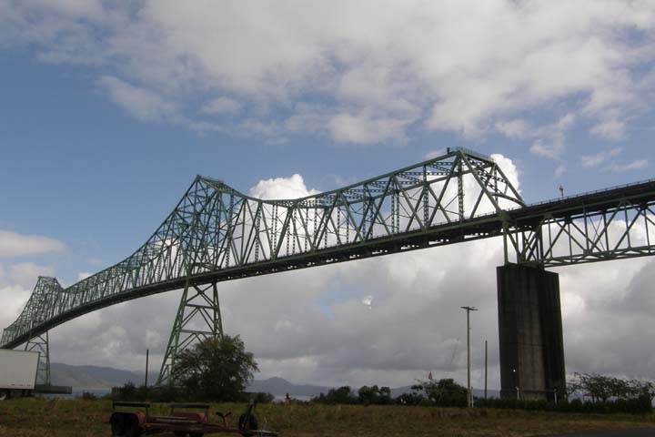
Astoria-Megler Bridge
from Motel 6, Astoria
We left the hotel at 10:30, got gas and groceries, and had a quick
look around Astoria before moving on. Stupid factoid: It is illegal
to pump your own gas in Oregon. Apparently, the Oregon legislature
doesn't trust the general public to not blow themselves up while
filling their tanks and would rather leave the job to
professionals. This is also the case in New Jersey. But for those
of us from the other 48 states and most of the rest of the world,
who have been managing this menial task for decades, getting gas in
Oregon is inefficient and awkward. To my further annoyance, only
once in Oregon was I allowed to pay at the pump with a credit card.
The other times, I had to go inside the gas station both before and
after the gas was pumped to facilitate the transaction. And Tom
wasn't allowed to clean our windshield, but rather we had to leave
that to the attendants, who performed the job poorly. None of this
was helpful.
Founded by John Jacob Astor in 1811 as a fur-trading outpost,
Astoria, near the mouth of the Columbia River, is the oldest U.S.
settlement west of the Rockies. Victorian homes climb the
hillsides, and at the highest peak is the 125-foot Astoria Column,
offering panoramic views of the entire region. Supposedly, that is.
It was a very clear morning, and the views were probably fantastic,
but the Column and park where it's located were unfortunately
closed! The Column was closed for restoration, and then the park
itself had to close as well when a recent storm tore off pieces of
scaffolding which had been erected around the Column, causing a
fear that additional parts could come down and hit passersby. Fair
enough, but pretty disappointing.
At Fort Stevens State Park, outside Warrenton, we stopped along a
sandy beach at the remnants of an old shipwreck, the “Peter
Iredale,” a sailing vessel that ran aground on October 25, 1906, in
strong winds and high seas. None of the 27 lives aboard were lost,
but the ship became inextricably embedded in the sand and was
eventually sold for scrap. Only the bow remains.
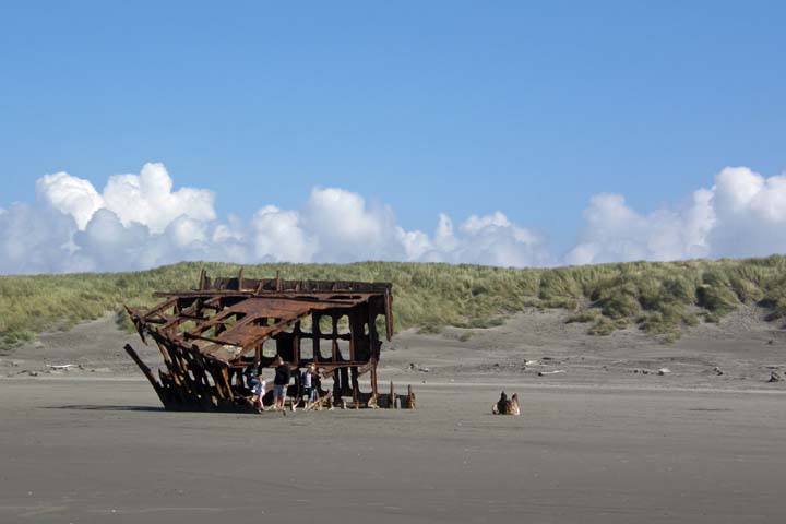
A piece of the "Peter
Iredale," resting in peace
Also in Fort Stevens State Park, we paused at the site of a
Japanese submarine shelling. The inscription of the historic
landmark reads: “On June 21, 1942, a 5.5-inch shell exploded here,
one of 17 fired at Columbia River harbor defense installations by
the Japanese Submarine I-25, the only hostile shelling of a
military base on the U.S. Mainland during World War II and the
first since the War of 1812.” I later read that the shelling caused
no damage, but that the marker is a reminder of “those dark,
uncertain days when the forces of Japan were ranging throughout the
Pacific and no one was sure what the future held.” (Port Angeles
Evening News, February 26, 1970)
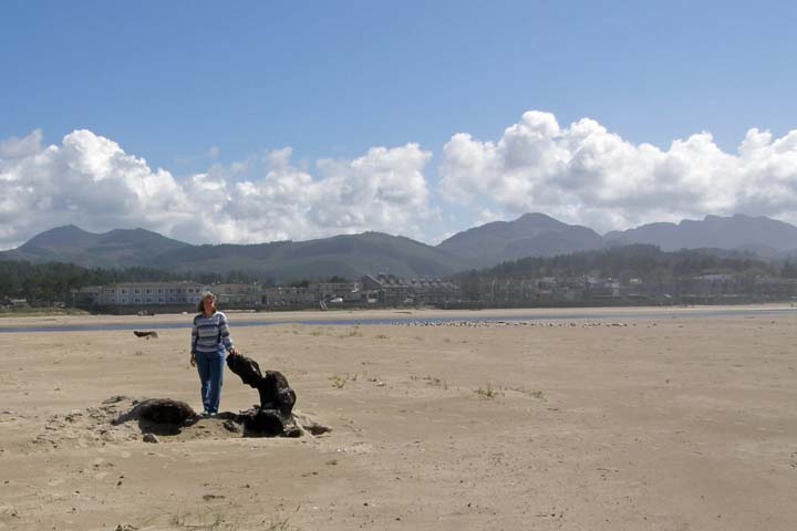
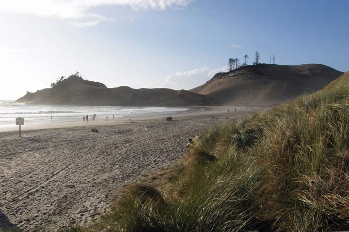
We next stopped at Seaside, a cute little Oregon-style beach resort
town. By “Oregon style,” I mean that most of its attractions, from
bumper cars to carousels, are indoors rather than outdoors, due,
presumably, to the many days of wet weather that make outdoor
recreation here unfeasible. Today was nice, though - too cold to
swim but pleasant for a stroll. We walked along Broadway to “The
Turnaround” on the oceanfront promenade, where a statue of Lewis
and Clark commemorates the end the 18-month, 4,000-mile Corps of
Discovery journey from St. Louis to the Oregon Coast. The
expedition over-wintered in present-day Astoria in 1805-1806, but
the explorers came as far as Seaside to acquire salt for their
return trip.
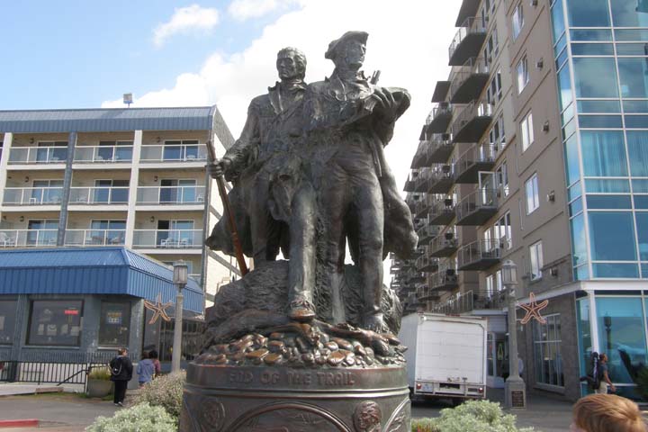
Lewis & Clark and
Seaman (Lewis's dog)
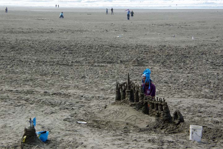
Seaside beach bum,
building sand castles for
donations
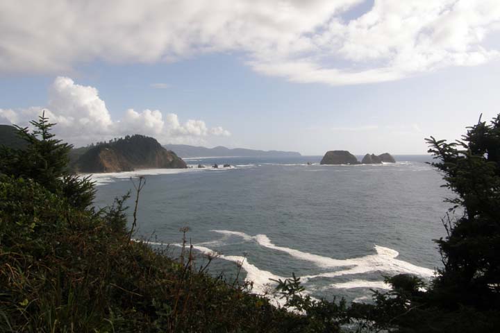
At Cannon Beach, we parked at tiny Les Shirley city park, just
south of Ecola State Park. Every freaking little state park in
Oregon charges a separate fee, so we avoided entering this one.
Yesterday we bought an annual Northwest Forest Recreation Pass for
$30 that covers a multitude of National Forest Service sites in
both Oregon and Washington, but I'm not aware of a similar pass for
the state parks. Anyway, we had a very enjoyable walk along an
estuary and on the beach and saw the famous Haystack Rock and other
offshore rocks, along with the Tillamook Rock Lighthouse, a/k/a
Terrible Tilly.”
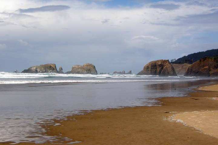
Cannon
Beach
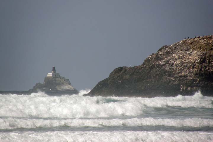
"Terrible
Tilly"
Jana at Cannon
Beach
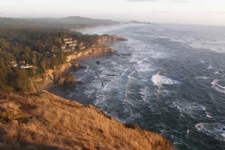
Continuing down 101, the scenery is outstanding, especially through
Oswald State Park, where there are a number of stunning roadside
viewpoints.
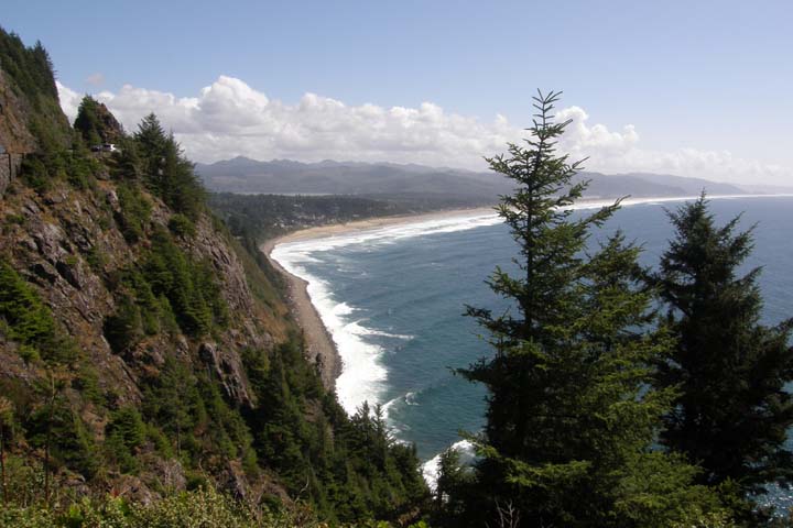
Oswald State Park, along
the North Oregon Coast
By mid-afternoon we were famished and decided to stop at the very
next restaurant we saw. Boy, did we luck out! We had lunch at the
Tsunami Bar & Grill in Wheeler, Oregon, seated on their deck
over the Nehalem River, in perfect weather, watching the local
fishermen in their enviable work environment. As a bonus, the food
was good too. But sorry, dear readers, I was too hungry for fish.
We both had burgers, fries, and beer. The local brew here was
Pelican Pub & Brewery's Cape Kiwanda Cream Ale, made just down
the coast in Pacific City – best brew of the trip, in my
opinion.

Tsunami Bar & Grill,
Wheeler, Oregon
Nehalem River from the
deck of the Tsunami
Leaving Highway 101 for a bit, we followed the Three Capes Scenic
Route down a stretch of coastline between Tillamook and Pacific
City. The northernmost stop is Cape Meares State Scenic Viewpoint,
home to a historic lighthouse on Tillamook Bay and a uniquely
shaped old growth Sitka Spruce called “The Octopus.” It is believed
that the tree was once a gathering site for the Tillamook Indians,
and that, as a specially chosen ceremonial tree, its branches were
forced to grow horizontally when they were still young and
flexible, and then when the branches were allowed to resume
vertical growth, it created the tree's distinctive shape.
Cape
Meares
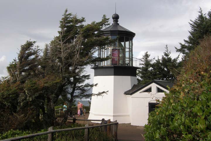
Cape Meares
Lighthouse
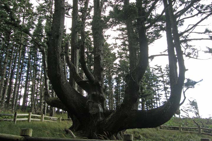
"The
Octopus"
It started pouring down rain as we left Cape Meares, and we thought
our fun for the day had ended, but we quickly drove out of the rain
and the sightseeing resumed. We stopped at the dory boat launching
area just south of Cape Kiwanda in Pacific City, next to a giant
sand dune, on a beach with crashing surf. Offshore lies Haystack
Rock, the second Haystack Rock of the day.
Cape Kiwanda, Pacific
City
Past Pacific City, our side route connected back with Highway 101.
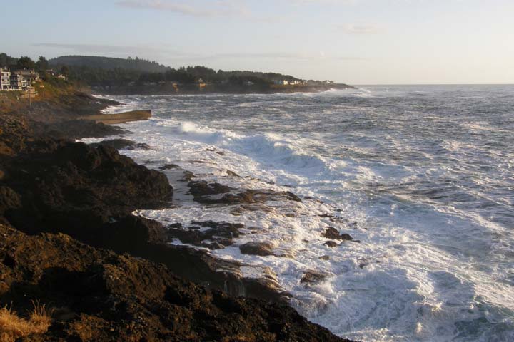
We stopped at Depoe Bay to check out the “World's Smallest
Navigable Harbor,” only six acres. I could swear we've seen
smaller, but Guinness says we haven't. Anyway, still not much to
look at, but at least we saw some sea lions from afar. More
impressive were the views a bit farther south at Cape Foulweather.
Then we checked out the “Devil's Punchbowl," at times a spot where
you can watch the sea swirling and frothing “like a devilish brew,”
but it was low tide, and the punchbowl was empty.
Depoe Bay,
Oregon
Cape
Foulweather
Just after dark, at 8:15, we checked in at the Rodeway Inn in
Newport. It's a three hour and 15 minute drive from Astoria to
Newport, but we managed to make it in ten! Still full from the late
lunch, we stayed in for a snack dinner of Chex Mix and a six-pack
of Widmer Drop Top Amber Ale, a good beer brewed in Portland. The
hotel room had no A/C, which I found shocking, but apparently
that's common on the Oregon coast.
|