Monday, September 7, 2015 – Labor Day
John Day Fossil Beds National Monument, The
Dalles
This morning we said goodbye to my brother Brian, as we continued
on our separate journeys. What a beautiful, clear morning we had to
resume our drive! Tom and I returned to Pilot Butte before
leaving town and finally got a decent look at the nearby
glacier-covered Cascades. We could see all the way to Mt. Hood, 93
miles away.
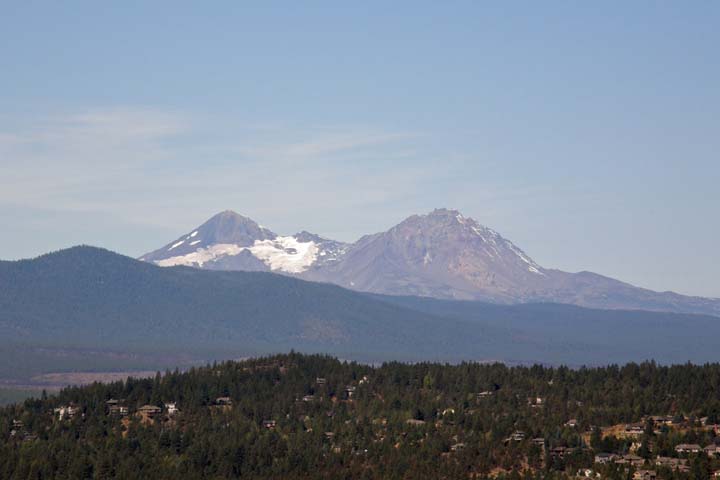
From Pilot Butte
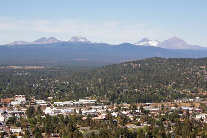
Bend, Oregon, from Pilot Butte
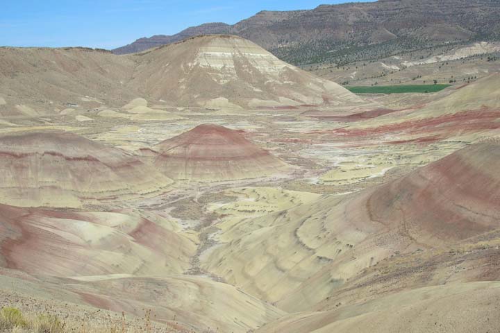
We drove east out of Bend past the Prineville Reservoir and headed
into the desert to the colorful landscape of the John Day Fossil
Beds National Monument. The John Day is divided into three
separate, non-contiguous units in the John Day River basin: the
Painted Hills Unit, the Clarno Unit, and the Sheep Rock Unit. We
visited the first two. The Painted Hills was the closest of the
three remote locations, about two hours east of Bend.
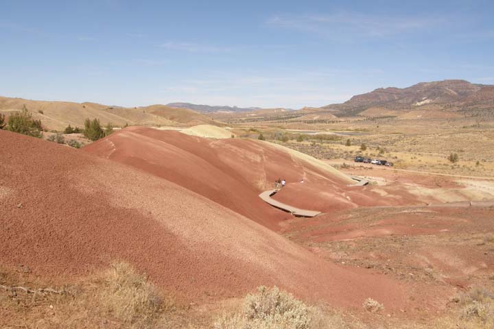
The multicolored strata of the Painted Hills badlands are stunning and almost
otherworldly. This would have been a great setting for an episode
of Star Trek!
We walked three short trails here: the Painted Hills Overlook
Trail, a 1/2-mile round trip along a ridge with panoramic views; the
Painted Cove Nature Trail, a 1/4-mile boardwalk taking you up close
and personal around a little hill (you are not allowed to walk on
the hills, as it causes permanent damage); and the Red Scar Knoll
Trail, a 1/4-mile trail ending at a hill made of red and yellow
clay.
John Day Fossil
Beds National Monument, Painted Hills Unit
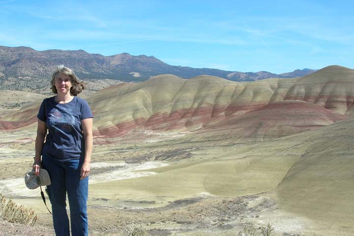
Jana at the Painted Hills Overlook
Painted Cove Nature Trail
On our way out of the Painted Hills Unit, we stopped at a nice picnic
area and devoured a giant sub we'd picked up at Safeway this
morning, washed down with a Paddleboard Porter (delicious). It was
warm this afternoon, in the mid 80s, and I finally got a chance to
change into some shorts.
The most direct route from the Painted Hills Unit toward the Clarno
Unit began via a twisting gravel road through private ranchland,
with views down to the John Day River. After about a dozen miles,
we turned at Twickenham onto a paved road, but it was still about
another 40 miles to the Clarno
Unit. As I said, these places are remote and disconnected.
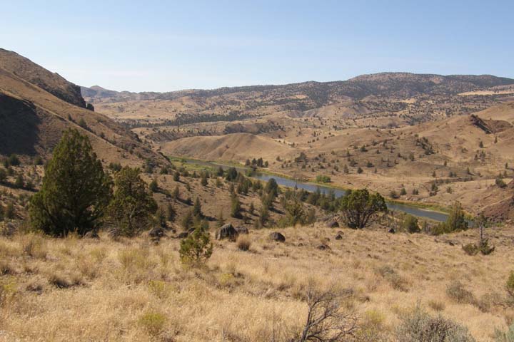
John Day River
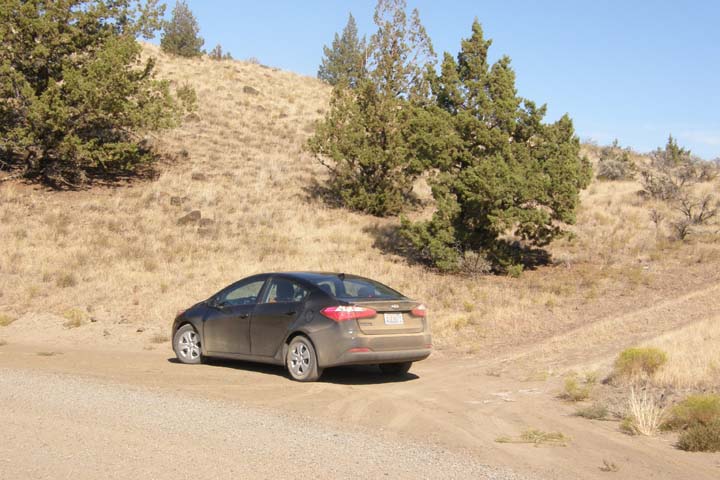
Our rental car on a dusty road
We stopped at the Clarno Palisades but opted to skip the planned
hike. The Palisades were striking but would have been more
impressive if we hadn't just been to Smith Rock yesterday, so we
quickly moved on.
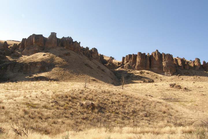
John Day Fossil
Beds National Monument, Clarno Unit
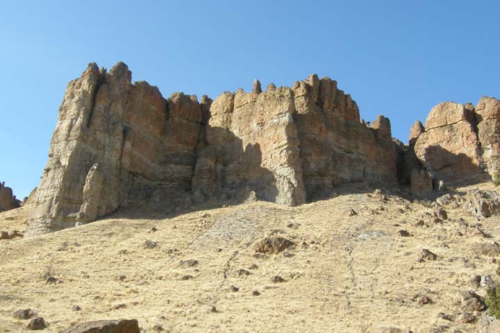
Clarno Palisades
On State Route 118, we passed through a depressed-looking little
community by the name of Antelope, Oregon, population 46, that has
an interesting history. The town of Antelope was named “Rajneesh”
for a few years in the 1980s, for Indian guru Bhagwan Shree
Rajneesh, when members of his international cult moved into the
small town and voted in the name change. After the cult leader was
arrested and pled guilty to immigration fraud and had to abandon
his nearby commune, the remaining residents of the town, both
original and Rajneeshee, voted unanimously to restore the original
name. Today there is a plaque at the base of the Antelope Post
Office flagpole that reads: "Dedicated to those of this community
who, through the Rajneesh invasion and occupation of 1981-85,
remained, resisted, and remembered."
We continued northwest from Antelope and at the town of Maupin got
on the Lower Deschutes River Scenic Byway. The road is a total
of 36 miles and follows the picturesque Lower Deschutes River and
Canyon along an old railroad grade. Only a few miles of the byway
is paved.
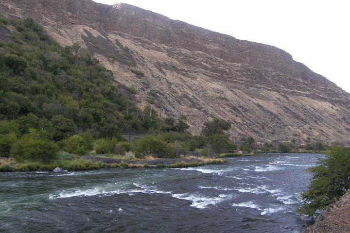
Lower Deschutes River

Deschutes Canyon
From the Deschutes, we headed for The Dalles, our destination for
the night, stopping alongside the road to admire Mt. Hood and Mt.
Adams at sunset.
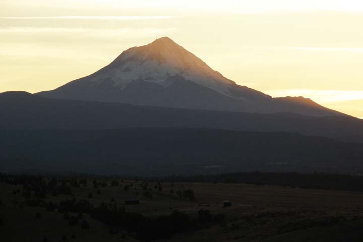
Mt. Hood
We arrived at the Oregon Motor Motel in The Dalles (pronounced "the dalz") at 8:00, and
just as we got the car unloaded, a torrent of water rushed down 2nd
Street in front our motel. A water main had broken nearby. What
timing! We didn't have running water for hours, and when it started
back up, it was super muddy. At least we were able to flush the
toilets, but drinking the water or even showering was out of the
question even the next morning.
The nearby restaurants immediately closed when the break occurred,
but Casa El Mirador was still open just a mile away.
Dinner was delicious and the portions were huge! By the time we
finished eating, the water main issue had caught up to this place
too, and they couldn't serve any more drinking water. Still
thirsty, we stopped by Safeway, but it was just after 9:00, so the
store was closed (like almost everything in Oregon at that time of
night). Luckily, we found a gas station still open and picked up a
6-pack of Black Butte Porter. Gotta drink something!
|