Tuesday, September 8, 2015
The Dalles, Mount St. Helens, Packwood
The Dalles is situated on the south shore of the Columbia River and
is known as the end of the overland Oregon Trail. On their way west, here the pioneers
loaded onto barges and floated down the Columbia to the mouth of
the Willamette River and beyond. The Dalles at that time was the
location of a series of rapids the French fur traders called “les
dalles,” or the trough. The rapids have since been submerged by the
backwaters of The Dalles Dam.
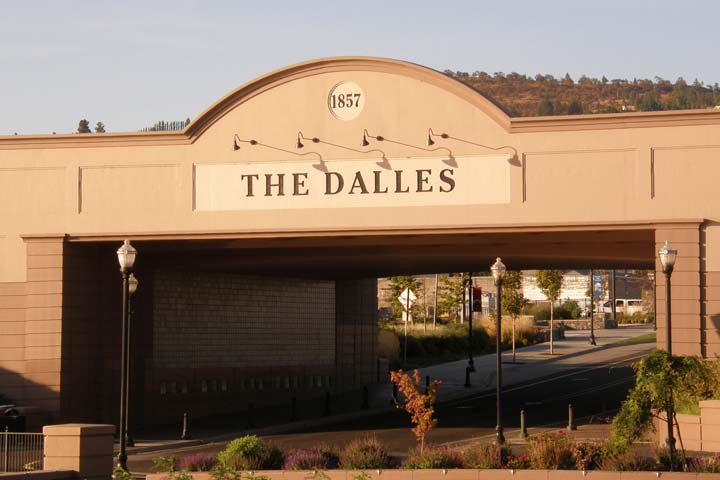
Gateway to the Columbia River Gorge
It was a beautiful morning, so while Tom slept in, I took a walk to Lewis & Clark
Park on the riverfront and returned through the historic downtown
district. There are a number of murals painted
throughout downtown, every mural depicting a historic
event occurring in or around The Dalles.
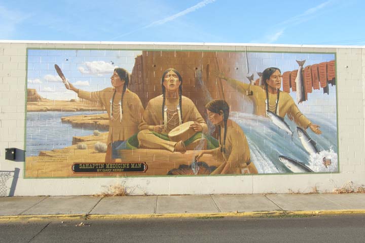
The wisdom and mystery of the Native American medicine man
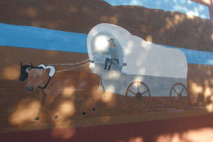
Westward ho!
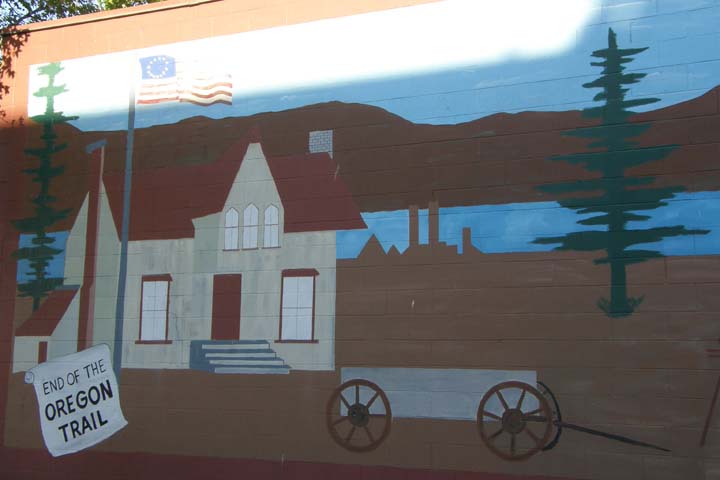
End of the Oregon Trail
We had driven most of the Columbia River Gorge our first day in
Oregon, but when we'd turned at Hood River, we had missed one
especially scenic overlook, so this morning we drove to the Rowena
Crest Viewpoint, where we met a couple of local old-timers
who told us their fish stories while we watched dozens of salmon
fishermen on the river below.
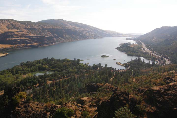
Columbia River from Rowena Crest Viewpoint
Finally it was time for the Washington portion of our trip. We
crossed the Columbia River via the Hood River-White Salmon toll
bridge ($1.00). I hope they're saving up those dollars for a new
bridge, because this one, built in 1924, is narrow, loud, and a
little bit scary. But we successfully crossed, stopped in Bingen
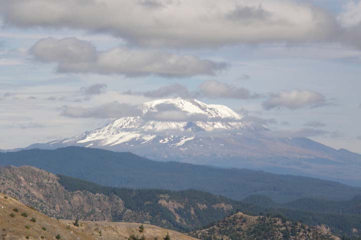
for a little shopping, and then as we passed through White Salmon,
we got the best view of Mt. Hood yet!
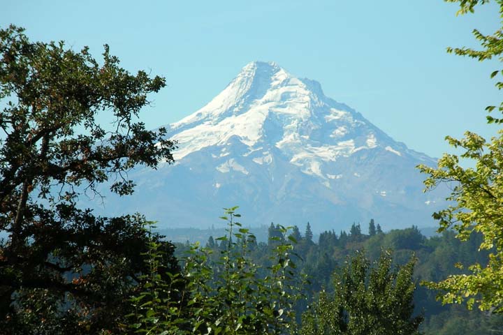
Mt. Hood, Oregon
Today we visit Mount St. Helens. Over 35 years ago, a tremendous eruption blew off the top of the mountain,
causing a plume of ash to rise more than 15 miles into the
atmosphere and dump volcanic dust all over the northwest. A 100-mph
landslide of the destroyed mountaintop left debris and ash as much
as 600 feet deep. Many of the volcanoes of the Cascade Range could
erupt at any time, but only Mount St. Helens has done it in our
lifetimes... so far.
Along the road in Washington
We decided to visit Mount St. Helens' less-frequented east side,
heading ultimately for Windy Ridge Viewpoint. From the Columbia River, we
turned north at Carson on the Wind River Highway, then veered onto
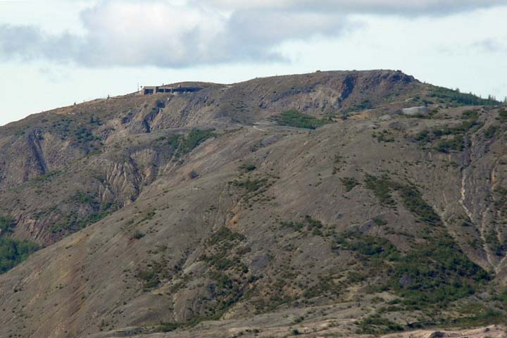
Meadow Creek Road / Curly Creek Road, where we stopped at McClellan
Viewpoint for a distant view of Mount St. Helens. Even from afar,
you could plainly see that the mountain was missing its top. In fact,
it's missing 1,313 feet compared to before the eruption.
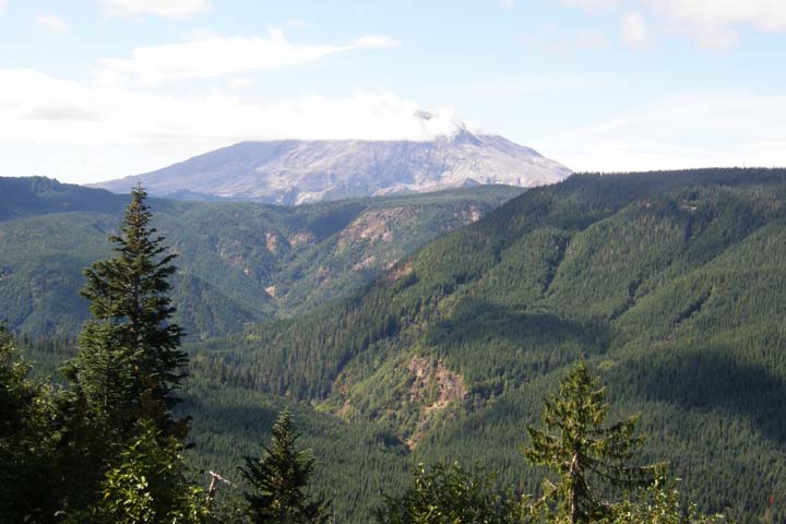
Mount St. Helens from McClellan Viewpoint
From Curly Creek Road, we got on Highway 90 west, then Forest Road
25 north, and then finally Forest Road 99 heading southwest toward
Windy Ridge. FR-25 is winding, narrow, and in terrible condition.
Beyond mere potholes, big portions of the road were actually
sinking. I guess that's what happens when you build a road on the
flank of an active volcano!
It's only 16 miles along FR-99 from the turnoff to its terminus at
Windy Ridge, but with all the scenic stops and a little hiking, it
took us half the day. There's ten or so distinct viewpoints along
FR-25, and we stopped at each one. Even though tourist season is
coming to an end, I was surprised how few people were here on such
a fine day.
On May 18, 1980, everything within eight miles of Mount St. Helens
was decimated by a 300-mile-per-hour burst of gas, ash, and rock.
At Blast Edge Viewpoint, you can see old-growth forest contrasted
with still-standing dead trees contrasted with dead trees lying on
the ground, blown down in the blast. The landscape has recovered a
lot in 35 years, but it's still far from normal.
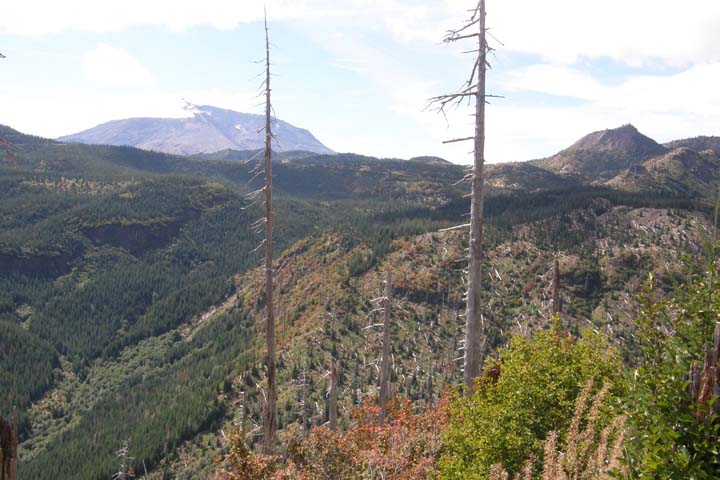
Blast Edge Viewpoint
Further along the road lay the remains of a 1972 Pontiac Grand
Prix belonging to the Parker family. Donald and Natalie Parker,
along with their nephew Rick, were eight and a half miles from the
crater at the time of the eruption, in the so-called “Blue Zone,”
closed to the general public but open to those conducting business
with a permit if they signed a liability waiver with the state. The
Parkers, who had a mining permit, signed the waiver and lost their
lives. The vehicle remains as a reminder of the 57 people who died
in the eruption.
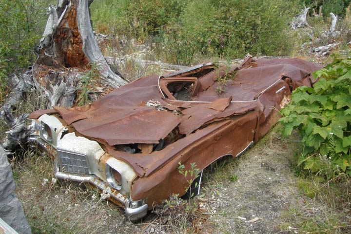
Miners' car
Some clouds were moving in, so we went on to the end of
the road at Windy Ridge, deciding to catch the rest of the
viewpoints on our way back out. At the Windy Ridge Viewpoint you
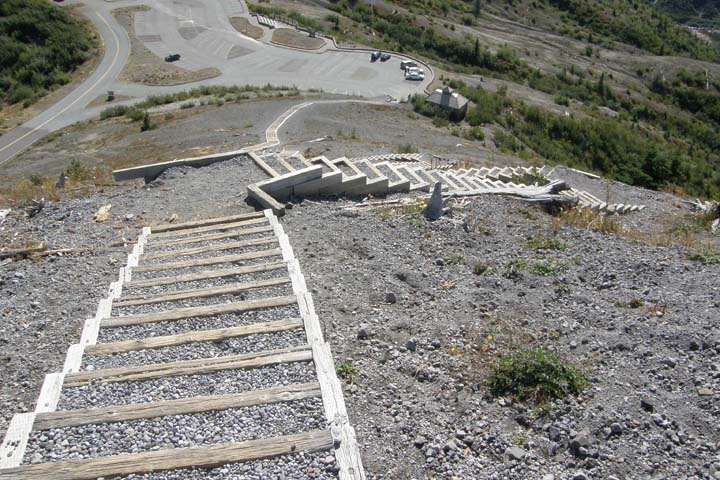
get one of the best close-up views of the crater, only five miles
away. A 361-step staircase leads up a hill above the parking area
for even better views. I climbed the stairs and was the only one at
the top! Not only did I have great views of Mount St. Helens'
blasted-out crater and Spirit Lake, but I could see Mt. Hood (62 mi
SE), Mt. Adams (34 mi E), and Mt. Rainier (closer, N) as well.
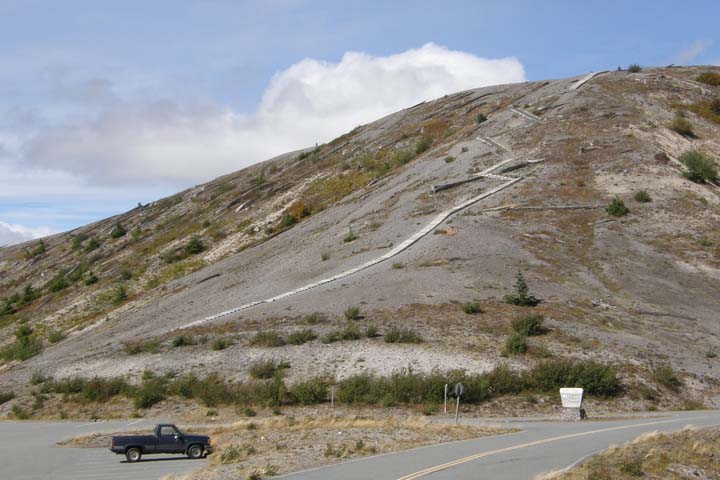
To the top of Windy Ridge
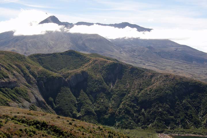
Mount St. Helens' caldera
Johnston Ridge Observatory from Windy Ridge
Mt. Rainier from Windy Ridge
Dizzying view
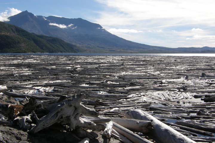
Spirit Lake, in its idyllic location, was once one of the most
popular summer vacation spots in the Cascades. Today the lake is
lifeless. The eruption of Mount St. Helens released a mile-wide
avalanche, causing water to surge like a tsunami 800 feet up the
surrounding hills, dragging the forest, already toppled by the
blast, down into the lake, where a floating log mat of thousands of
trees remains today. We took the two-mile round trip Harmony Trail
down to the lake shore. This trail is the only legal access to the
shoreline. We had the lake to ourselves. People really
don't like to stray far from their vehicles, do they? You get a
completely different perspective of the logjam from lake level.
Those are some BIG trees!
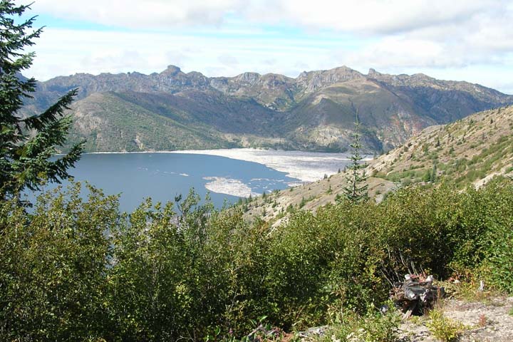
Spirit Lake
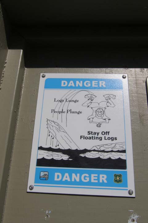
Beware of logs!
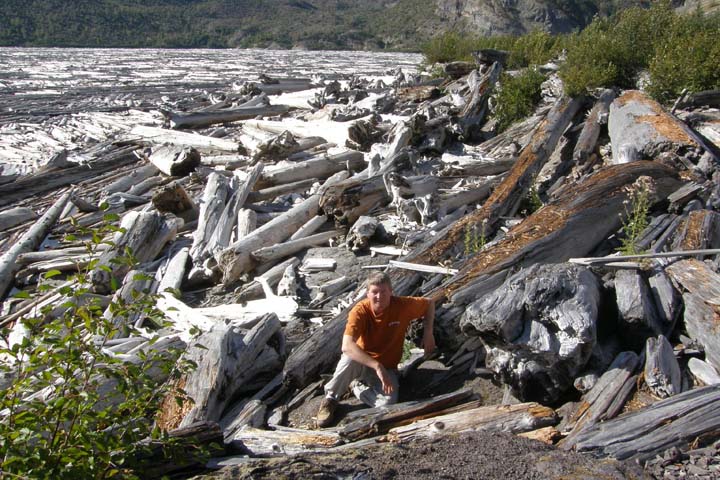
Tom at Spirit Lake
View from lake level
We left Mount St. Helens National Monument and turned north, again
onto FR-99. Almost immediately past the 25/99 junction, we stopped
at Iron Creek Falls, just off the side of the road. There wasn't
much water going over it at the time, but it was lovely
nonetheless.
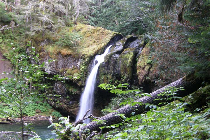
Iron Creek Falls
Shockingly, FR-99 north of 25 was even worse and more collapsed
than the portion we'd traveled on this morning. I was glad when we
got to Randle and turned onto U.S. 12. We got gas in Randle, and it
was nice to be in the modern state of Washington, where you can pay
at the pump and get the gas yourself. Amazingly, we managed to do
so without blowing ourselves up. Take note, Oregon!
Shortly before dark, we arrived at the Cowlitz River Lodge, in the quaint little town of
Packwood, Washington. There were elk roaming around town, including
on the grounds of our hotel. We liked the area and the lodgings
enough that we decided to extend our stay here to two nights.
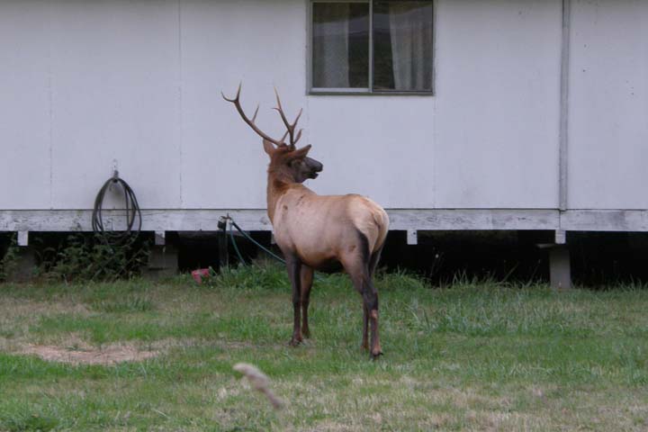
Packwood yard elk
We went for dinner about a block from the lodge at the
Blue Spruce Saloon & Grill, a rough-and-tumble
kind of place like you might expect in a logging town. Tom had a
steak and baked potato, and I had the chef salad. Plus we had a
couple of beers, naturally, this being a saloon and all, the Hoppy
Bitch IPA and Quilters Irish Death. I wouldn't order either again.
We were the next to last customers to leave, at 10:00 p.m., though
they're supposedly open till midnight. What's with these fake
closing hours everywhere???
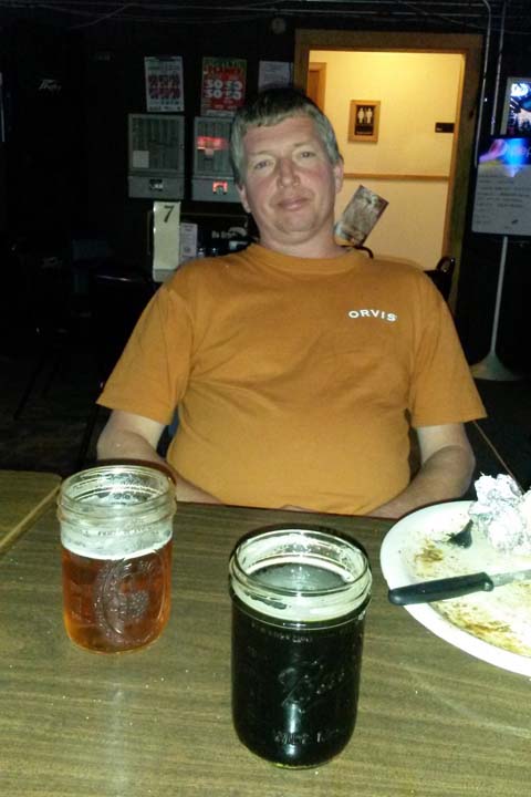
Well, we did ask for a pint of beer
|